Subject: Kentucky
Period: 1795 (circa)
Publication: An Historical, Geographical, Commercial, and Philosophical View of the United States...
Color: Black & White
Size:
4.8 x 6.5 inches
12.2 x 16.5 cm
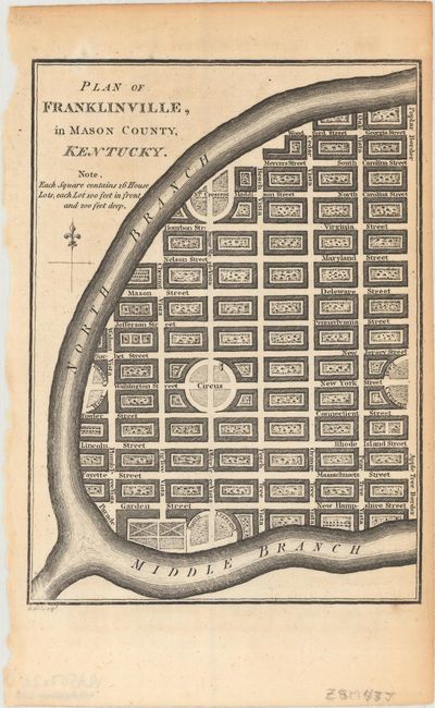
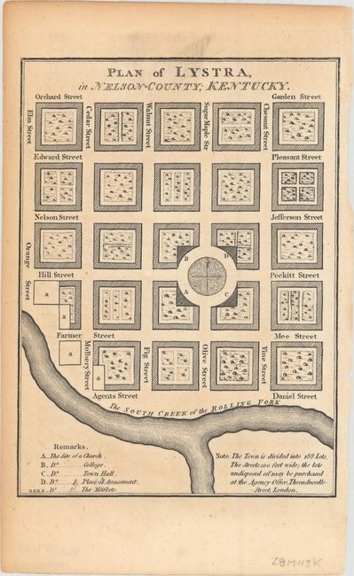
The opening of the trans-Appalachian West launched one of the greatest land rushes in American history. Land speculation was a big business and books such as William Winterbotham’s View of the United States inspired European immigration to the Kentucky frontier. This small pair of maps illustrate towns that were proposed by a group of London speculators but were never actually built. Franklinville was to be located at the confluence of the North and Middle Forks of the Kentucky River, near present-day Beattyville in eastern Kentucky. Lystra was a proposed town that was to be located along the South Creek of the Rolling Fork of the Salt River in what was then Nelson County. Both maps show lots that were available for purchase along a street grid pattern along with parks, markets and sites for colleges and churches.
References: Howes #W581; Wheat & Brun #648, #649.
Condition: B+
Light toning primarily along sheet edges.