Subject: California
Period: 1854 (dated)
Publication:
Color: Black & White
Size:
12.3 x 8.3 inches
31.2 x 21.1 cm
The Office of Coast Survey is the oldest U.S. scientific organization, dating from 1807 when Congress directed that a "survey of the coast" be carried out. By 1836, it was called the U.S. Coast Survey and in 1878, the name was changed to the U.S. Coast and Geodetic Survey. Today the Office of Coast Survey is a division of the National Oceanic and Atmospheric Administration NOAA.
The survey teams, composed of civilians as well as Army and Naval officers, charted the nation's waterways and produced a wide array of reports, survey charts, hydrographic studies of tides and currents, astronomical studies and observations, and coastal pilots. These charts are an important record of the changing nature of the nation's coastlines. In additional to coastal charts, the U.S. Coast and Geodetic Survey produced land sketches, Civil War battle maps, and the early aeronautical charts.
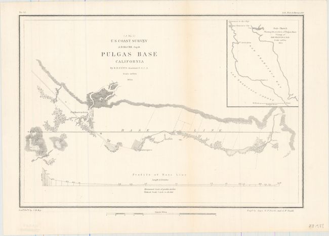
This small chart shows the 6.5 mile long base line that was used for surveying the San Francisco Bay. Base lines are utilized for long surveys and for difficult to reach areas. Locates Embarcadero and individual property owners including Carr, Steinbergen and Jones. Includes a small inset of San Francisco Bay at top and an elevation profile of the base line at bottom.
References:
Condition: A
On a clean sheet with a hint of toning along the fold.