Showing Featured Lots(remove filter)
Showing results for:Auction 144
Catalog Archive
33 lots
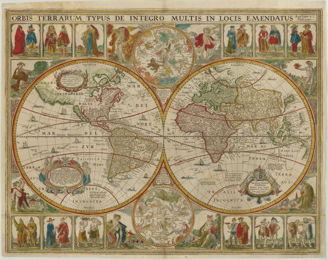
Auction 144, Lot 2
Subject: World
Visscher, Claes Janszoon
Orbis Terrarum Typus de Integro Multis in Locis Emendatus, 1652
Size: 22.2 x 17.3 inches (56.4 x 43.9 cm)
Estimate: $14,000 - $16,000
Visscher's Rare Cartes-a-Figures World Map
Sold for: $12,000
Closed on 4/3/2013
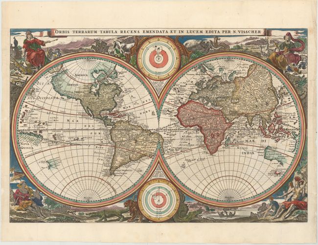
Auction 144, Lot 3
Subject: World
Visscher, Nicolas
Orbis Terrarum Tabula Recens Emendata et in Lucem Edita per N. Visscher, 1663
Size: 18.7 x 12.1 inches (47.5 x 30.7 cm)
Estimate: $1,500 - $1,700
Sold for: $1,300
Closed on 4/3/2013
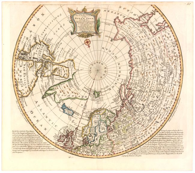
Auction 144, Lot 19
Subject: North Pole
Bowen, Emanuel
A New & Accurate Map of the North Pole, with all the Countries Hitherto Discovered, Situated Near or Adjacent to it, as well as Some Others More Remote…, 1747
Size: 16 x 15 inches (40.6 x 38.1 cm)
Estimate: $450 - $550
Sold for: $425
Closed on 4/3/2013
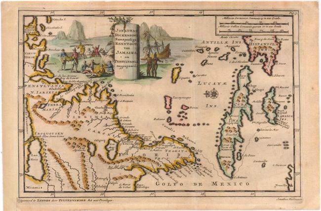
Auction 144, Lot 39
Subject: Colonial North America and Caribbean
Aa, Pieter van der
Jonathan Dickenson Ramspoedige Reystogt van Jamaika na Pensylvania Nagespoord, 1714
Size: 9.3 x 6 inches (23.6 x 15.2 cm)
Estimate: $650 - $750
Sold for: $475
Closed on 4/3/2013
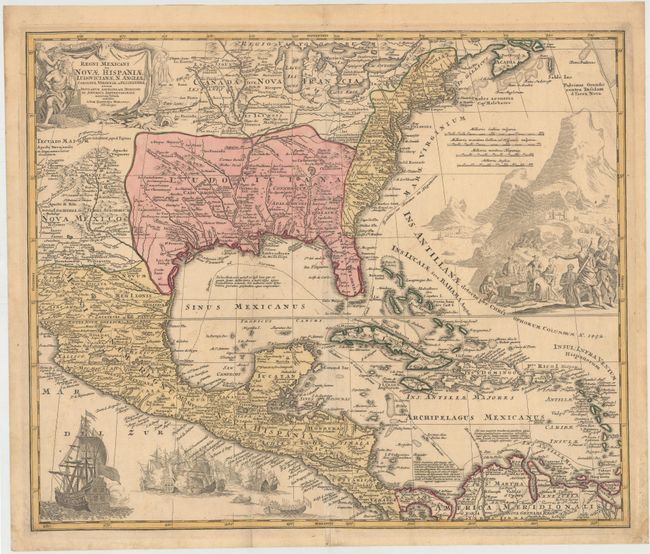
Auction 144, Lot 40
Subject: Colonial North America and Caribbean
Homann, Johann Baptist
Regni Mexicani seu Novae Hispaniae, Ludovicianae, N. Angliae, Carolinae, Virginiae et Pensylvaniae..., 1720
Size: 22.4 x 18.8 inches (56.9 x 47.8 cm)
Estimate: $1,500 - $1,800
Sold for: $1,500
Closed on 4/3/2013
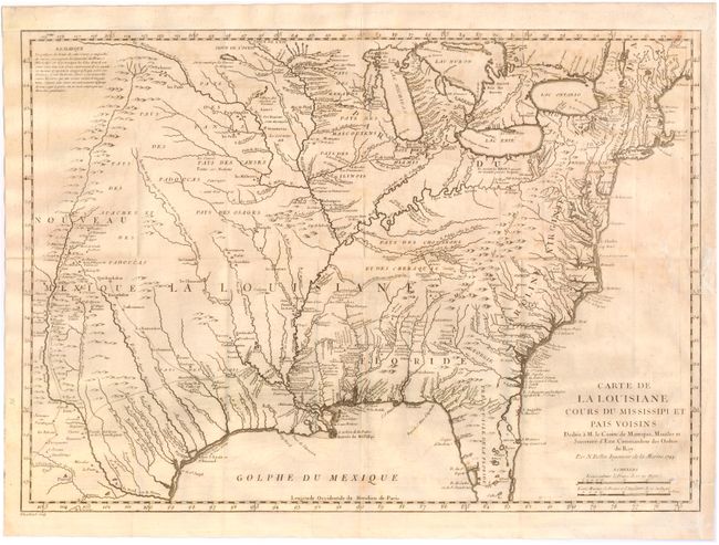
Auction 144, Lot 56
Subject: Colonial Eastern United States
Bellin, Jacques Nicolas
Carte de la Louisiane Cours du Mississipi et Pais Voisins…, 1744
Size: 22 x 15.5 inches (55.9 x 39.4 cm)
Estimate: $800 - $1,000
Sold for: $850
Closed on 4/3/2013
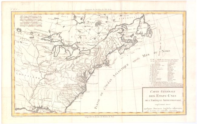
Auction 144, Lot 58
Subject: Eastern United States
Crevecoeur, Michel Guillaume De
Carte Generale des Etats-Unis de l'Amerique Septentrionale, Renfermant Aussi quelques Provinces Angloises adjacentes…, 1787
Size: 16.6 x 10 inches (42.2 x 25.4 cm)
Estimate: $300 - $375
First Printed Map to Name Franklinia
Sold for: $850
Closed on 4/3/2013
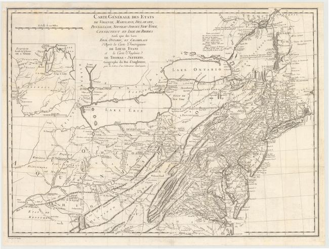
Auction 144, Lot 59
Subject: Eastern United States
Crevecoeur, Michel Guillaume De
Carte Generale des Etats de Virginie, Maryland, Delaware, Pensilvanie, Nouveau-Jersey, New-York, Connecticut et Isle de Rhodes Ainsi que des Lacs Erie, Ontario, et Champlain…, 1787
Size: 25.5 x 18.8 inches (64.8 x 47.8 cm)
Estimate: $1,000 - $1,300
Sold for: $850
Closed on 4/3/2013
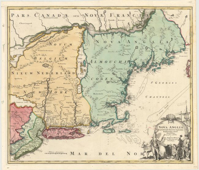
Auction 144, Lot 61
Subject: Colonial New England & Mid-Atlantic
Homann, Johann Baptist
Nova Anglia Septentrionali Americae Implantata Anglorumque Coloniis Florentissima, 1730
Size: 22.3 x 19 inches (56.6 x 48.3 cm)
Estimate: $1,500 - $1,700
Sold for: $850
Closed on 4/3/2013
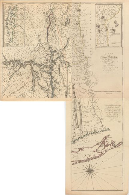
Auction 144, Lot 62
Subject: Colonial New England & Mid-Atlantic
Montresor, John
[On 3 Sheets of 4] A Map of the Province of New York, with Part of Pensilvania, and New England. From an Actual Survey by Captain Montresor, 1775
Size: 15.5 x 28.5 inches (39.4 x 72.4 cm)
Estimate: $4,000 - $5,000
An Important Revolutionary War Period Map
Unsold
Closed on 4/3/2013
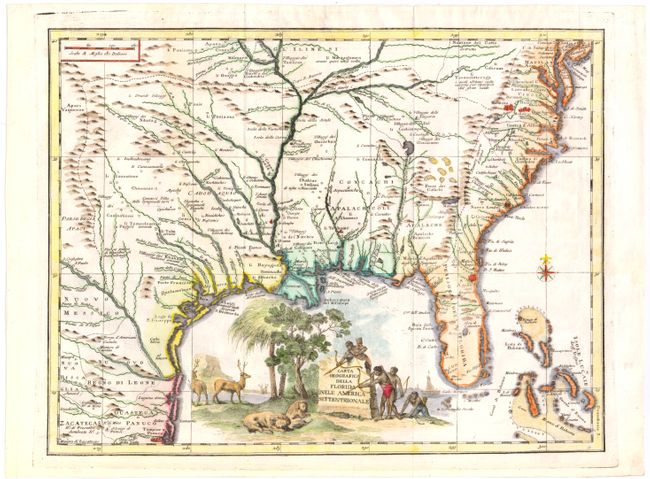
Auction 144, Lot 67
Subject: Colonial Southeast
Albrizzi, Girolamo
Carta Geografica della Florida nell' America Settentrionale, 1740
Size: 16.8 x 12.8 inches (42.7 x 32.5 cm)
Estimate: $1,300 - $1,600
Unsold
Closed on 4/3/2013
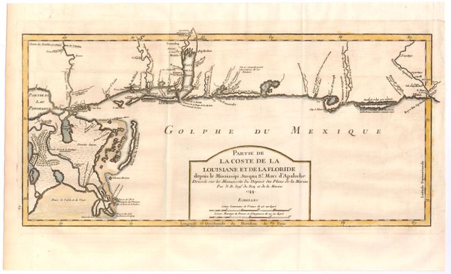
Auction 144, Lot 68
Subject: Colonial South
Bellin, Jacques Nicolas
Partie de la Coste de la Louisiane et de la Floride depuis le Missisippi jusqua St. Marc d'Apalache, 1744
Size: 16.8 x 8.3 inches (42.7 x 21.1 cm)
Estimate: $1,100 - $1,400
Sold for: $800
Closed on 4/3/2013
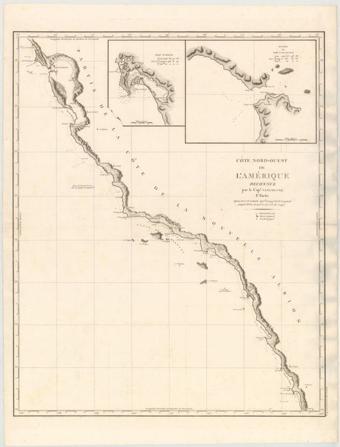
Auction 144, Lot 73
Subject: West Coast, United States
Vancouver, George (Capt)
Cote Nord-Ouest de l'Amerique Reconnue par le Cap.e. Vancouver. 1e Partie, 1799
Size: 24.2 x 30.2 inches (61.5 x 76.7 cm)
Estimate: $1,400 - $1,700
Sold for: $900
Closed on 4/3/2013
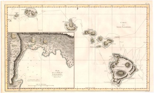
Auction 144, Lot 86
Subject: Hawaii
Cook, James (Capt.)
Carte des Isles Sandwich, 1784
Size: 18.3 x 11 inches (46.5 x 27.9 cm)
Estimate: $800 - $1,000
Important Map of the Hawaiian Islands
Sold for: $600
Closed on 4/3/2013
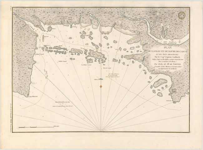
Auction 144, Lot 92
Subject: Casco Bay, Maine
Sartine
Plan de la Baie et du Havre de Casco et des Iles Adjacentes…, 1779
Size: 23 x 16 inches (58.4 x 40.6 cm)
Estimate: $1,000 - $1,200
Sold for: $650
Closed on 4/3/2013
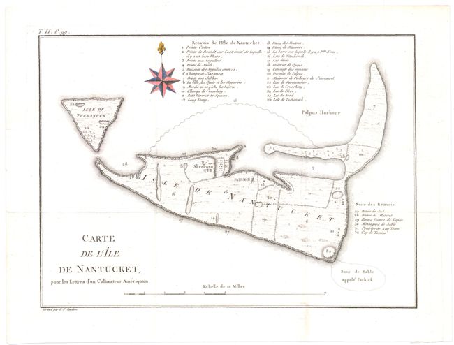
Auction 144, Lot 93
Subject: Nantucket, Massachusetts
Crevecoeur, Michel Guillaume De
Carte de l'Ile de Nantucket, pour les Lettres d’un Cultivateur Ameriquain, 1787
Size: 11 x 8 inches (27.9 x 20.3 cm)
Estimate: $1,400 - $1,700
Sold for: $1,000
Closed on 4/3/2013
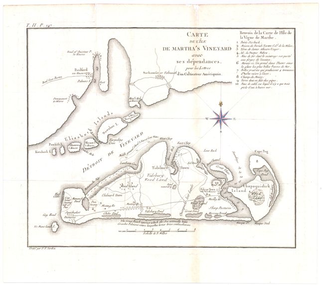
Auction 144, Lot 94
Subject: Martha's Vineyard, Massachusetts
Crevecoeur, Michel Guillaume De
Carte de l'Ile de Martha's Vineyard avec ses Dependances…, 1787
Size: 10.3 x 8.3 inches (26.2 x 21.1 cm)
Estimate: $1,400 - $1,700
Sold for: $1,000
Closed on 4/3/2013
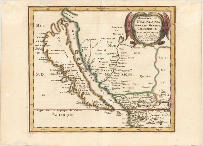
Auction 144, Lot 101
Subject: Western United States & Mexico, California
Sanson/Mariette
Audience de Guadalajara, Nouveau Mexique, Californie, &c., 1667
Size: 9.5 x 8.1 inches (24.1 x 20.6 cm)
Estimate: $1,000 - $1,200
Sold for: $750
Closed on 4/3/2013
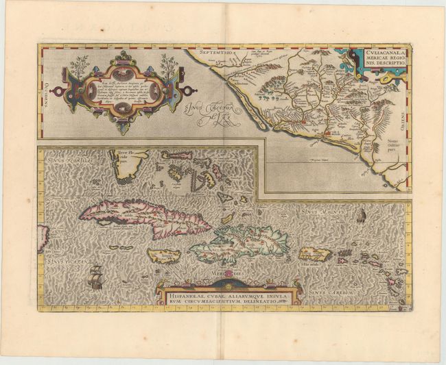
Auction 144, Lot 105
Subject: Caribbean and Mexico
Ortelius, Abraham
Culiacanae, Americae Regionis, Descriptio [on sheet with] Hispaniolae, Cubae, Aliarumque Insularum Circumiacientium, Delineatio, 1579
Size: 19.7 x 14 inches (50 x 35.6 cm)
Estimate: $1,100 - $1,400
Unsold
Closed on 4/3/2013
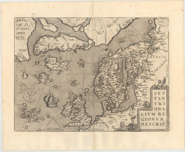
Auction 144, Lot 148
Subject: Arctic & Scandinavia
Ortelius, Abraham
Septentrionalium Regionum Descrip., 1598
Size: 19.4 x 14.3 inches (49.3 x 36.3 cm)
Estimate: $2,400 - $3,000
Sold for: $1,900
Closed on 4/3/2013
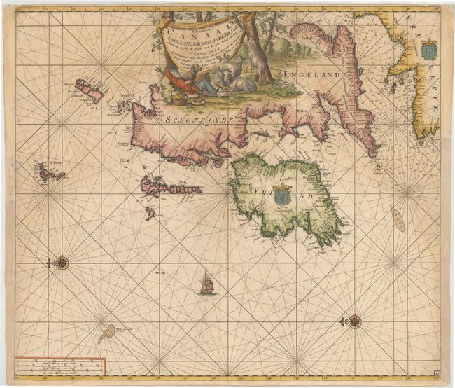
Auction 144, Lot 152
Subject: Britain
Keulen, Johannes van
Paskaart van't Canaal Engelandt Schotlandt en Yrland. Naaukeurig. Opgestelt en Dienstig Voor die Achter Yrland Omkomen…, 1698
Size: 23 x 20 inches (58.4 x 50.8 cm)
Estimate: $1,300 - $1,500
Unsold
Closed on 4/3/2013
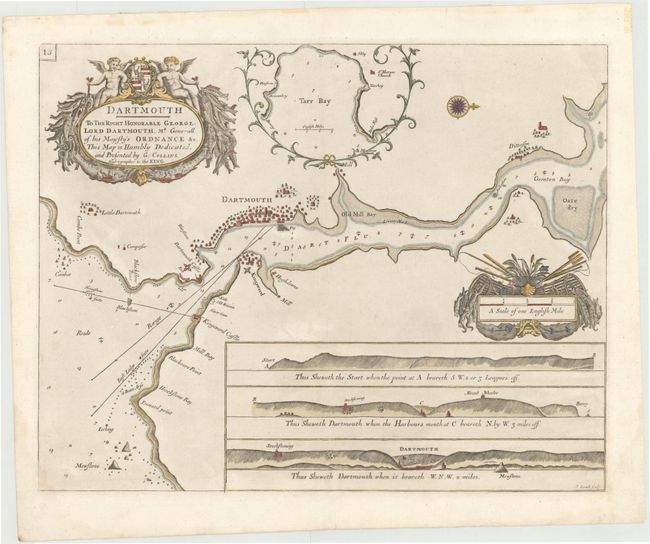
Auction 144, Lot 155
Subject: Dartmouth, England
Collins, Capt. Greenvile
Dartmouth. To the Right Honorable George Lord Dartmouth, Mr. Generall of his Majesty’s Ordnance &c., 1693
Size: 22 x 17.5 inches (55.9 x 44.5 cm)
Estimate: $900 - $1,100
Sold for: $525
Closed on 4/3/2013
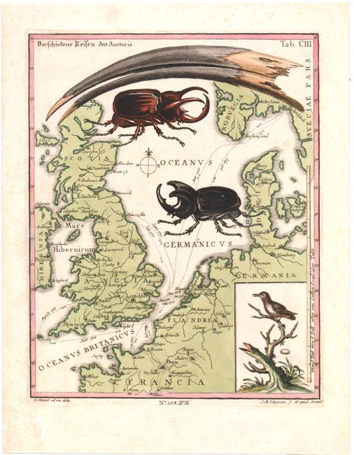
Auction 144, Lot 163
Subject: Northern Europe
Seligmann, Johann Michael
Verschiedene Reisen des Auctoris, 1749
Size: 8 x 10 inches (20.3 x 25.4 cm)
Estimate: $250 - $350
The "Beetle" Map
Sold for: $300
Closed on 4/3/2013
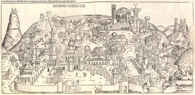
Auction 144, Lot 208
Subject: Jerusalem, Holy Land
Schedel, Hartmann
Folio LXIII - Destruccio Iherosolime, 1493
Size: 21 x 10 inches (53.3 x 25.4 cm)
Estimate: $1,400 - $1,800
Schedel's Woodcut View of Jerusalem
Sold for: $1,000
Closed on 4/3/2013
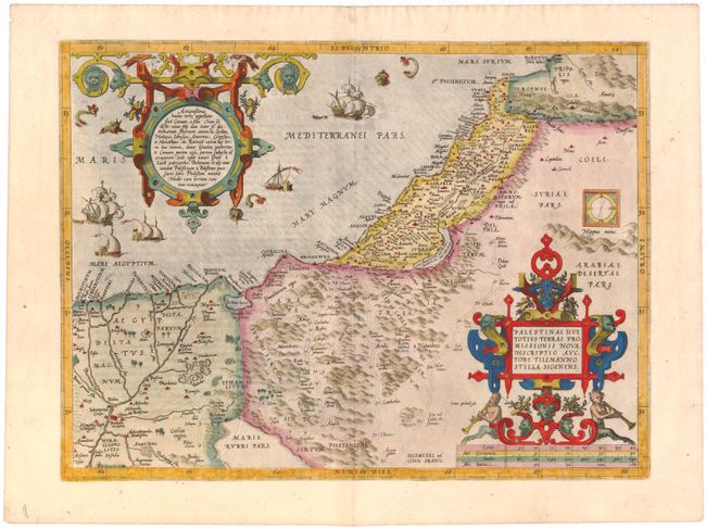
Auction 144, Lot 209
Subject: Holy Land
Ortelius, Abraham
Palestinae sive Totius Terrae Promissionis Nova Descriptio Auctore Tilemanno Stella Sigenens, 1570
Size: 18.5 x 13.7 inches (47 x 34.8 cm)
Estimate: $1,000 - $1,200
Sold for: $950
Closed on 4/3/2013
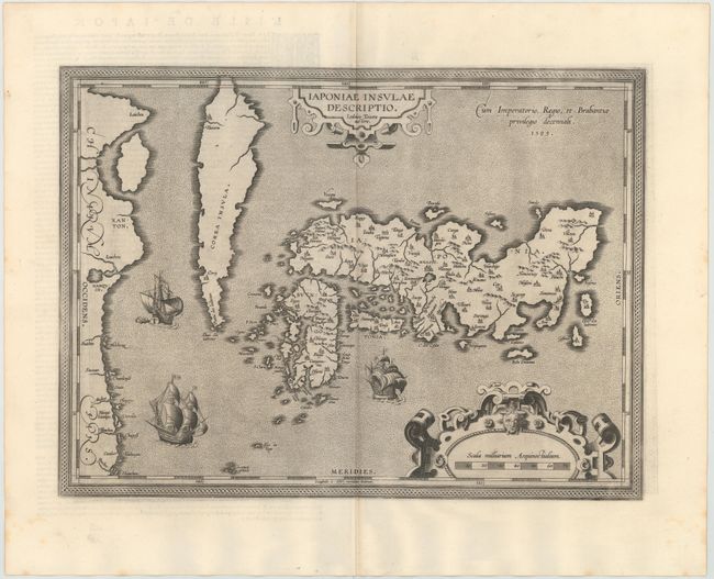
Auction 144, Lot 240
Subject: Japan & Korea
Ortelius, Abraham
Iaponiae Insulae Descriptio. Ludoico Teisera Auctore, 1598
Size: 19.1 x 14 inches (48.5 x 35.6 cm)
Estimate: $3,000 - $3,750
Ortelius' Influential Map of Japan
Sold for: $1,850
Closed on 4/3/2013
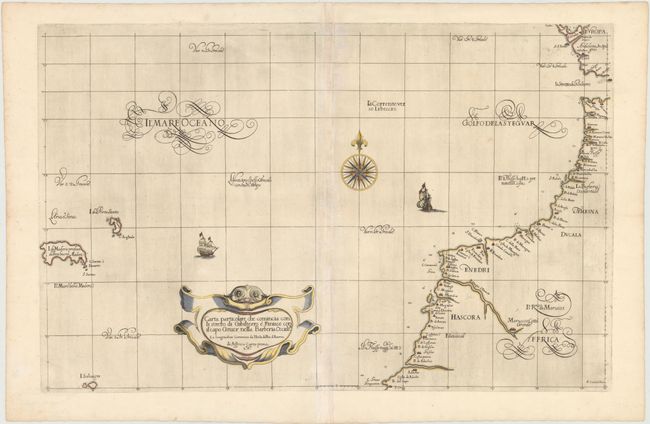
Auction 144, Lot 257
Subject: Northwestern Africa
Dudley, Robert (Sir)
Carta Particolare che Comincia con li Stretto di Gibilterro e Finisce con il Capo Gruer nella Barberia Occide…, 1661
Size: 29.5 x 19 inches (74.9 x 48.3 cm)
Estimate: $950 - $1,200
Sold for: $700
Closed on 4/3/2013
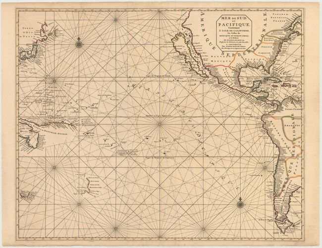
Auction 144, Lot 265
Subject: Pacific Ocean
Mortier, Pierre
Mer de Sud, ou Pacifique, Contenant L'Isle De Californe, les Costes de Mexique, du Perou, Chili, et le Detroit de Magellanique, &c., 1693
Size: 29 x 23.5 inches (73.7 x 59.7 cm)
Estimate: $3,500 - $4,250
Sold for: $2,500
Closed on 4/3/2013
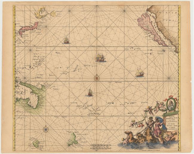
Auction 144, Lot 266
Subject: Pacific Ocean
Renard/De Wit
Magnum Mare del Zur cum Insula California / De Groote Zuyd-Zee en 't Eylandt California, 1715
Size: 22.3 x 19.5 inches (56.6 x 49.5 cm)
Estimate: $3,000 - $3,500
One of the Finest Charts Showing California as an Island
Sold for: $2,200
Closed on 4/3/2013
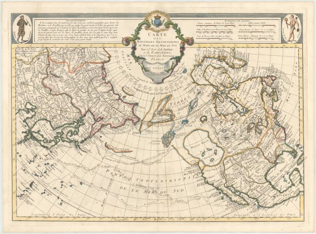
Auction 144, Lot 269
Subject: North Pacific Ocean
Santini, Francois
Carte des Nouvelles Decouvertes au Nord de la Mer du Sud, tant a l'Est de la Siberie et du Kamtchatka, au'a l'Ouest de la Nouvelle France, 1776
Size: 12.5 x 8.5 inches (31.8 x 21.6 cm)
Estimate: $1,600 - $1,800
Sold for: $1,200
Closed on 4/3/2013
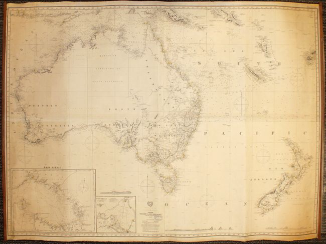
Auction 144, Lot 279
Subject: Australia & New Zealand
Imray, James
Australia and New Zealand, 1894
Size: 57.8 x 42.5 inches (146.8 x 108 cm)
Estimate: $1,600 - $1,800
A Rare and Detailed Navigational Chart
Sold for: $2,500
Closed on 4/3/2013
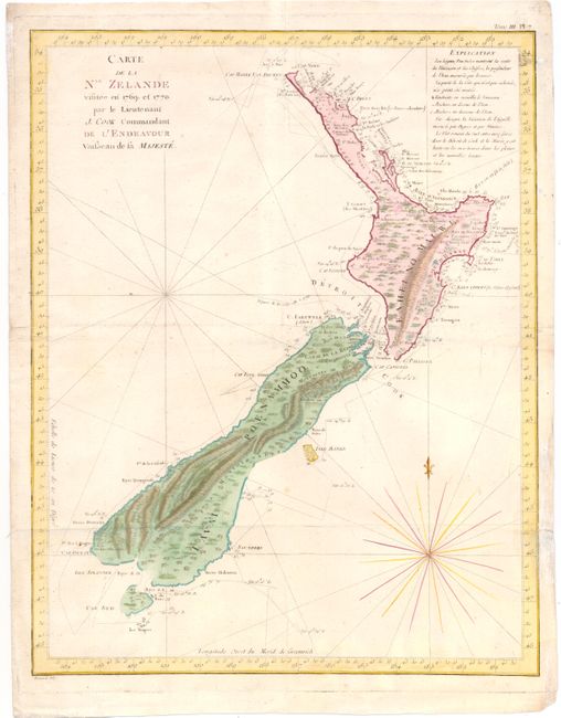
Auction 144, Lot 283
Subject: New Zealand
Cook/Benard
Carte de la Nle. Zelande Visitee en 1769 et 1770. Par le Lieutenant J. Cook Commandant de l'Endeavour Vaisseau de la Majeste, 1774
Size: 15 x 19 inches (38.1 x 48.3 cm)
Estimate: $1,600 - $1,800
Sold for: $1,200
Closed on 4/3/2013
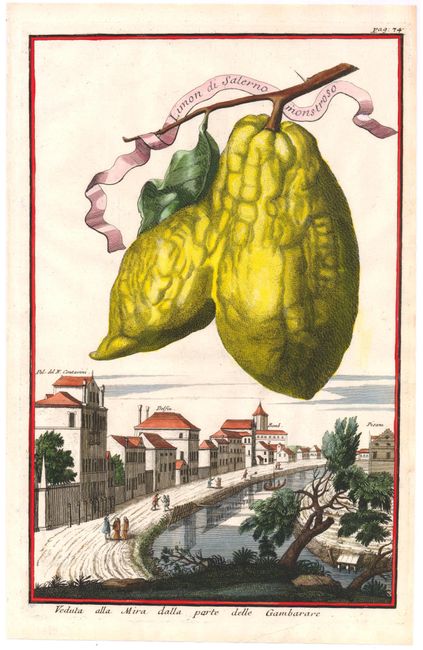
Auction 144, Lot 292
Subject: Prints Botanical
Volkamer, Johann Christoph
Limon di Salerno Monstroso, 1710
Size: 7.8 x 12.2 inches (19.8 x 31 cm)
Estimate: $550 - $700
Sold for: $400
Closed on 4/3/2013
33 lots