Subject: Britain
Period: 1698 (circa)
Publication:
Color: Hand Color
Size:
23 x 20 inches
58.4 x 50.8 cm
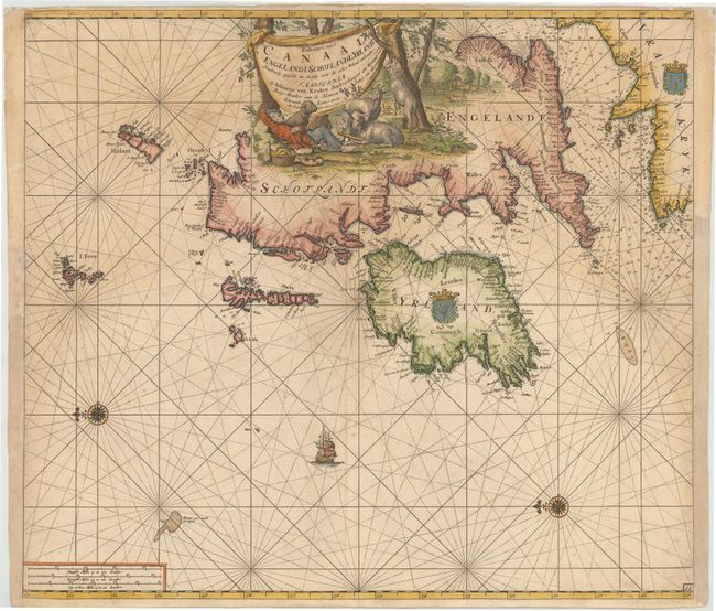
This is the second of Johannes van Keulen's sea charts of the British Isles, which was designed for Zee-Fakkel. Oriented by two compass roses with north on the left, the map provides a detailed picture of the coastlines of the English Channel and Britain. The large title cartouche obscures much of the east coast of England and Scotland. The scene was probably etched by Jan Luyken who signed the title page of both of Van Keulen's atlases. It presents a quaint scene of a shepherd boy with his sheepdog and a picnic basket, surrounded by his sheep and goats in a lovely pastoral landscape. This is the second state with the plate number 11, but still includes the apocryphal sandbank Nieuwgeronde Droogte in the Atlantic which was removed in later examples. It appeared in both the Zee-Fakkel and in the Zee-Atlas from about 1704 onwards. The second state of this map is very scarce and rarely appears on the market.
References: Shirley (BI to 1750) Van Keulen 2.
Condition: B
A nice impression on double-thick paper with light soiling and a few short tears in blank margins. There is a small professionally repaired hole in an unengraved area in Scotland, and a tiny worm hole adjacent to the Island of Man that has been closed on verso with archival tape. Partially remargined at right and left to accommodate framing.