Subject: New Zealand
Period: 1774 (published)
Publication: Cartes et Figures des Voyages…
Color: Hand Color
Size:
15 x 19 inches
38.1 x 48.3 cm
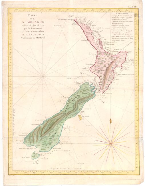
This is one of the most important maps in New Zealand's history and the first complete map of the two islands' coastlines. The chart was made during Cook's first voyage and shows the track of the Endeavour with dates and soundings. The interior reflects the mountainous topography. From the French edition published by Hawkesworth and engraved by Benard.
Capt. James Cook sailed from England in 1768 on his ship the Endeavour on his first round-the-world voyage visiting islands in the Pacific before sighting New Zealand's north & south islands and the strait that divides them, which he named Cook's Strait. Between 1769-1770 Cook sailed around both islands, proving that they were independent of the Great Southern Continent, which was what navigators had believed since Abel Tasman discovered the land mass in 1642. This finely engraved map was taken from a sketch brought back to London by Cook in 1771, which was published in English in London by Cadell & Strahan in 1773, and in French in Paris in 1774.
References: Tooley (Australia) p. 47 #339.
Condition: B+
Issued folding, now pressed, on watermarked paper with very light soiling and a tiny hole along one fold intersection. A short tear in right blank margin has been archivally repaired.