Subject: Tasmania
Period: 1888 (dated)
Publication: Picturesque Atlas of Australasia, Vol. III
Color: Printed Color
Size:
14.5 x 24 inches
36.8 x 61 cm
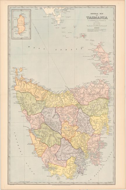
The Picturesque Atlas of Australasia was one of the first best-sellers of Australian publishing. Despite its title, however, it contained relatively few maps. Instead, it attempted, in words and pictures, to describe Australia and was a revealing marker of an emerging nation. This map of Tasmania, drawn by Alex. J. Scally, is filled with details and includes an inset of King Island. Existing railroads, those under construction, and proposed lines are all identified. The verso contains an index to the island as well as a small illustration.
References:
Condition: A+
A clean, bright example. There are remnants of paper tape on verso along the sheet edge at top.