Subject: Pacific Islands
Period: 1813 (dated)
Publication: Pinkerton's Modern Atlas
Color: Hand Color
Size:
27.4 x 19.8 inches
69.6 x 50.3 cm
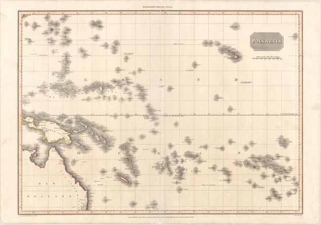
This finely engraved, large chart covers the islands of the South Pacific from the Mariana Islands through Hawaii, and from northeastern Australia through the Society and Marqueses islands. The map is intensely detailed, showing names of islands and island groups, harbors, channels, and straits. It is typical of the precise style of early 19th century cartography with its emphasis on scientific accuracy. Drawn, under the direction of John Pinkerton, by L. Herbert and engraved by Samuel Neele. John Pinkerton's largest and most impressive production was the Modern Atlas, which was first issued in parts to subscribers and as a complete atlas in 1815.
References: Tooley (AUS) #980.
Condition: B+
There is minor toning and two long centerfold separations that nearly run the length of the map that have been archivally repaired. There are also some edge tears that have been archivally repaired.