Subject: Eastern Canada
Period: 1670 (circa)
Publication: Atlas Major
Color: Hand Color
Size:
22.3 x 17.7 inches
56.6 x 45 cm
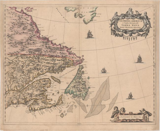
This handsome map of the Canadian Maritimes is based on Samuel de Champlain's great map of 1632, and augmented with place names from De Laet and Jansson. This is Blaeu's only map of Canada. It shows Nova Scotia, Newfoundland, the Gulf of St. Lawrence, Labrador and the Davis and Hudson Straits as well as the southern tip of Greenland and a portion of northern Maine. The elaborate cartouches symbolize the importance of the Grand Banks fisheries, which are boldly engraved on the map. Only five editions of the Atlas Maior, containing this map, were published prior to the fire that destroyed the Blaeu printing house in 1672. Thus the map is now quite scarce. Published in the German text edition of the Atlas Major with no text on verso.
References: Burden #371, Goss (Blaeu) p. 158; Kershaw #149; Van der Krogt (Vol. II) #9130:2.
Condition: A
Original color on a sturdy sheet with very minor soiling. Professionally remargined at right with the left margin partially extended to accommodate framing. There are a few additional professional repairs to a few small tears and chips confined to blank margins.