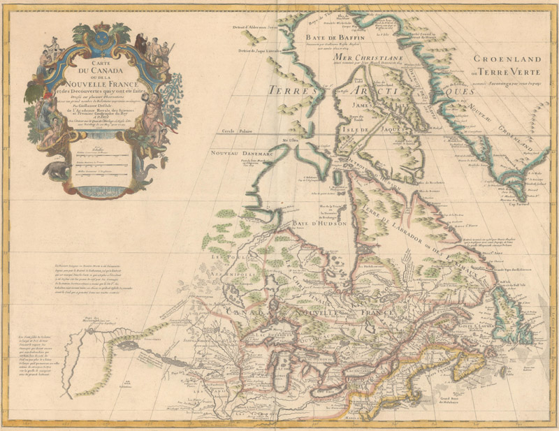
A key map for one collector in Iowa: Guillaume Delisle’s Carte du Canada ou de la Nouvelle France… (1703)
The Collector From the Prairies
by Joe McAlhany
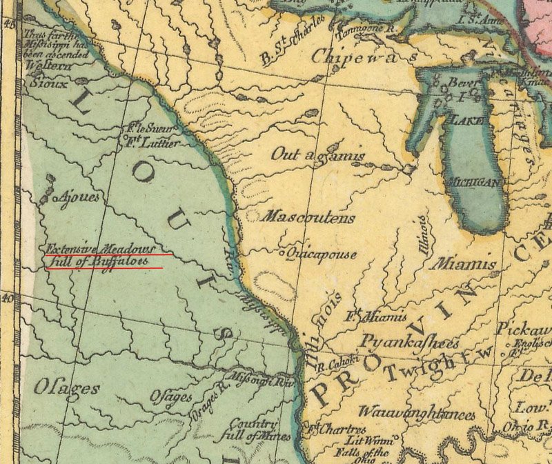
What were the prairies of Iowa like before Lewis and Clark ventured west on the Missouri River? In the decades following their expedition, the landscape of Iowa—and the American West as a whole—underwent massive and rapid change. American pioneers officially began to settle the region of present-day Iowa in 1833, and over the course of the following decade, the area’s native populations were relocated and resettled elsewhere. The Iowa Territory was officially established in 1838, stretching into present-day Minnesota and the Dakotas. In December 1846, the southeastern portion of this rambling territory became the 29th state to be admitted into the Union. The young state developed quickly, with its population more than tripling throughout the 1850s. By 1860, most of the “extensive meadows full of buffaloes” or “grand prairie” that appeared on old maps of Iowa had been plowed into farmland. The wild prairie of the past began to vanish.
“Extensive Meadows full of Buffaloes” in present-day Iowa, from Daniel Friedrich Sotzmann’s Die Vereinigten Staaten von Nord-America… (1785)
These are just the broad strokes of a small part of Iowa’s history; for a more comprehensive telling of the state’s development, one can turn to maps. For one Iowan map collector, this is how his journey into collecting began: a fascination with the history of his home state and the incredible evolution of North America. “It is amazing how quickly the interior of the American continent was transformed from wilderness to the Jeffersonian grid and row crop agriculture,” the collector says. “My map collection has allowed me to be a time traveler, in a way, and go back in time and wonder what this continent looked like before that transformation, and during that transformation.”
The collector, who wishes to remain anonymous, has deep roots in Iowa. A sixth-generation Iowan with homesteader ancestors, he returned to the state after law school hoping to “enjoy the full beauty of rural living.” His lifestyle is deeply connected to the state’s land and history. He restored and maintains a farmhouse originally built in the 1890s and rebuilt a settler’s cabin dating back to 1865 by a pond on his property. After his parents took 14 acres of highly erodible farmland out of production, the collector and his family planted 80 different species of plants, converting the land into beautiful reconstructed prairie. Over time his family has expanded those 14 acres to restore approximately 80 acres of diverse prairie that perhaps resemble the “grand prairie” that once thrived before Lewis and Clark’s expedition and the subsequent cascade of history.
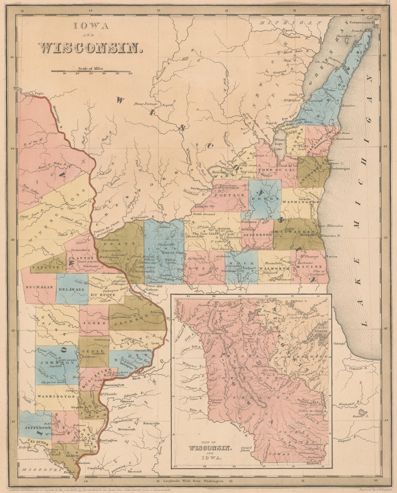
The collector’s first map: Thomas Gamaliel Bradford’s Iowa and Wisconsin (1838)
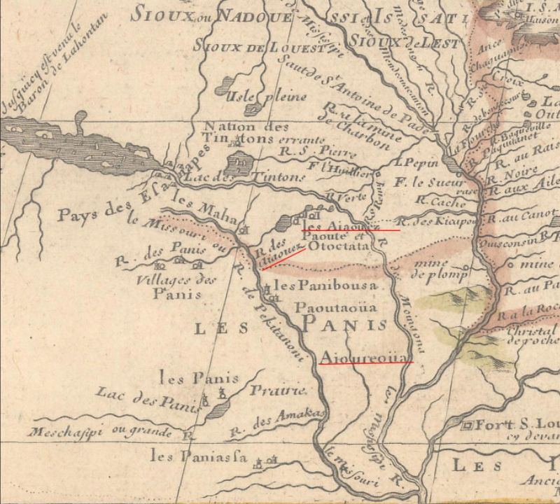
He began collecting maps nearly two decades ago, initially focusing on Iowa’s early history. The first two maps he purchased were Iowa and Wisconsin, from Thomas Gamaliel Bradford’s 1838 atlas, and Samuel Augustus Mitchell’s Iowa (1847). Perhaps the key map in sparking his interest in Iowa’s cartographic history was Guillaume Delisle’s Carte du Canada ou de la Nouvelle France… (1703). It is the earliest map he has found to feature a variation on the word “Iowa”: a “R. des Aiaouez” branches off the Missouri River, with nearby settlements labeled “les Aiaouez.” The name “Aioureoüa” also appears in an area between the Mississippi and Missouri rivers. Iowa’s distinctive eastern bulge is identifiable, and the Des Moines River (here the Moingona) is delineated, albeit with an erroneous due west course and a connection to the mythical Riviere Longue. A beautiful old color example of Mortier’s 1708 derivative of the map hangs on the collector’s office wall.
“Aiaouez” before Iowa: detail from Delisle’s Carte du Canada ou de la Nouvelle France… (1703)
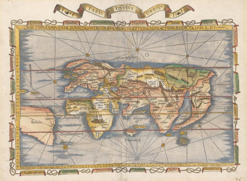
As many collectors can attest, once you start down the path of collecting, it is easy (if not inevitable) for curiosity to lead you to new avenues of interest. While searching auctions for maps related to Iowa, the collector soon had the revelation that there were obtainable and relatively affordable maps from the 16th and 17th centuries, such as maps that showed America in the days of Plymouth and Jamestown, or, going back even further, maps that showed the Western Hemisphere before anybody knew the shapes of the continents. “I bought a 1535 example of Lorenz Fries’ Orbis Typus Universalis,” the collector recalls. “I still remember marveling that I held in my hand a map that had the word ‘America’ on it and showed the American continents, made from a plate that dated to the time of Magellan’s journey.”
Lorenz Fries’ Orbis Typus Universalis… (1535)
Around the time he purchased the Fries map, the collector read Laurence Bergreen’s Over the Edge of the World: Magellan’s Terrifying Circumnavigation of the Globe (2004). After that, he was “hooked on the Age of Exploration.” He hunted down 16th-century maps that showed early configurations of the Western Hemisphere, including maps by Honter, Apianus, Munster, Ruscelli, and Ortelius. “I was fascinated by what they got right and what they got wrong, and how the knowledge of our hemisphere evolved over that century,” he says.
Sebastian Munster’s Die Neuwen Inseln… (1574), the collector’s “favorite map of the Americas from that period”
The collector’s reading and travels have informed and deepened his cartographic interests over the years. Along with Bergreen’s chronicle of Magellan’s expedition, he cites as influences Andrea Wulf’s The Invention of Nature: Alexander von Humboldt’s New World (2015), Dava Sobel’s Longitude: The True Story of a Lone Genius Who Solved the Greatest Scientific Problem of His Time (2007), and books on Charles Darwin (“preferably read while touring the Galapagos”). He encourages all collectors to try a little “map tourism.” When he returned to his alma maters for reunions, he visited their special collections to examine the cartographic treasures therein. He has traveled far and wide to view some of the most important maps in the history of cartography: to the Library of Congress for Martin Waldseemüller’s 12-sheet world map (1507); to Hereford Cathedral in England for the medieval Hereford Mappa Mundi (ca. 1300); to Vatican City’s Gallery of Maps for the painted topographical maps of Italy by the 16th-century friar and geographer Ignazio Danti; and to the Church of Saint George in Madaba, Jordan, for the Madaba Mosaic Map, a geographic floor mosaic dating back to the 6th century. “All of these experiences deepened my appreciation for cartography as visual history,” the collector says.
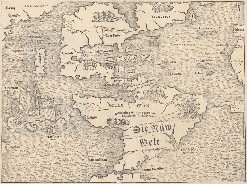
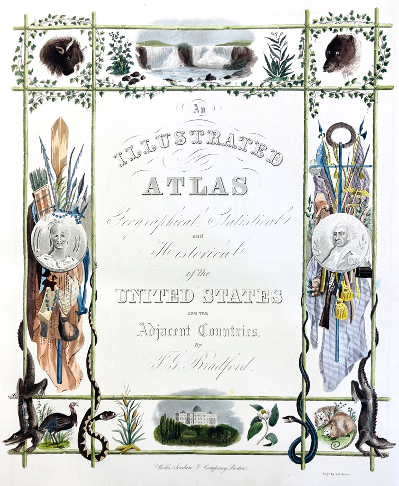
When asked about favorites from his collection, the collector’s wide-ranging interests make it hard for him to narrow it down to just a few. He has a particular fondness for large format maps, specifically citing David H. Vance’s Map of the United States of North America… (1825) and maps of colonial America by Moll, Jefferys, Bowen & Gibson, and Zatta. All of Fries’ maps rate highly, but his Tabula Terrae Novae (1541; also known as the “Admiral’s Map”) holds pride of place (“I just love that map.”). He describes Munster’s Die Neuwen Inseln… (1574) as his favorite map of the Western Hemisphere of its era. He is fascinated by the fantastical references to Magellan’s expedition on Apianus’ Charta Cosmographica, cum Ventorum Propria Natura et Operatione (ca. 1553), such as the giants and cannibals in South America and the cadaverous windhead in the south, a grim nod to the scurvy that plagued the explorer’s crew. Thomas Gamaliel Bradford’s An Illustrated Atlas Geographical Statistical and Historical of the United States and the Adjacent Countries (1838) is in the collector’s estimation “a work of art and the most attractive atlas I have ever held in my hands.” (It’s likely not a coincidence that it is also the atlas that originally contained the first map he ever bought.)
The title page of the collector’s favorite atlas, Thomas Gamaliel Bradford’s An Illustrated Atlas Geographical Statistical and Historical of the United States and the Adjacent Countries (1838)
The collector has decided to downsize his collection and to shift focus back to the Iowa-centric cartography at its core. Old World Auctions is proud to feature a portion of this remarkable collection, including many of the maps described above, in our upcoming June auction. This special one-week auction, which runs from June 2nd to June 9th, will include more than 250 maps and atlases from this collection, ranging from Ptolemaic maps to maps showing the early railroads in the United States. There will be scores of material from the 16th century, among them rare and exquisite maps by Fries, Munster, Apianus, Honter, Ruscelli, Ortelius, de Bry, and Linschoten. Given the collector’s boundless curiosity, the auction is bound to include something of interest for every collector.
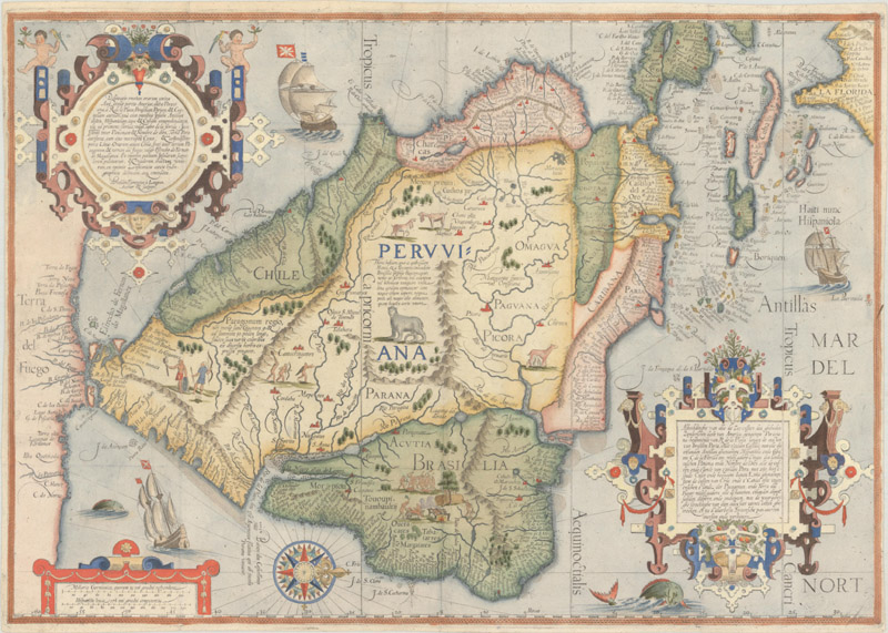
Linschoten/Langren’s Delineatio Omnium Orarum Totius Australis Partis Americae… (ca. 1596), another one of the collector’s favorites
“I am still amazed that it is possible for collectors of relatively modest means to own artifacts of history like the ones in my collection,” the collector muses. Take it from a man who actively lives his connection to the past: “There is nothing else you can hold in your hands that connects you to history the same way these maps do.”