A Cataloger's Perspective: Mapping Africaby Joe McAlhany
This month, we continue our tour of the world and continents with Africa. (As a reminder, you can view the previous articles in our newsletter archive.) Evidence suggests that the mapping of Africa dates back to the Neolithic, on rocks and the walls of caves in Morocco, Algeria, and southern Africa. These rudimentary map-like drawings depicted hunting grounds and, later on, agricultural communities. The oldest surviving map to show part of the continent--indeed, one of the oldest surviving maps period--is a papyrus map of Egypt's "Valley of Many Baths" dating back to 1150 BCE. But for the most part, early African cartography has been lost to the sands of time--quite literally when it comes to the improvised directions that the early non-literate societies would sketch into the sand.
Therefore, our understanding of the history of the mapping of Africa is largely limited to the perspective of European cartographers. As Oscar I. Norwich puts it in his Maps of Africa, "The history of African cartography is a history of the interaction of external and internal cultures and societies, with the actual production of the documents taking place outside the continent." While European explorers and mapmakers drew on indigenous sources to form their understanding of the continent, theirs was always an outsider's view, full of errors, lacunae, and distortions. From the first printed map of the continent (Antonio Fracanzano da Montalbodo's untitled map from Itinerarium Portugallensium e Lusitania..., published in 1508 in Milan) until well into the era of scientific cartography, Africa remained a mystery to European cartographers. As a result, maps of the continent are filled with inaccuracies, conjecture, cartographic myths, and expanses with little to no geographical detail.
Of course, from a collector's point of view, these curiosities and misunderstandings are often what distinguishes a map. Here we will review some of the most fascinating details we look for when cataloging maps of Africa. (Click on any image below to view the entire map.)
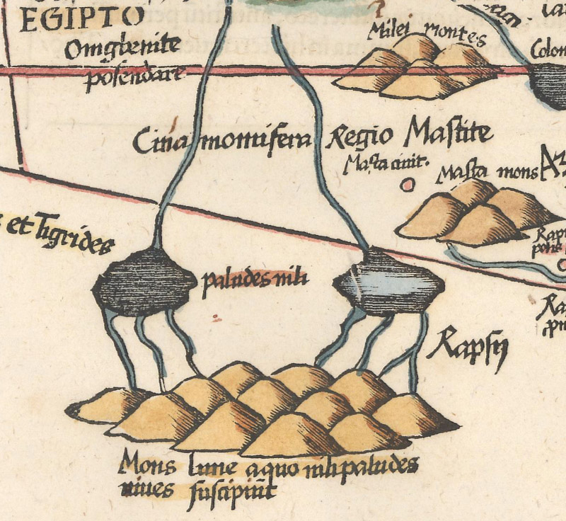
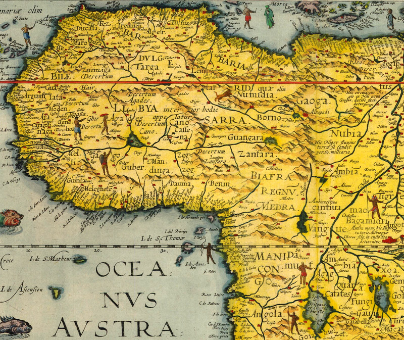
The Mountains of the Moon and the Origins of the Nile The Mountains of the Moon are the most notable and enduring of the cartographic myths found on maps of Africa. For centuries, cartographers depicted the apocryphal range to the south of the equator with two associated lakes, usually referred to as Zaire and Zaflan, forming from rivers of snowmelt. These lakes were believed to be the twin sources of the Nile River. Ptolemy popularized the idea that the Mountains of the Moon were the Nile's source, likely drawing on Marinus of Tyre's account of the travels of the Greco-Roman merchant Diogenes.
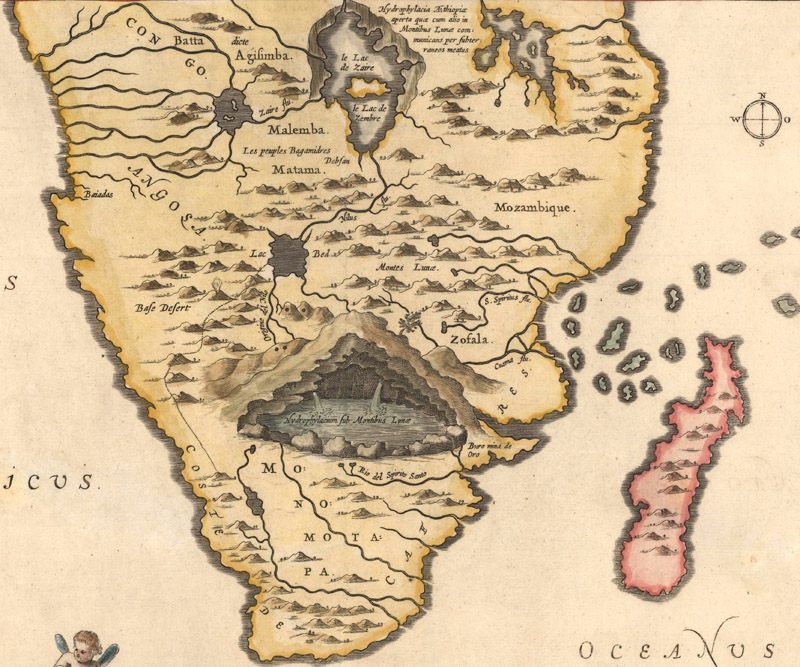
Ptolemy's spurious mountain range and lakes continued to appear on maps even as geographical knowledge of the continent increased over the centuries. In 1613, the Spanish Jesuit missionary Pedro Páez located and described the source of the Blue Nile at Lake Tana. But when Athanasius Kircher published Páez's account with a strange accompanying map, he still included the Mountains of the Moon and lakes in addition to his version of Lake Tana (Lac Bed), which for some reason was located in southern Africa instead of north of the equator in present-day Ethiopia. Guillaume Delisle, the influential French cartographer who developed a more scientific approach to mapmaking, did not include the Mountains of the Moon or Zaire and Zaflan on his landmark map L'Afrique, Dressee sur les Observations de Mrs. de l'Academie Royale des Sciences... (1700). But many of his respected peers continued to perpetuate Ptolemy's myths well into the era of scientific cartography, haphazardly blending ancient theories with up-to-date geographical information. It was only after Henry Morton Stanley definitively discovered the source of the White Nile in the 1870s that the myth of the Mountains of the Moon and the lakes Zaire and Zaflan was finally put to rest. (Click here to read a more in-depth article on the Mountains of the Moon from our archives.)
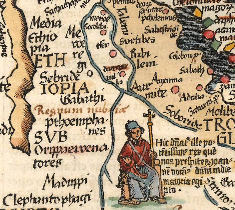
Ptolemy's Mons Lune (Mountains of the Moon) with Paludes Nili (Swamps or Marshes of the Niles). Ptolemy/Fries, Aphricae Tabula Quarta..., 1541.
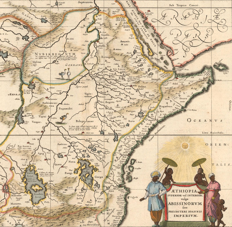
Blaeu's prominent depictions of the lakes Zaire/Zembre and Zaflan, both filled with small islands. Johannes Blaeu, Aethiopia Superior vel Interior..., 1640.
Kircher reveals the fountains of the Nile in an underground cavern beneath the Mountains of the Moon. Athanasius Kircher, Hydrophylacium Africae Precipuum, in Montibus Lunae Situm..., 1682.
Delisle's landmark map takes a more scientific approach and omits the Mountains of the Moon and fabled source lakes. Guillaume Delisle, L'Afrique, Dressee sur les Observations de Mrs. de l'Academie Royale des Sciences..., 1700.
The Kingdom of Prester John The legend of the heroic Christian King Prester John arose during the Crusades, seemingly to lift the spirits of Christendom after a series of devastating defeats. After the Muslims took back Edessa, the original Crusader state, in 1144, Bishop Hugh of Jabala attempted to assuage Pope Eugenius III with stories of a warrior Christian priest and king valiantly battling Persian, Median, and Assyrian troops somewhere in the "extreme Orient." A couple decades later, a letter emerged, allegedly from Prester John, describing his vast Christian kingdom in the "Three Indias" (and extending into "Farther India") consisting of 72 tributary provinces, only a few of which were Christian, but all of which obeyed the virtuous king. The letter describes a literal land of milk and honey, an earthly paradise filled with beasts both real (elephants, camels, and crocodiles) and imaginary (centaurs, giants, and cyclopes), governed by a pious king with a zero tolerance policy for sin and vice. It did not matter that the letter was a fabrication; it was printed, translated into many languages, and disseminated throughout Europe.
But where was Prester John's supposed kingdom? During the medieval age, the European conception of the "Three Indias" was decidedly hazy, so the imaginary Christian kingdom shifted locations from India to Central Asia to, finally, Ethiopia or Abyssinia. There was a certain logic to this relocation; after all, Ethiopia was a remote Christian kingdom. In the 16th and 17th centuries, maps from great cartographers including Munster, Ortelius, Mercator, Jansson, and Blaeu portrayed Ethiopia as Prester John's domain, legitimizing the myth. Over the centuries, numerous attempts were made to contact Prester John or locate his kingdom; all of them failed, of course. But the alleged Christian paradise continued to appear on maps until the beginning of the 18th century, when scholars demonstrated that Prester John was not part of the lineage of Ethiopian monarchs.
Prester John on his throne. Ptolemy/Fries, Aphricae Tabula Quarta..., 1541.
The king of Abyssinia. Mercator/Hondius, Africa ex Magna Orbis..., 1623.
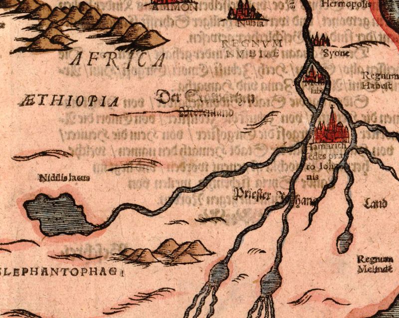
Priester Johans Land and its capital Hamarich at the juncture of the twin sources of the Nile. Heinrich Bunting, Africa Tertia Pars Terrae, 1597.
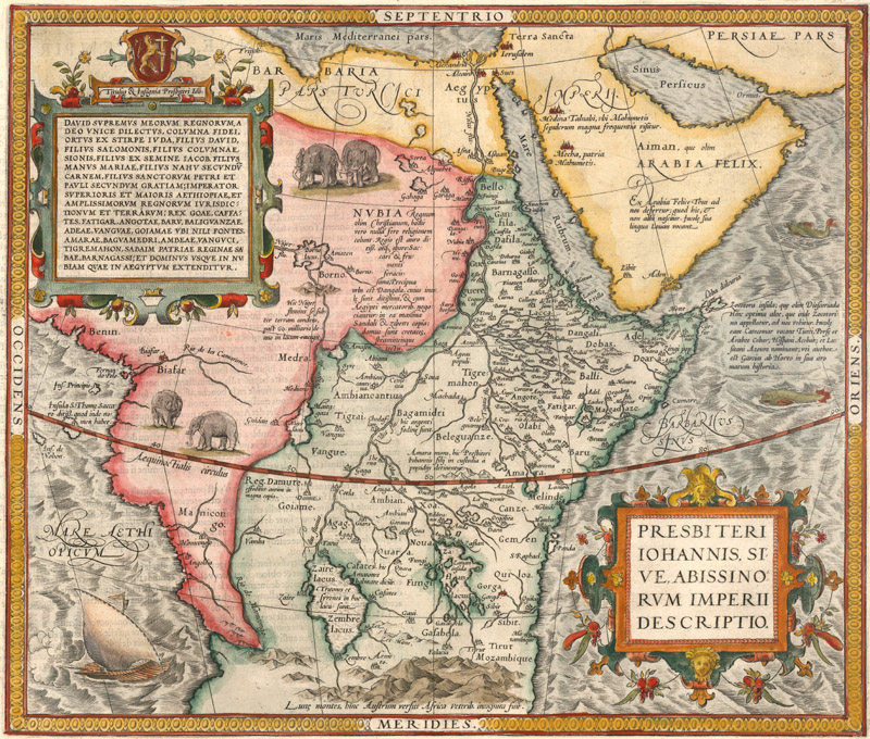
Ortelius' map of the mythical central African kingdom traces Prester John's lineage back to King David. Abraham Ortelius, Presbiteri Iohannis, sive, Abissinorum Imperii Descriptio, 1581.
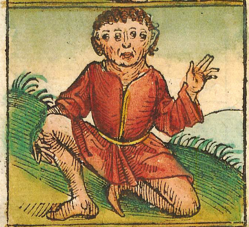
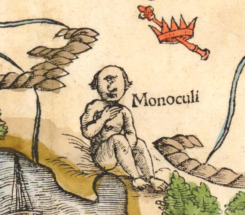
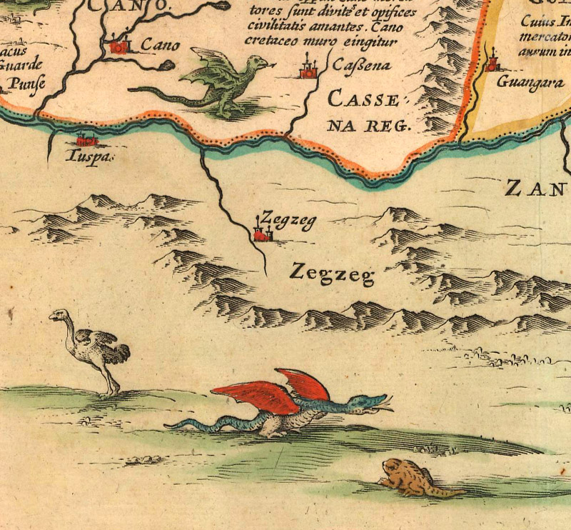
Mythical Creatures of the Continent As mentioned above, the widely circulated Prester John letter lists various mythological beings. These kinds of tall tales were not uncommon when describing Africa. Early mapmakers often turned to invention when faced with the unknown, so it is no surprise that many maps of Africa were populated with strange and otherworldly creatures. In the Nuremberg Chronicle, Hartmann Schedel drew on sources such as Pomponius Mela, Pliny the Elder, and Gauis Julius Solinus to describe an assortment of odd humanoid figures, many of them supposedly found in Africa. Among the African creatures he includes in the panels surrounding his decorative world map are the Ethiopian satyrs, the Nisyti (four-eyed Ethiopians), the Blemmyes (a headless Libyan species with eyes and mouths on their chests), and a species of quick-hopping, one-footed Ethiopians. Other mapmakers illustrated their maps of Africa with cyclopes, dragons, sea monsters, and other bizarre beasts, heightening the aura of exoticism and terror around the unfamiliar continent.
The four-eyed Nisyti of Ethiopia. Hartmann Schedel, Secunda Etas Mundi, 1493.
The headless Blemmyes of Libya. Hartmann Schedel, Secunda Etas Mundi, 1493.
A Monoculi (cyclops) on Africa's western coast. Sebastian Munster, La Table & Description Universelle de Toute l'Afrique..., 1552.
Two different species of African dragons among the other wildlife. Jan Jansson, Nova Barbariae Descriptio, 1631.
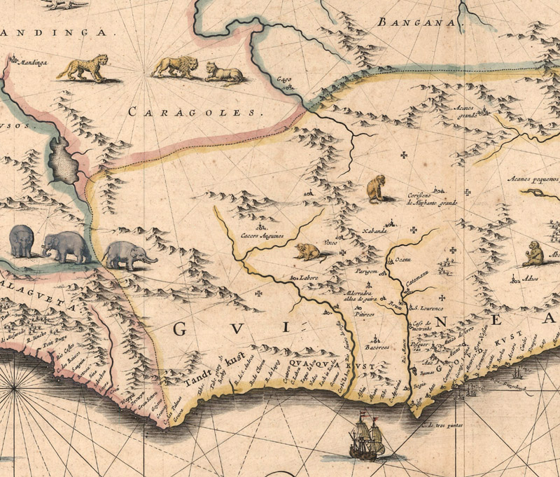
Animals of Africa To Europeans, the real wildlife of Africa was just as exotic as the mythical creatures purportedly strewn across the continent. Mapmakers used elephants, lions, ostriches, apes, and various other native species to decorate the title cartouches and blank spaces of their African maps. In his "On Poetry," satirist Jonathan Swift, ever the keen observer, noted cartographers' strategy: "So Geographers in Afric-Maps/ With Savage-Pictures fill their Gaps;/ And o'er unhabitable Downs/ Place Elephants for want of Towns." Filler or not, these illustrations still delight collectors to this day.
Elephants, lions, monkeys, and a cheetah filling the gaps in the African landscape. Willem Blaeu, Guinea, 1640.
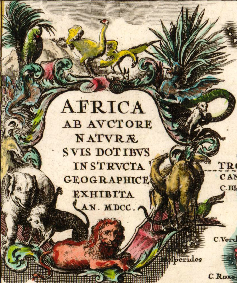
A title cartouche decorated with African wildlife. Heinrich Scherer, Africa ab Auctore Naturae..., 1700.
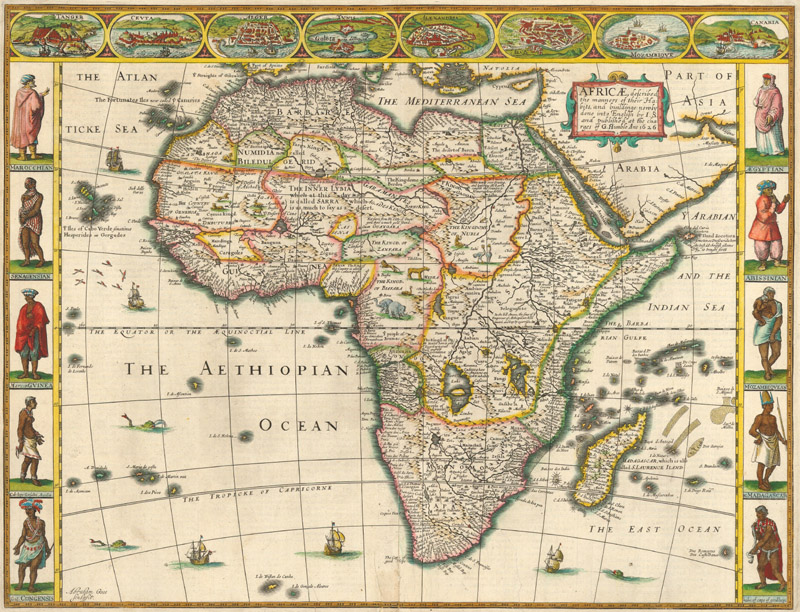
Inhabitants and Culture Images of Africa's people and culture were also used to decorate maps of the continent, often appearing in the cartouches and borders. Ornamental as these illustrations are, there is also a genuine (if amateur) anthropological component to them. They exhibit native dress and suggest customs and habits, and, in the carte-a-figures maps of Speed, Blaeu, De Wit, and others, showcase a range of cultures within the mysterious continent. As with their geographical knowledge of the continent, much of the anthropological information early mapmakers had at their disposal was secondhand and often speculative or fictitious. For instance, text on the verso on John Speed's carte-a-figures map of Africa (1626) describes the Anthropophagi, cannibals who kill their own young so as to avoid the hassle of raising them, only to snatch babies from neighboring regions in order to perpetuate their race. Such a description surely terrified and titillated 17th century England; it did not matter that there was little factual basis for such a claim. City views also appear on the carte-a-figures maps and occasionally in vignettes on other maps of Africa. Most of the views included in carte-a-figures maps published in the 17th century focused primarily on cities in northern Africa, such as Tangiers, Tunis, and Alexandria, and were based on the work of Braun and Hogenberg.
Speed's carte-a-figures map of the continent. John Speed, Africae, Described, the Manners of their Habits, and Buildinge…, 1493.
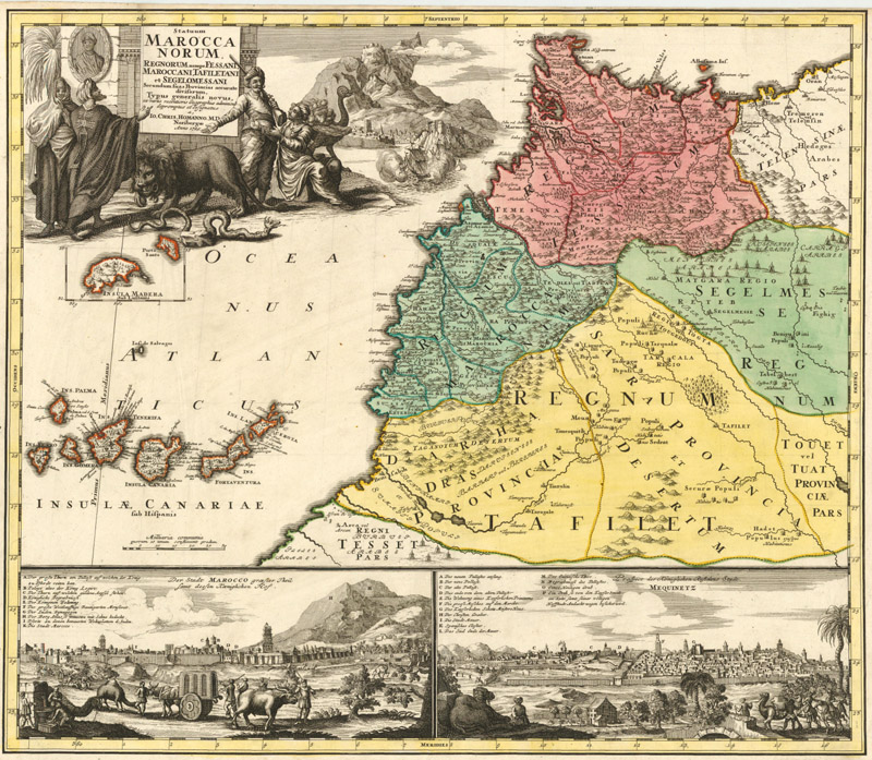
Homann's map of Morocco features a title cartouche showing merchants, soldiers, wild animals, and Tangiers, as well as views of Marrakech and Meknes at bottom. Johann Christoph Homann, Statuum Marocca Norum..., 1728.
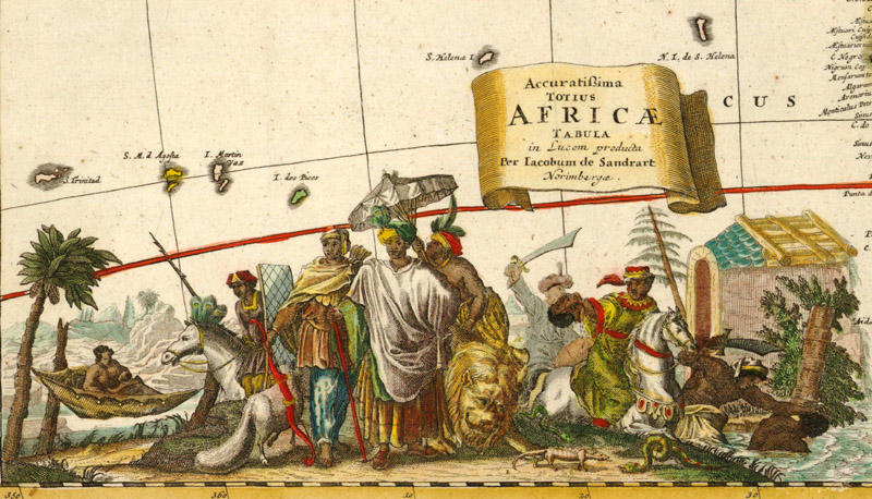
A title cartouche depicting numerous Africans. Jacob van de Sandrart, Accuratissima Totius Africae Tabula..., 1697.
Various natives decorate the landscape. Cornelis de Jode, Africae Vera Forma, et Situs, 1596.
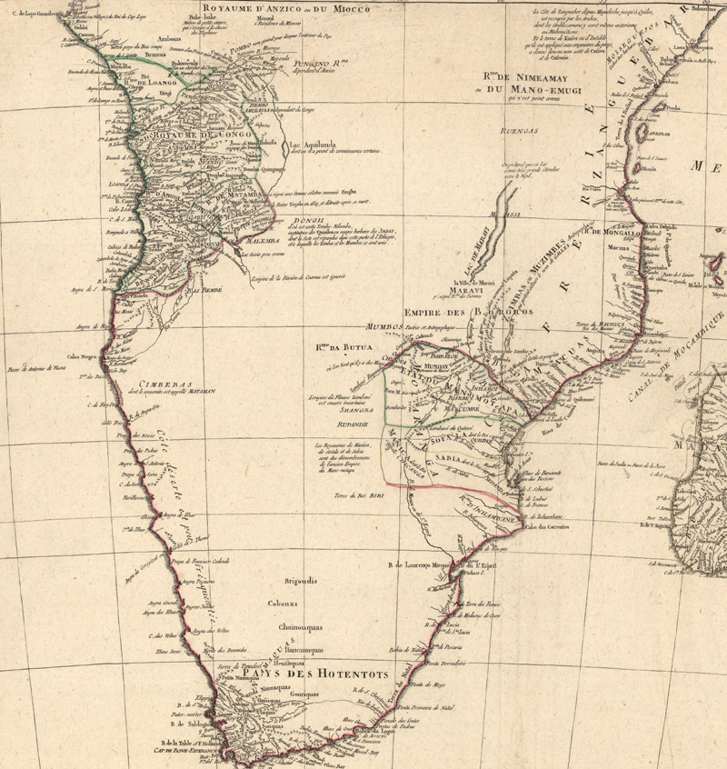
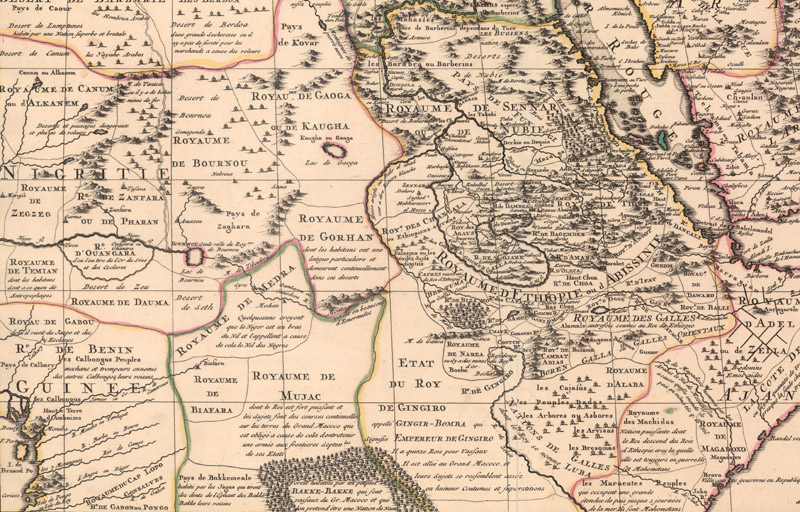
The Interior of the Continent Thanks to the efforts of European traders and mariners, the coast of Africa was relatively well mapped by the early 17th century, with the exception of the southeastern part. But the heart of the continent remained obscure, uncharted territory. For centuries, Europeans were more interested in getting around Africa to reach Asia than they were in exploring its forbidding terrain. During the 16th century, Portuguese missionaries and soldiers made headway in the Congo, Ethiopia, and around the Zambezi, but their contributions to the mapping of the interior began to disappear at the onset of the Age of Enlightenment and scientific cartography. For scientific cartographers like Guillaume Delisle and Jean Baptiste Bourguignon d'Anville, skepticism and precision was the rule; unverified geographical information had no place on their maps. However, their scientific approach presented a problem: how were they to fill the blank spaces on their maps?
Unlike their predecessors, the new generation of scientific cartographers could not rely on invention, guesswork, and decoration to compensate for their lack of knowledge of Africa's interior. Some, like Delisle, used text to cover the gaps, such as tribal names in large print, ethnological descriptions (often ironically erroneous), and notes directly commenting on the lack of reliable geographical information. Others, like d'Anville, kept things simple and just left large sections of the interior blank. Variations of these strategies survived until the 19th century, when an era of imperialism lead to a more comprehensive mapping of the continent.
D'Anville left significant areas of unengraved space on his maps of Africa. D'Anville/Santini, Afrique..., 1784.
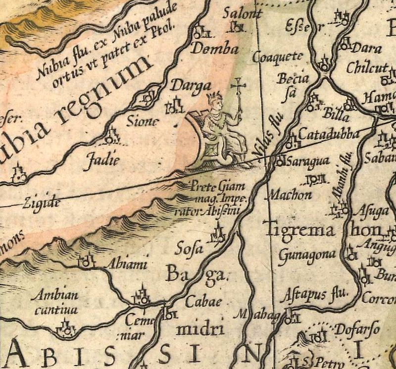
Notice the contrast in detail between the eastern part of the continent and the interior, where text replaces geographical detail. Delisle/Covens & Mortier, Carte de l'Egypte de la Nubie de l'Abissinie &c., 1730.
Stay Tuned Our journey through the cartography of the world and its continents continues in the fall with an article about the mapping of South America!
References
Baynton-Williams, Ashley, “Ptolemy’s Mountains of the Moon,” MapForum Issue 4, London, Winter 2004.
Betz, Richard L., The Mapping of Africa: A Cartobibliography of Printed Maps of the African Continent to 1700, Hes & De Graaf Publishers, t’ Goy-Houten, the Netherlands, 2007.
Brooke-Hitching, Edward, The Phantom Atlas: The Greatest Myths, Lies and Blunders on Maps, Chronicle Books, San Francisco, 2018.
Jacobs, Frank, "The Kingdom of Prester John, Christianity's Imaginary Ally," Big Think, 23 July 2010. https://bigthink.com/strange-maps/434-prester-john-king-of-wishful-thinking [accessed 15 July 2019]
Norwich, Oscar I., Norwich’s Maps of Africa (2nd Edition), Terra Nova Press, Norwich, Vermont, 1997.