Current Auction
"[Map in Magazine] L'Inde [in] 7 Jours - 8 Mars 1942"
Subject: Southern & Southeast Asia, World War II
Period: 1942 (published)
Publication:
Color: Printed Color
Size:
22.1 x 16.4 inches
56.1 x 41.7 cm
Download High Resolution Image
(or just click on image to launch the Zoom viewer)
(or just click on image to launch the Zoom viewer)
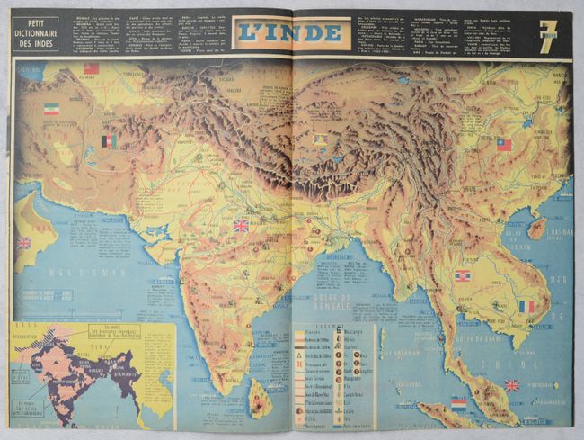
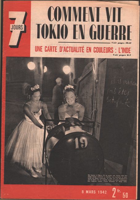
This graphic and informative World War II-era map covers Southern and Southeast Asia. It centers on India and extends from Iran to Hong Kong. A legend at bottom identifies elevations, mountain passes, naval bases, important ports, resources, and the historical routes of Alexander the Great, Marco Polo, and the Yellow Expedition. An inset at bottom left is color-coded to show areas of India that are semi-independent (pink), Muslim territories (striped), and under British control (violet). Across the top of the map is a Petit Dictionnaire des Indes providing brief explanations of key terms. The map was designed by graphic artist Jacques Mercier for the March 8, 1942 edition of 7 Jours. The entire issue of the magazine is included here, with a film shoot at the opera on the cover.
References: Rumsey #15804.
Condition: A
The map is clean and colorful, with a staple along centerfold as issued.
Estimate: $160 - $190
Price: $120
Bid Increments
$50 - $99$5
$100 - $249$10
$250 - $499$25
$500 - $999$50
Terms & Conditions