Current Auction
Scarce Maps Documenting Operations in the Philippine-American War
"[Lot of 2] Map of Central Luzon Showing a Portion of the Field of Operations of the 8th Army Corps... [and] Southern Luzon Showing Portion of the Theatre of Operations...", U.S. Corps of Engineers
Subject: Luzon, Philippines
Period: 1899 (dated)
Publication:
Color:
Size:
See Description
Download High Resolution Image
(or just click on image to launch the Zoom viewer)
(or just click on image to launch the Zoom viewer)
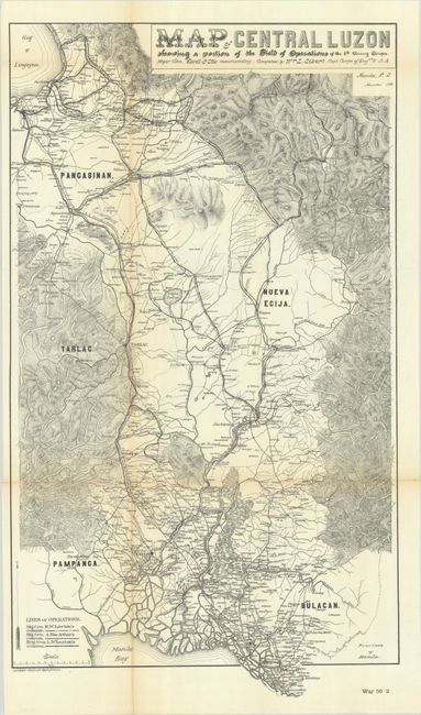
A. Map of Central Luzon Showing a Portion of the Field of Operations of the 8th Army Corps..., printed color (15 x 26.1"). This exceptionally detailed map was produced during the Philippine–American War. It presents the field of operations under Major General Elwell Otis from the Gulf of Lingayen south to Manila Bay. This was an active area in the war and delineates the lines of operation for Generals Lawton, MacArthur Jr. and Wheaton along with a railroad (highlighted in color) extending from Dagupan south to Manila. The map further depicts the region's rugged topography, rivers, cities and smaller settlements. Compiled by William Sibert and lithographed by Andrew Graham in Washington. Condition: Issued folding on a bright sheet with some light toning along the left vertical fold. One tiny split at a fold junction has been closed on verso with archival tape.
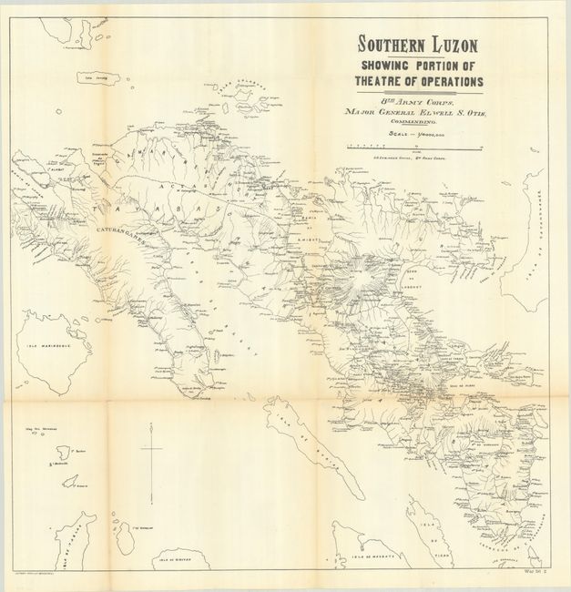
B. Southern Luzon Showing Portion of the Theatre of Operations..., black & white (25.5 x 26.1"). This map shows the field of operations from Lopez Bay east to Catanduanes Island and south to the San Bernardino Strait. It depicts the region's numerous islands, coastal features, rivers, settlements, and two volcanoes north of Legazpi City. An overall useful map that demonstrates the challenges of conventional warfare in a rugged and island-filled region.
References: Phillips (Philippine Islands) #507 & #558.
Condition: B+
See description above.
Estimate: $180 - $220
Price: $100
Bid Increments
$50 - $99$5
$100 - $249$10
$250 - $499$25
$500 - $999$50
Terms & Conditions