Current Auction
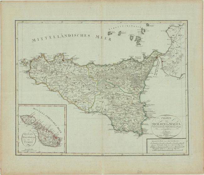
"Charte von Sicilien und Malta nach den Bewahrtesten Hulfsmitteln Neu Entworfen und Gezeichnet von F. Goetze", Weimar Geographisches Institut
Subject: Sicily, Italy & Malta
Period: 1801 (dated)
Publication:
Color: Hand Color
Size:
22.1 x 17.3 inches
56.1 x 43.9 cm
Download High Resolution Image
(or just click on image to launch the Zoom viewer)
(or just click on image to launch the Zoom viewer)
The large map gives excellent detail of the island of Sicily, with cities, roads, political boundaries, topography, and a nice rendering of Mt. Etna. A large inset depicts the archipelago of Malta. Drawn by Ferdinand Goetze.
References:
Condition: B+
A nice impression with original color on a bluish sheet with very light soiling, minor offsetting, and a few spots of foxing. There are dampstains along the far edges of the sheet.
Estimate: $200 - $230
Price: $150
Bid Increments
$100 - $249$10
$250 - $499$25
$500 - $999$50
$1,000 - $2,499$100
Terms & Conditions