Current Auction
"Ducatus Mantuani quam Castigatissima Delineatio per Dom. I.I. v. Baumeister...", Seutter, Matthias
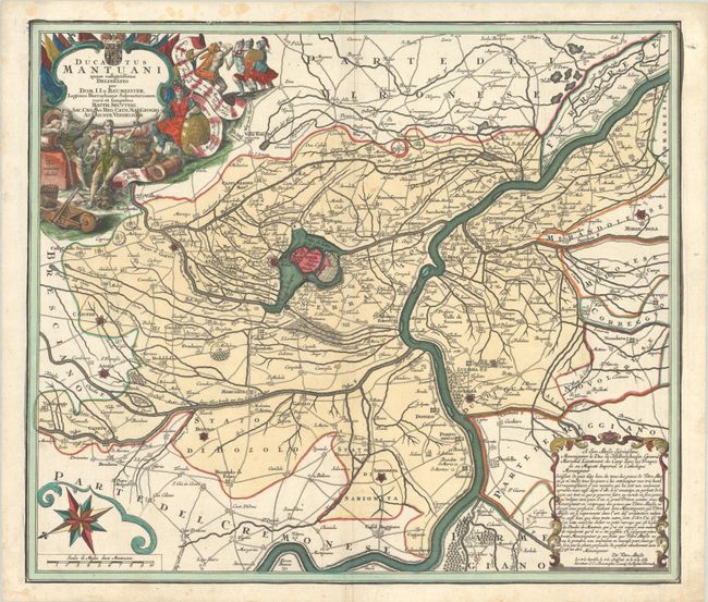
Subject: Mantua, Italy
Period: 1760 (circa)
Publication:
Color: Hand Color
Size:
23 x 19.8 inches
58.4 x 50.3 cm
Download High Resolution Image
(or just click on image to launch the Zoom viewer)
(or just click on image to launch the Zoom viewer)
This lovely copper-engraved map is centered on the northern Italian city of Mantua and the region along the Po and Oglio rivers. The city proper is shown surrounded by three artificial lakes that were created as part of the city's defense system in the 12th century. Other fortified cities in the vicinity are depicted and colored in red. The map is embellished by a decorative title cartouche and compass rose.
References:
Condition: A
A sharp impression on a bright sheet with original color in the map and later color in the cartouches. There are minor printer's crease at top and bottom center, and some small dampstains confined to the blank margins.
Estimate: $200 - $230
Price: $150
Bid Increments
$100 - $249$10
$250 - $499$25
$500 - $999$50
$1,000 - $2,499$100
Terms & Conditions