Current Auction
"Italia Antiqua", Cluver, Philipp
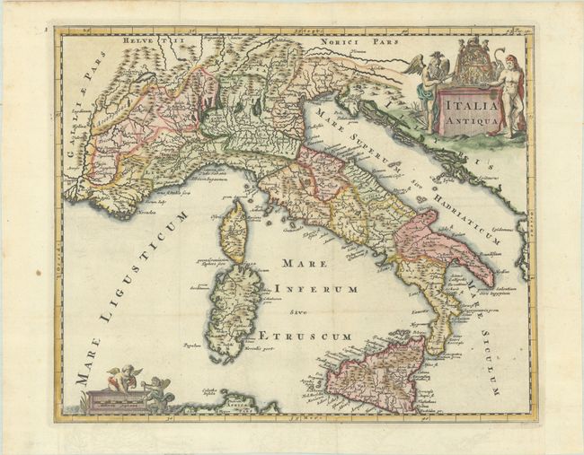
Subject: Italy
Period: 1697 (published)
Publication: Introductio in Universam Geographiam
Color: Hand Color
Size:
12.8 x 10.5 inches
32.5 x 26.7 cm
Download High Resolution Image
(or just click on image to launch the Zoom viewer)
(or just click on image to launch the Zoom viewer)
Lovely map of ancient Italy including Corsica, Sardinia and Sicily. It is fully engraved to illustrate topography with ancient place names and embellished with two decorative cartouches with mythical figures, including Father Time.
Cluver's Introductio in Universam Geographicam was a popular atlas, appearing in over 45 editions during a 100-year period. The first edition was published without maps in the 1620s, and the first edition to include maps was published circa 1641. The various editions were published in different cities throughout Europe, including Amsterdam, Nuremberg, and London. This map is from an Amsterdam edition published by Jan Wolters.
References: Shirley (BL Atlases) T.CLUV-8a #16.
Condition: A
A dark impression, issued folding on a bright sheet with a hint of offsetting and a couple of spots in the left margin. A binding trim at bottom right has been replaced with old paper.
Estimate: $160 - $190
Price: $120
Bid Increments
$50 - $99$5
$100 - $249$10
$250 - $499$25
$500 - $999$50
Terms & Conditions