Current Auction
"Italia", Cloppenburg, Johannes
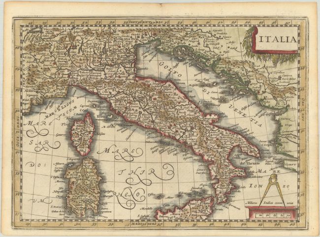
Subject: Italy
Period: 1676 (published)
Publication: Introductionis in Universam Geographiam
Color: Hand Color
Size:
10 x 7.2 inches
25.4 x 18.3 cm
Download High Resolution Image
(or just click on image to launch the Zoom viewer)
(or just click on image to launch the Zoom viewer)
A lovely small map of Italy,including the islands of Corsica, Sardinia and northern Sicily. The map is adorned with two decorative cartouches. This map was originally engraved for for Cloppenburgh's small Atlas, first published in 1630, and later used by Jansson's heirs for an edition of Philipp Cluver's popular series of geographical textbooks.
Cluver's Introductio in Universam Geographicam was a popular atlas, appearing in over 45 editions during a 100-year period. The first edition was published without maps in the 1620s, and the first edition to include maps was published circa 1641. The various editions were published in different cities throughout Europe, including Amsterdam, Nuremberg, and London, often with new sets of maps engraved. This map is from an Amsterdam edition published by Jansson's heirs, which included some maps from the Jansson and Cloppenburgh editions of Atlas Minor.
References: Shirley (BL Atlases) T.CLUV-6a #15; Van der Krogt (Vol. III) #7000:353.
Condition: A
A nice impression on a bright sheet with minor toning along the edges of the sheet. The margins are a bit narrow, as issued, but still sufficient for framing.
Estimate: $200 - $230
Price: $150
Bid Increments
$100 - $249$10
$250 - $499$25
$500 - $999$50
$1,000 - $2,499$100
Terms & Conditions