Current Auction
"Li Palatinati di Minsk, Mscislaw, Polok e Witebsk nella Lithuania. Tratta dall' Atlante Polacco del Sigr. Rizzi Zanoni", Zatta, Antonio
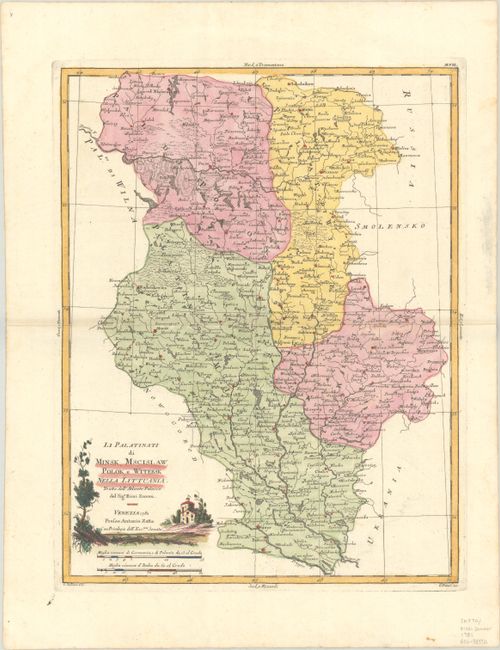
Subject: Eastern Belarus
Period: 1781 (dated)
Publication: Atlante Novissimo…
Color: Hand Color
Size:
12.4 x 16 inches
31.5 x 40.6 cm
Download High Resolution Image
(or just click on image to launch the Zoom viewer)
(or just click on image to launch the Zoom viewer)
This densely engraved map focuses on the eastern portion of present-day Belarus. The Dnieper and Dvina Rivers flow through the map, which includes the cities of Minsk, Mazyr, and Vitsyebsk. The map is filled with place names and gives good detail of political boundaries in the region. Engraved by G. Zuliani with lettering by G. Pitteri. Adorned with a decorative title cartouche.
References: Shirley (BL Atlases) T.ZAT-1a Vol. 2, #42.
Condition: A
A crisp impression on a bright sheet with one small, unobtrusive stain in the image.
Estimate: $140 - $170
Price: $100
Bid Increments
$50 - $99$5
$100 - $249$10
$250 - $499$25
$500 - $999$50
Terms & Conditions