Current Auction
"Poland. Subdivided into Its Several Palatinates &c. Agreeable to Modern History", Moll, Herman
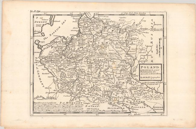
Subject: Eastern Europe, Poland
Period: 1744-46 (published)
Publication: Modern History...
Color: Black & White
Size:
10.3 x 7.8 inches
26.2 x 19.8 cm
Download High Resolution Image
(or just click on image to launch the Zoom viewer)
(or just click on image to launch the Zoom viewer)
This copper engraved map of Poland and the Baltic states extends as far north as Riga, Latvia and to Vienna, Austria in the southwest. It includes excellent detail of roads, major cities, and towns. A long note at the bottom provides the lengths of Poland's frontiers and the location of Warsaw in relation to London, Paris, and St. Petersburg. Published in London in the third edition of Thomas Salmon's Modern History: or the Present State of All Nations (1744-46).
References: McCorkle (18th C. Geography Books) #348 Vol. I [18]; Shirley (BL Atlases) G.SALM-1c #20.
Condition: B+
A nice impression on a sheet with a "H" watermark. There are a few spots of foxing in the image and marginal dampstaining and toning.
Estimate: $160 - $190
Price: $120
Bid Increments
$50 - $99$5
$100 - $249$10
$250 - $499$25
$500 - $999$50
Terms & Conditions