Current Auction
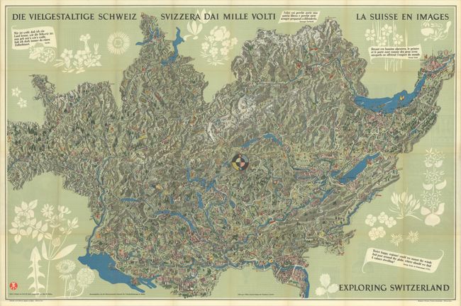
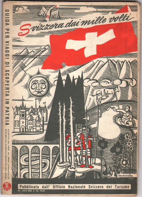
"Die Vielgestaltige Schweiz - Svizzera dai Mille Volti - La Suisse en Images - Exploring Switzerland"
Subject: Switzerland
Period: 1939 (dated)
Publication:
Color: Printed Color
Size:
45.3 x 29.8 inches
115.1 x 75.7 cm
Download High Resolution Image
(or just click on image to launch the Zoom viewer)
(or just click on image to launch the Zoom viewer)
This superb, wall-sized pictorial map of Switzerland shows the mountainous country in three-dimensional perspective. An Art Deco compass rose in the center of the map orients north to the bottom. Rivers, roads, and railroads criss-cross the landscape, with towns depicted with bird's-eye views. Interspersed are the coats of arms, costumed figures, and regional products from each Canton. The map is titled in four languages - German, Italian, French, and English - with each title accompanied by a quote from native from that country. On verso is English text describing each Canton in detail. The map was created by Otto M. Mueller under the guidance of Prof Eduard Imhof and published by the Schweizerischen Zentrale fuer Verkehrsfoerderung (Swiss Tourism Board). Printed by Hallwag.
References: Rumsey #8126.003.
Condition: A
Issued folding with a short separation at a fold junction along the upper horizontal fold and minor toning along the fold lines.
Estimate: $240 - $300
Price: $180
Bid Increments
$100 - $249$10
$250 - $499$25
$500 - $999$50
$1,000 - $2,499$100
Terms & Conditions