Current Auction
Full Contemporary Color
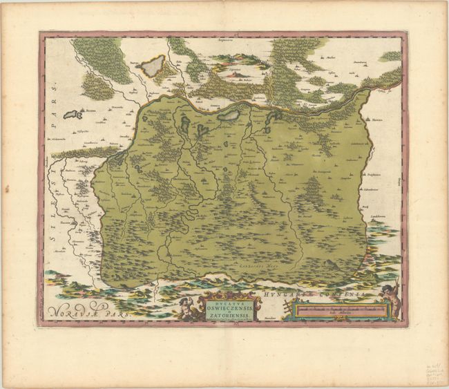
"Ducatus Oswieczensis, et Zatoriensis", Wit, Frederick de
Subject: Southern Poland
Period: 1700 (circa)
Publication:
Color: Hand Color
Size:
20.2 x 16.1 inches
51.3 x 40.9 cm
Download High Resolution Image
(or just click on image to launch the Zoom viewer)
(or just click on image to launch the Zoom viewer)
Handsome map shows the source of the Vistula River and the duchy of Oswieczin and Zator in the southern part of Poland. The map is fully engraved with mountains, forests and a few cities and villages. Embellished with a strapwork title cartouche and a distance scale cartouche with putti. Blank verso.
References:
Condition: B+
A sharp impression with full contemporary color, minor printer's ink residue, light foxing, and toning along the edges of the sheet.
Estimate: $275 - $350
Price: $200
Bid Increments
$100 - $249$10
$250 - $499$25
$500 - $999$50
$1,000 - $2,499$100
Terms & Conditions