Current Auction
"Saxonia Superior, cum Lusatia et Misnia", Blaeu, Johannes
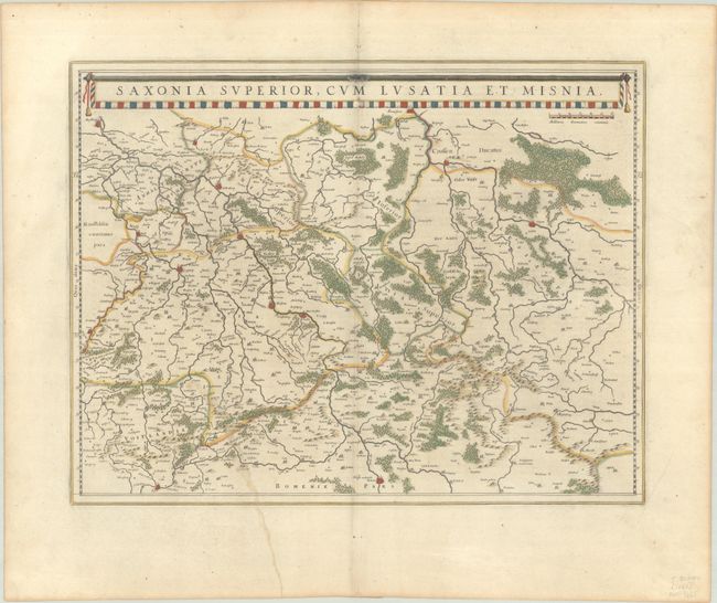
Subject: Eastern Germany
Period: 1662 (circa)
Publication:
Color: Hand Color
Size:
20.1 x 15.5 inches
51.1 x 39.4 cm
Download High Resolution Image
(or just click on image to launch the Zoom viewer)
(or just click on image to launch the Zoom viewer)
This finely engraved and detailed map of the region includes the cities of Halle, Leipzig, Magdeburg, Dresden, and Frankfurt an der Oder, and extends east to Glogow and south to Prague. The map is fully engraved to show the forests and tiny villages and decorated with a long title banner at top. Dutch text on verso, published between 1642-64.
References: Van der Krogt (Vol. II) #2100:2A.
Condition: B+
Full contemporary color on a wide-margined sheet with a large watermark of the god Atlas. There is marginal soiling and an archivally repaired tear that extends 6" into the image at bottom.
Estimate: $100 - $130
Price: $75
Bid Increments
$50 - $99$5
$100 - $249$10
$250 - $499$25
$500 - $999$50
Terms & Conditions