Current Auction
"Principatus Isenacensis cum Adjacentibus Vicinorum Statuum Ditionibus Exhibitus", Homann, Johann Baptist
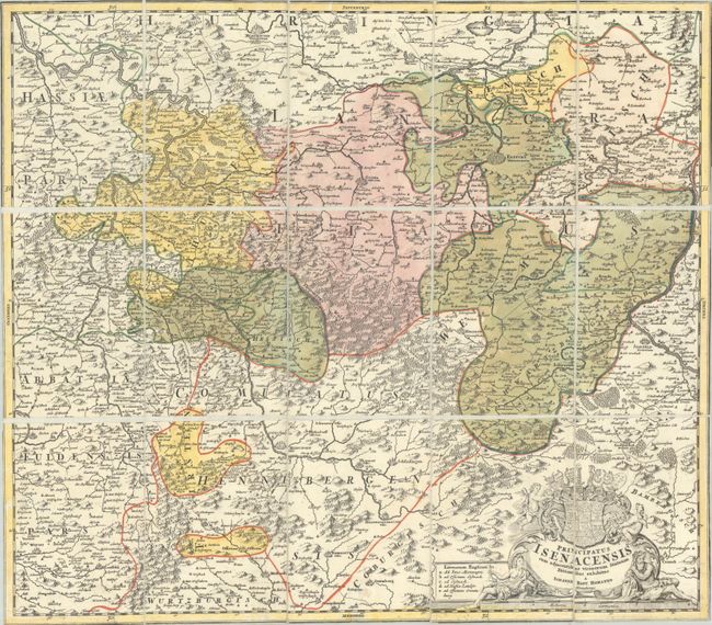
Subject: Central Germany
Period: 1720 (circa)
Publication:
Color: Hand Color
Size:
22.3 x 19.4 inches
56.6 x 49.3 cm
Download High Resolution Image
(or just click on image to launch the Zoom viewer)
(or just click on image to launch the Zoom viewer)
A graphic map of east central Germany, the Thuringia region, including Erfurt, Gotha, and Weimar, with Muhlhausen in the north, and Konigshofen at the southern border. Mountains and forests predominate the map and an intricate coat of arms highlights the stunning title cartouche that is flanked by river gods.
References:
Condition: B+
A nice impression with full contemporary color on a bright sheet with minor soiling. This example has been trimmed to the neatlines, dissected, and backed in linen for folding purposes.
Estimate: $100 - $130
Price: $75
Bid Increments
$50 - $99$5
$100 - $249$10
$250 - $499$25
$500 - $999$50
Terms & Conditions