Current Auction
"Electoratus Moguntinus ut et Palatin: Infer. Hassiae, & Fluminis Moeni...", Homann, Johann Baptist
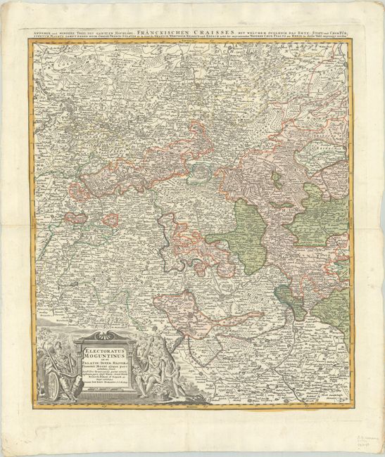
Subject: Western Germany
Period: 1730 (circa)
Publication:
Color: Hand Color
Size:
18.8 x 21.6 inches
47.8 x 54.9 cm
Download High Resolution Image
(or just click on image to launch the Zoom viewer)
(or just click on image to launch the Zoom viewer)
This densely engraved map depicts present-day Rhineland Palatinate. The map is centered on Frankfurt am Main and extends to include Koblenz, Stuttgart, Fulda and Wertheim. Larger cities are surrounded by fortifications, and the early roads in the region are also shown. The decorative title cartouche features symbols of the bounty of the region.
References:
Condition: A
A nice impression with full contemporary color on a bright sheet that has been folded vertically and horizontally.
Estimate: $160 - $190
Price: $120
Bid Increments
$50 - $99$5
$100 - $249$10
$250 - $499$25
$500 - $999$50
Terms & Conditions