Current Auction
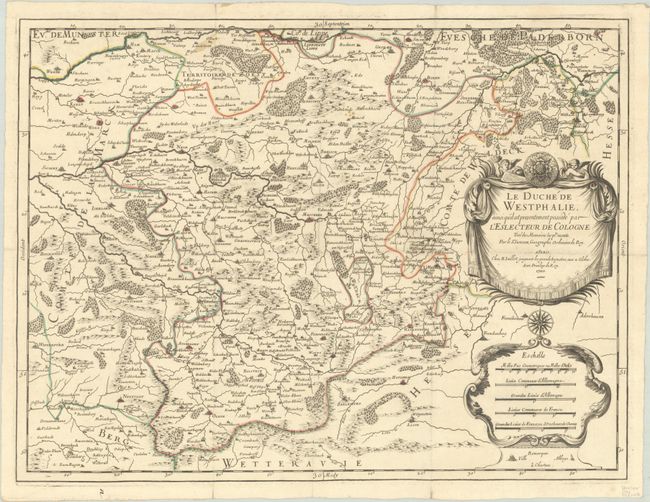
"Le Duche de Westphalie, Ainsi qu'il est Presentement Possede par l'Eslecteur de Cologne Tire des Memoires les Pl. Recents", Sanson/Jaillot
Subject: Western Germany
Period: 1700 (dated)
Publication:
Color: Hand Color
Size:
22.8 x 17.2 inches
57.9 x 43.7 cm
Download High Resolution Image
(or just click on image to launch the Zoom viewer)
(or just click on image to launch the Zoom viewer)
This map is centered on Meschede and depicts the southeastern portion of North Rhine Westphalia. The map is filled with detail and extends to include Lippstadt, Warburg and Hagen. Adorned with a drape-style title cartouche with two cherubs, and a distance scale cartouche that incorporates a simple legend.
References:
Condition: B+
A crisp impression with contemporary outline color on a bright sheet with the watermark of a Maltese cross encircled in rosary beads. This example was folded, rather than inserted into an atlas, and has small holes at fold intersections and a few short fold separations that have been repaired with archival tape on verso.
Estimate: $120 - $150
Price: $90
Bid Increments
$50 - $99$5
$100 - $249$10
$250 - $499$25
$500 - $999$50
Terms & Conditions