Current Auction
"[Frisia Orientalis]", Kaerius/Bertius
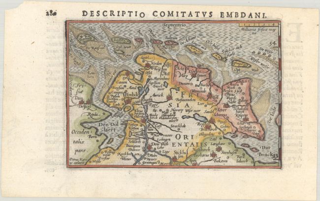
Subject: Northwestern Germany
Period: 1606 (circa)
Publication: Tabulae Geographicae Contractae
Color: Hand Color
Size:
4.9 x 3.4 inches
12.4 x 8.6 cm
Download High Resolution Image
(or just click on image to launch the Zoom viewer)
(or just click on image to launch the Zoom viewer)
This miniature map of East Frisia depicts the important shipping center of Emden and the Watten Islands. The seas are filled with a moire pattern. Engraved by Pieter van den Keere. Latin text on verso, published between 1602-06.
The map was first published by Cornelius Claesz and printed by Barent Langenes in the 1598 edition of the popular Map-treasury. For the 1599 edition, graduation lines and latitude numerals were added to one side of the border on most of the maps, which were again used for multiple editions through 1650. This is the second state with the added graduation lines from a Latin edition, with new text by Bertius and published by Cornelius Claesz.
References: Van der Krogt (Vol. III) #2310:341.
Condition: A+
A sharp impression on a bright sheet with a small chip at top left.
Estimate: $100 - $130
Price: $75
Bid Increments
$50 - $99$5
$100 - $249$10
$250 - $499$25
$500 - $999$50
Terms & Conditions