Current Auction
"Marchionatus Brandenburgici Pars, quae Marchia Vetus, Vulgo Altemarck, Dicitur", Blaeu, Johannes
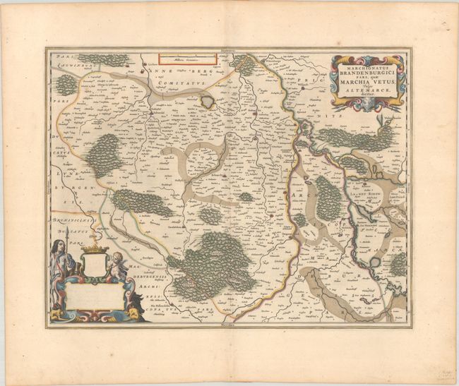
Subject: Northern Germany
Period: 1660 (circa)
Publication:
Color: Hand Color
Size:
20.1 x 15.4 inches
51.1 x 39.1 cm
Download High Resolution Image
(or just click on image to launch the Zoom viewer)
(or just click on image to launch the Zoom viewer)
This map shows part of eastern Saxony Anhalt, just west of Berlin, and follows the Elbe River from Wittenberge to Werben, Sandau, Arneburg, and Tangermunde. The map is filled with dozens of tiny towns and decorated with two lovely cartouches. Spanish text on verso, published between 1659-72.
References: Van der Krogt (Vol. II) #2171:2.
Condition: A
A sharp impression with full contemporary color on a sturdy sheet with a large watermark of the god Atlas. There is minor toning along the centerfold and light foxing and soiling in the blank margins.
Estimate: $180 - $210
Price: $130
Bid Increments
$50 - $99$5
$100 - $249$10
$250 - $499$25
$500 - $999$50
Terms & Conditions