Current Auction
Map of Trade Routes
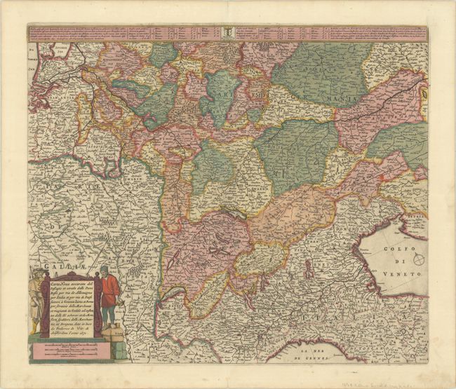
"Carta Nova Accurata del Passagio et Strada dalli Paesi Bassi per Via de Allemagna per Italia et per Via di Paesi Suizeri a Geneva, Lione et Roma...", Wit, Frederick de
Subject: Central Europe
Period: 1671 (dated)
Publication:
Color: Hand Color
Size:
21.8 x 18.4 inches
55.4 x 46.7 cm
Download High Resolution Image
(or just click on image to launch the Zoom viewer)
(or just click on image to launch the Zoom viewer)
This map was created to show the roads and trade routes between the Netherlands and Italy and extends from the North Sea to the Gulf of Venice. The tables at top list the prices to transport a bale between various cities. This is the fourth state, with the addition of two figures flanking the title cartouche. Although the first state of this plate bears the imprint of Cornelis Danckerts I, Carhart theorizes that the plate may have actually been engraved by De Wit.
References: Carhart #48.4.
Condition: A
A dark impression with full original color on a bright sheet with short centerfold separations at top and bottom and a bit of marginal soiling.
Estimate: $275 - $350
Price: $200
Bid Increments
$100 - $249$10
$250 - $499$25
$500 - $999$50
$1,000 - $2,499$100
Terms & Conditions