Current Auction
Full Contemporary Color
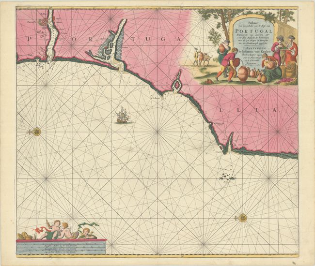
"Paskaart van een Gedeelte van de Kust van Portugal Beginnende van Zurara...", Keulen, Johannes van
Subject: Western Portugal
Period: 1680 (circa)
Publication:
Color: Hand Color
Size:
22.4 x 19.9 inches
56.9 x 50.5 cm
Download High Resolution Image
(or just click on image to launch the Zoom viewer)
(or just click on image to launch the Zoom viewer)
This sea chart depicts the coastline of Portugal from Porto to Peniche. There is good detail of the mouths of the rivers and of the Berlengas Archipelago just off the coast of Cape Carvoeiro. Two compass roses orient north to the left. The chart is handsomely embellished with a sailing ship, a distance scale surmounted by cherubs, and a large title cartouche featuring villagers pouring port wine into large ceramic containers.
References: Koeman, Van Keule [87].
Condition: B+
A nice impression with full contemporary color on a bright sheet. There are several short cracks that have been closed on verso with archival materials.
Estimate: $300 - $375
Price: $220
Bid Increments
$100 - $249$10
$250 - $499$25
$500 - $999$50
$1,000 - $2,499$100
Terms & Conditions