Current Auction
"Partie Meridionale du Gouvernement Genl. de Bourgogne... / Gouvernement General du Lyonois...", Robert de Vaugondy, Gilles
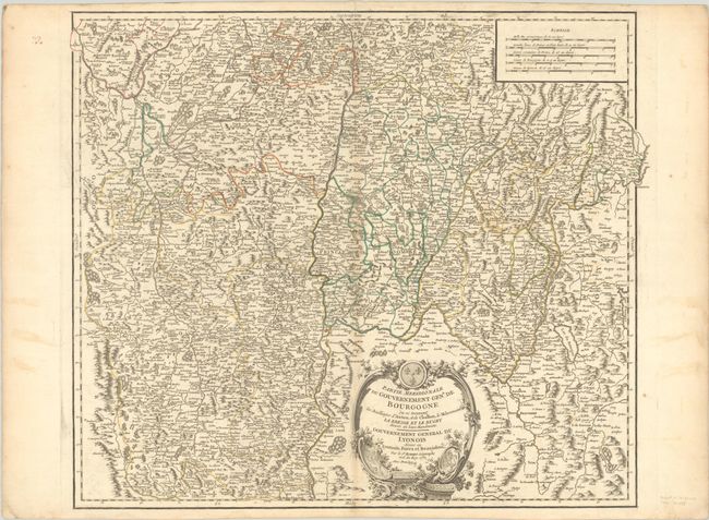
Subject: Eastern France
Period: 1752 (dated)
Publication: Atlas Universel
Color: Hand Color
Size:
22.5 x 19.2 inches
57.2 x 48.8 cm
Download High Resolution Image
(or just click on image to launch the Zoom viewer)
(or just click on image to launch the Zoom viewer)
Nicely engraved map of eastern France on the Swiss border with Geneva shown extending past the border at right. The map is highly detailed with hundreds of towns and villages, including the cities of Vienne, Lyon, Macon and Chalon along the Rhone River. The map is adorned with a lovely rococo cartouche.
References: Pedley #143.
Condition: B+
A nice impression with contemporary outline color on a watermarked sheet with a bit of soiling and light toning along the centerfold and edges of the sheet.
Estimate: $70 - $95
Price: $50
Bid Increments
Under $50$1
$50 - $99$5
$100 - $249$10
$250 - $499$25
$500 - $999$50
Terms & Conditions