Current Auction
"Borbonium, Ducatus - Bourbonnois", Jansson, Jan
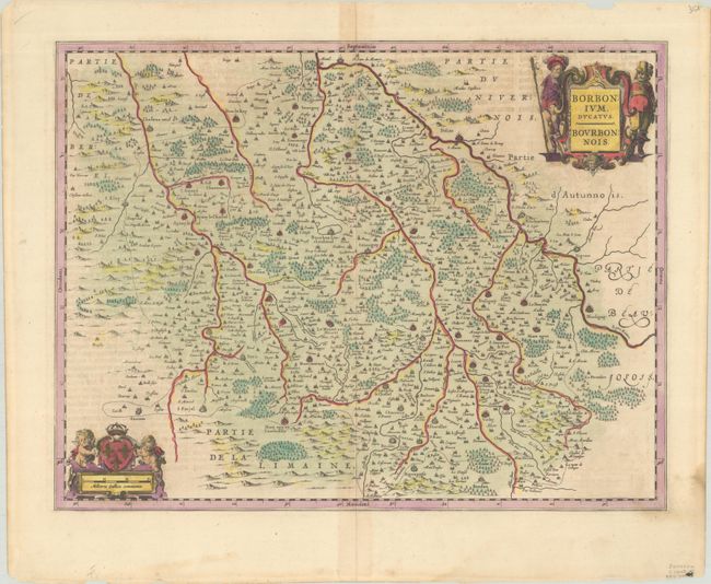
Subject: Central France
Period: 1645 (circa)
Publication: Novus Atlas
Color: Hand Color
Size:
19.7 x 15.1 inches
50 x 38.4 cm
Download High Resolution Image
(or just click on image to launch the Zoom viewer)
(or just click on image to launch the Zoom viewer)
A fine map of the Bourbonnais Province in central France with nice detail of cities, villages and forests. The Loire River flows through the upper corner of the map, past Bourbon-Lancy, Marsigny and many other towns. The map extends to include Nevers in the north, Vichy in the south, and Montluçon in the west. It is decorated with two beautiful cartouches featuring the coat of arms of the House of Bourbon-Condé, cherubs, and a pair of gentlemen. German text on verso, published between 1644-58.
References: Van der Krogt (Vol. I) #4850:1B.
Condition: B+
A nice impression on a sheet with light toning along the centerfold, minor soiling, and a few dampstains along the edges of the sheet.
Estimate: $100 - $130
Price: $75
Bid Increments
$50 - $99$5
$100 - $249$10
$250 - $499$25
$500 - $999$50
Terms & Conditions