Current Auction
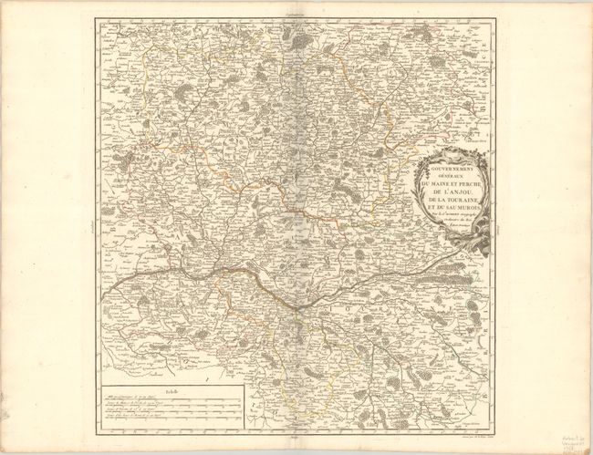
"Gouvernemens Generaux du Maine et Perche, de l'Anjou, de la Touraine, et du Saumurois", Robert de Vaugondy, Gilles
Subject: Western France
Period: 1753 (dated)
Publication: Atlas Universel
Color: Hand Color
Size:
18.1 x 18.9 inches
46 x 48 cm
Download High Resolution Image
(or just click on image to launch the Zoom viewer)
(or just click on image to launch the Zoom viewer)
This very detailed map shows fortified cities, towns, rivers, castles, churches, roads, forests and mountains. The map is roughly centered on the Loire River and includes Tours, Saumur, Ingrande, La Haye, Angers, Le Mans, Chartres and Sable. Robert de Vaugondy's Atlas Universel was one of the most successful and enduring works of the latter part of the eighteenth century.
References: Pedley #108.
Condition: A
A crisp impression with contemporary outline color on a bright sheet with a medallion watermark. There is a bit of printer's ink residue along the centerfold at top and two small worm holes in the blank margins.
Estimate: $70 - $90
Price: $50
Bid Increments
Under $50$1
$50 - $99$5
$100 - $249$10
$250 - $499$25
$500 - $999$50
Terms & Conditions