Current Auction
"Les Provinces de Saintonge, d'Angoumois, de la Marche, du Limosin, et du Pais d'Aunis...", Fer, Nicolas de
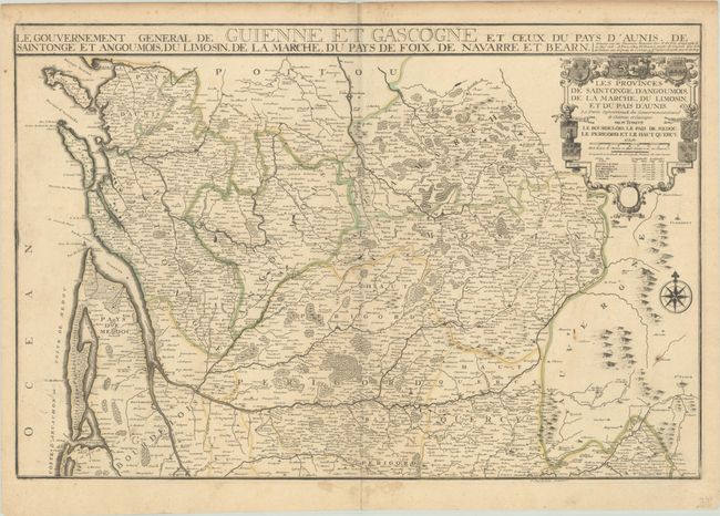
Subject: Western France
Period: 1711 (dated)
Publication: Atlas ou Recueil de Cartes Geographiques
Color: Hand Color
Size:
28 x 18.7 inches
71.1 x 47.5 cm
Download High Resolution Image
(or just click on image to launch the Zoom viewer)
(or just click on image to launch the Zoom viewer)
This large map covers the coast from Bordeaux to La Rochelle, and extends east past Limoges and Sarlat. The map is filled with hundreds of tiny towns, political boundaries, and the extensive river systems in the region. The title cartouche features the arms of the various provinces featured on the map. An alternate title is included above the map: "Le Gouvernement General de Guienne et Gascogne et Ceux du Pays d'Aunis, de Saintonge et Angoumois, du Limosin, de la Marche, du Pays de Foix, de Navarre et Bearn." Published by Nicolas de Fer's son-in-law, Jacques-Francois Benard. Engraved by P. Starckman.
References: Pastoureau, FER II D [110].
Condition: B+
A nice impression with contemporary outline color on a sheet with the watermarks of rosary beads and the initials "FL." There are a couple of small paper flaws at right, light soiling, and toning along the top edge of the sheet.
Estimate: $140 - $170
Price: $100
Bid Increments
$50 - $99$5
$100 - $249$10
$250 - $499$25
$500 - $999$50
Terms & Conditions