Current Auction
"Nieuwe Kaart van de Westfaalse Kreits Verdeelt in Deszelfs Bisdommen Vorstendommen Graafschappen enz na de Naaukeurigste Ondervindingen int Ligt Gegeven", Tirion, Isaac
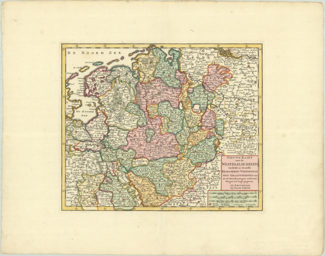
Subject: Western Germany & Eastern Netherlands
Period: 1769 (circa)
Publication: Nieuwe en Beknopte Hand Atlas
Color: Hand Color
Size:
13.4 x 11.1 inches
34 x 28.2 cm
Download High Resolution Image
(or just click on image to launch the Zoom viewer)
(or just click on image to launch the Zoom viewer)
This detailed map includes northwestern Germany and The Netherlands, including the cities of Hamburg, Hanover, Bremen, Dusseldorf, Amsterdam and Utrecht. The map is filled with towns and shows the political divisions.
References:
Condition: A+
A sharp impression with full original color on a sheet with a fleur-de-lis watermark and wide margins. There is minor soiling along the edges of the sheet.
Estimate: $100 - $130
Price: $75
Bid Increments
$50 - $99$5
$100 - $249$10
$250 - $499$25
$500 - $999$50
Terms & Conditions