Current Auction
"Tabula Geographica Ostendens Situm Castrorum Suedicorum in Iutia Septentrionali ut et Oppidorum Coldingae...", Pufendorf, Samuel, Baron von
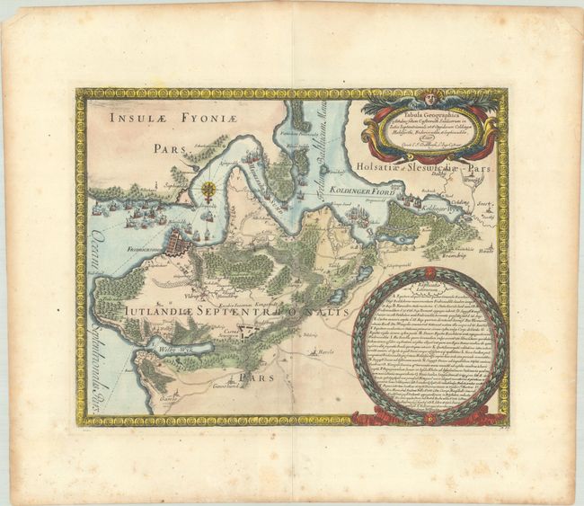
Subject: Fredericia, Denmark
Period: 1697 (published)
Publication:
Color: Hand Color
Size:
12.3 x 9.6 inches
31.2 x 24.4 cm
Download High Resolution Image
(or just click on image to launch the Zoom viewer)
(or just click on image to launch the Zoom viewer)
This graphic map depicts the successful Swedish siege of Fredriksodde in 1657. The fortified city is shown, and the nearby roads and towns in Jutland are illustrated. Several sea battles are shown within the Little Belt strait. Oriented with north to the bottom by a lovely compass rose, and surrounded by a picture-frame style border. Published in Pufendorf's chronicle on the Northern Wars and military campaigns of Sweden's King Charles X, which appeared in a German and a French edition in 1697.
References: Shirley (BL Atlases) G.PUF-1a #55.
Condition: B+
A sharp impression with a coat of arms watermark, foxing that is mostly confined to the blank margins, and light toning along the edges of the sheet. There is a small chip at top left.
Estimate: $140 - $170
Price: $100
Bid Increments
$50 - $99$5
$100 - $249$10
$250 - $499$25
$500 - $999$50
Terms & Conditions