Current Auction
"Metsker's Map of King County Washington", Metsker
Subject: Seattle, Washington
Period: 1950 (circa)
Publication:
Color: Printed Color
Size:
39 x 25 inches
99.1 x 63.5 cm
Download High Resolution Image
(or just click on image to launch the Zoom viewer)
(or just click on image to launch the Zoom viewer)
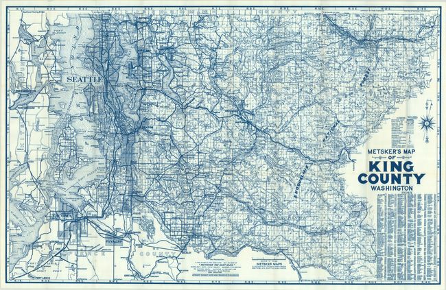
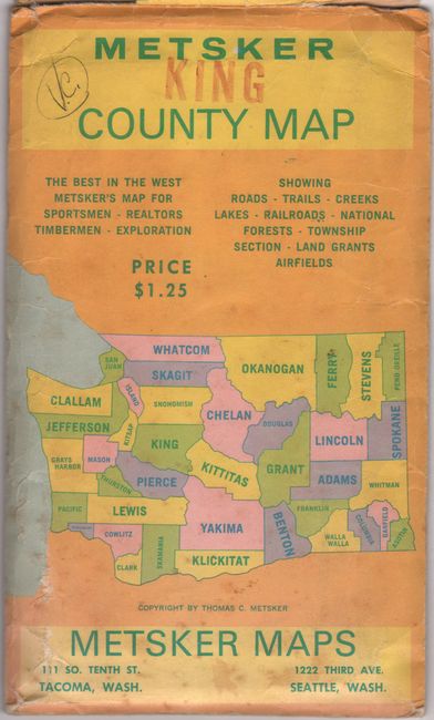
This detailed map of King County, including the county seat of Seattle, was published by hometown cartographer Metsker Maps. Printed in blue ink, the map's primary emphasis is on the road network, railroads and township grids. However, given the county's proximity to both water and mountains, the legend also identifies lighthouses, trails, ranger stations, camps, and even glaciers. Drawn on a detailed scale of 2 miles per inch. Decorated by a compass rose with magnetic variation at right. Text at bottom states "It pays to have a few good maps. Buy the best of 'Metsker The Map Man'." Blank verso. Folds into original paper envelope with printed price of $1.25. Circa date is based upon the publisher noted on the envelope, Thomas Metsker, who was the son of founder Charles Metsker who retired in 1948.
References:
Condition: A
Remarkably clean and bright with a 2" fold separation at top right that has been tape repaired (pristine otherwise). Accompanying envelope is worn and lightly soiled.
Estimate: $140 - $170
Price: $100
Bid Increments
$50 - $99$5
$100 - $249$10
$250 - $499$25
$500 - $999$50
Terms & Conditions