Current Auction
"[Lot of 2] A New Map of South Carolina with Its Canals, Roads & Distances... [and] Tunison's Georgia and South Carolina"
Subject: South Carolina & Georgia
Period: 1850-85 (circa)
Publication:
Color: Hand Color
Size:
See Description
Download High Resolution Image
(or just click on image to launch the Zoom viewer)
(or just click on image to launch the Zoom viewer)
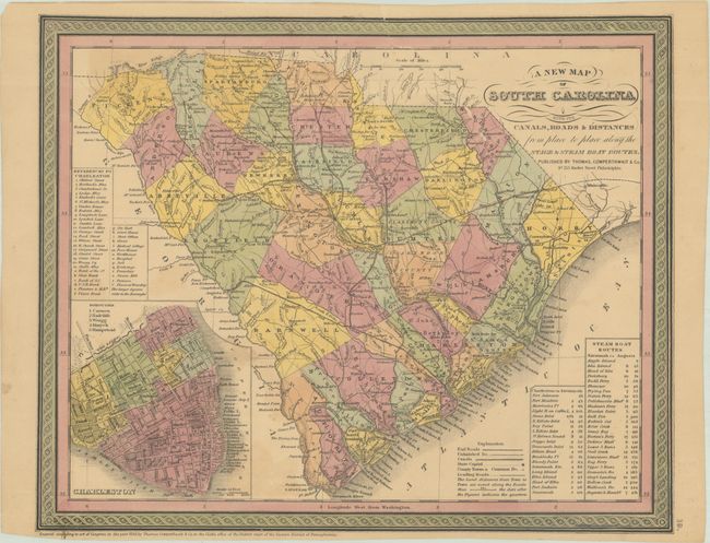
A. A New Map of South Carolina with Its Canals, Roads & Distances from Place to Place Along the Stage & Steam Boat Routes, by Thomas, Cowperthwait & Co., dated 1850 (14.3 x 11.5"). A handsome map with a large inset of Charleston showing numerous buildings, streets and places of interest identified. Good detail throughout, locating numerous towns and villages, rivers and several railroads. Table gives the steamboat routes between Charleston and Savannah, and Savannah to Augusta. Decorative borders. Condition: Contemporary color on a lightly toned sheet with two archivally repaired 3.5" edge tears at top. (B)
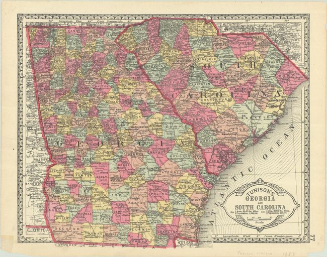
B. Tunison's Georgia and South Carolina, by H. C. Tunison, circa 1885 (12.6 x 10.1"). This finely lithographed map features counties in original bright coloring in Tunison's unique style. By this period most mapmakers had adopted printed color rather than the more labor intensive hand coloring employed here. It is decorated with a Victorian-style border and title cartouche, which gives the population of Georgia as 1,542,180 and South Carolina as 995,557. Tunison's maps were printed on both sides; on the verso is half of the double-page map of Arkansas, Louisiana and Mississippi. Condition: Clean and colorful with a few short archivally repaired edge tears. (A)
References:
Condition:
See description above.
Estimate: $100 - $130
Price: $75
Bid Increments
$50 - $99$5
$100 - $249$10
$250 - $499$25
$500 - $999$50
Terms & Conditions