Subject: New York
Period: 1827 (published)
Publication: A Complete Historical, Chronological, and Geographical American Atlas
Color: Hand Color
Size:
18 x 11.9 inches
45.7 x 30.2 cm
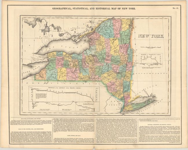
This attractive early 19th century map of New York recognizes the completion of the Erie Canal (1826) with a "Profile of Levels of the Grand Canal." County development is current to 1824 with the recent organization of Orleans county along Lake Ontario. In the north, Hamilton and Herkimer counties are labeled Wild Unsettled Country. Surrounded by descriptive text concerning the boundaries, soils, natural curiosities, and more. Drawn by Fielding Lucas, Jr. and engraved by J. Yeager. On a full sheet with text measuring 21.9 x 17.5".
See also lot 705 for Phillips & LeGear's A List of Geographical Atlases in the Library of Congress with Bibliographical Notes that notes this map.
References: Phillips (Atlases) #1177-16.
Condition: A
A crisp impression with contemporary color and a hint of offsetting. There is a small printer's crease in the left blank margin.