Current Auction
"Massachusetts", Bradford, Thomas Gamaliel
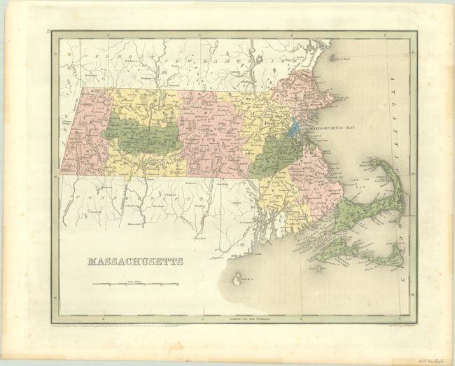
Subject: Massachusetts
Period: 1838 (dated)
Publication: General Atlas of the World
Color: Hand Color
Size:
14.3 x 11.4 inches
36.3 x 29 cm
Download High Resolution Image
(or just click on image to launch the Zoom viewer)
(or just click on image to launch the Zoom viewer)
An attractive, early map of the state that details county seats, towns and settlements, and river systems. County development is current to the copyright date on the map with 14 counties. The railroad network stretches throughout the state and extends to both Maine and Connecticut. Not to be confused with the maps from the Comprehensive Atlas, this map is several inches larger and carries much more information. Engraved by G. W. Boynton.
References:
Condition: B+
Contemporary color with minor foxing mostly in the blank margins.
Estimate: $100 - $130
Price: $75
Bid Increments
$50 - $99$5
$100 - $249$10
$250 - $499$25
$500 - $999$50
Terms & Conditions