Current Auction
"Idaho", Rand McNally & Co.
Subject: Idaho
Period: 1908 (dated)
Publication:
Color: Printed Color
Size:
12.4 x 19.1 inches
31.5 x 48.5 cm
Download High Resolution Image
(or just click on image to launch the Zoom viewer)
(or just click on image to launch the Zoom viewer)
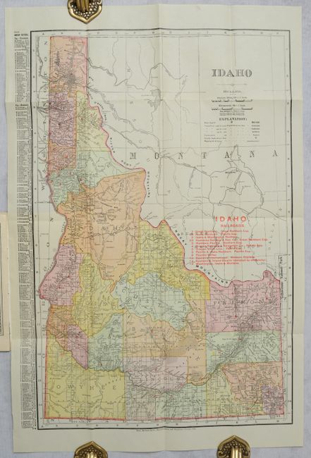
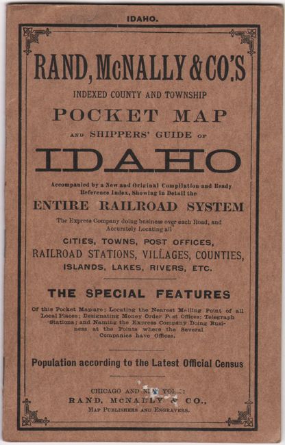
An attractive pocket map issued 18 years after statehood. County configurations are current to 1907 with the additions of Bonner County at the northern tip and Twin Falls County along the southern border. Railroads are numbered with red overprinting in the map, which corresponds to a table listing 12 railroads including the Great Northern, Northern Pacific, Pacific & Idaho Northern, and Payette Valley. Drawn on a scale of 26 miles per inch. Includes a 17-page index and several pages of advertisements. Folds into brown paper covers entitled "Rand, McNally & Co.'s Indexed County and Township Pocket Map and Shippers' Guide of Idaho."
References:
Condition: A
Issued folding on a clean sheet with a few tiny splits at the fold junctions. A tiny edge tear in the right blank margin has been closed on verso with archival tape. Front cover has a small abrasion at bottom.
Estimate: $110 - $140
Price: $80
Bid Increments
$50 - $99$5
$100 - $249$10
$250 - $499$25
$500 - $999$50
Terms & Conditions