Current Auction
"[Lot of 2] Charlotte Harbor Florida [and] Preliminary Examination Charlotte Harbor, Florida", U.S. Corps of Engineers
Subject: Southwest Florida
Period: 1912-18 (dated)
Publication:
Color: Black & White
Size:
See Description
Download High Resolution Image
(or just click on image to launch the Zoom viewer)
(or just click on image to launch the Zoom viewer)
This lot features two U.S. government charts detailing the Boca Grande passage in Southwest Florida. Originally settled to take advantage of a large phosphate deposit, Boca Grande and the surrounding area quickly became a premier tourist destination, especially for fishing.
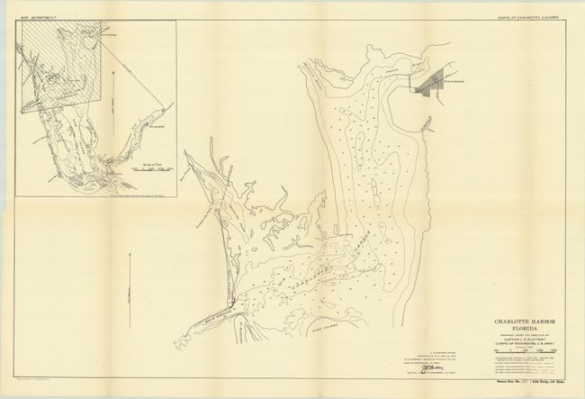
A. Charlotte Harbor Florida, from H.R. Doc. 121, 63d Congress, 1st Session, dated 1912 (25.1 x 16.4"). Details Charlotte Harbor to Punta Gorda with a large inset map showing a wider area including the barrier islands and Sanibel. Condition: Issued folding on a clean sheet. (A)
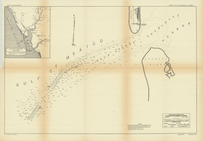
B. Preliminary Examination Charlotte Harbor, Florida, from H.R. Doc. 113, 66th Congress, 1st Session, dated 1918 (23.6 x 15.6"). Illustrates northern Lacosta Island, southern Gasparilla Island and the So. Boca Grande with a railroad terminus. A large inset map shows the vicinity around Boca Grande. Condition: Issued folding with light toning along the fold lines. (B+)
References:
Condition:
See description above.
Estimate: $140 - $170
Price: $100
Bid Increments
$50 - $99$5
$100 - $249$10
$250 - $499$25
$500 - $999$50
Terms & Conditions