Filtered by Category:United States(Show All Categories)
Showing results for:Auction 203
Catalog Archive
233 lots
Page 1 of 5
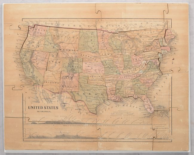
Auction 203, Lot 39
Subject: Cartographic Miscellany, Puzzle Map
Colton, Joseph Hutchins
[Puzzle Map] United States of America [in Box] The Silent Teacher! - Patent Improved Sectional Map of the United States..., 1877
Size: 15.1 x 11.9 inches (38.4 x 30.2 cm)
Estimate: $200 - $230
Sold for: $300
Closed on 4/23/2025
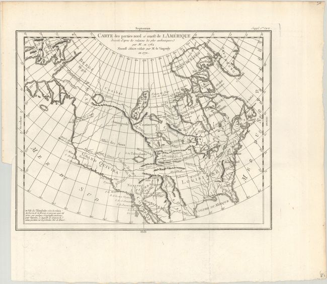
Auction 203, Lot 82
Subject: Colonial United States & Canada
Robert de Vaugondy, Didier
Carte des Parties Nord et Ouest de l Amerique Dresse d'Apres les Relations les Plus Authentiques par M... en 1764..., 1772
Size: 15 x 11.6 inches (38.1 x 29.5 cm)
Estimate: $200 - $230
Sold for: $100
Closed on 4/23/2025
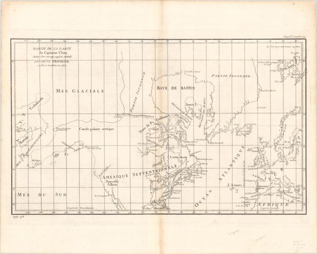
Auction 203, Lot 83
Subject: Colonial United States & Canada, Arctic
Robert de Vaugondy, Didier
Partie de la Carte du Capitaine Cluny Auteur d'un Ouvrage Anglois Intitule American Traveller, 1773
Size: 19.1 x 11.4 inches (48.5 x 29 cm)
Estimate: $80 - $100
Sold for: $60
Closed on 4/23/2025
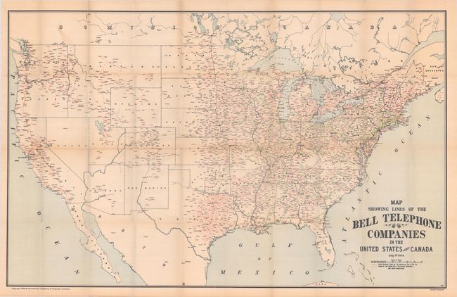
Auction 203, Lot 84
Subject: United States & Canada
Map Showing Lines of the Bell Telephone Companies in the United States and Canada, 1905
Size: 39.3 x 25.1 inches (99.8 x 63.8 cm)
Estimate: $500 - $650
Rare AT&T Map Showing Phone Lines in the Early Days of the 20th Century
Unsold
Closed on 4/23/2025
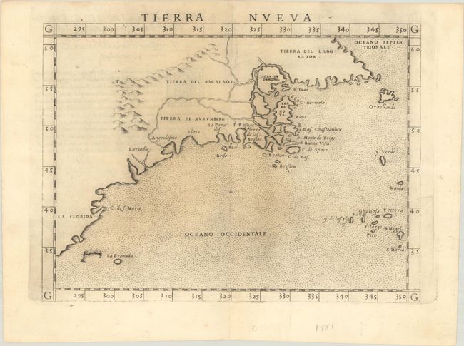
Auction 203, Lot 85
Subject: Eastern United States & Canada
Ruscelli, Girolamo
Tierra Nueva, 1562
Size: 9.7 x 7.2 inches (24.6 x 18.3 cm)
Estimate: $1,000 - $1,300
First State of Ruscelli's Map of the East Coast
Sold for: $750
Closed on 4/23/2025
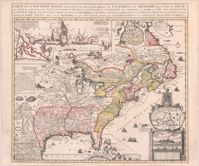
Auction 203, Lot 86
Subject: Colonial Eastern United States & Canada
Fer, Nicolas de
Carte de la Nouvelle France, ou se Voit le Cours des Grandes Rivieres de S. Laurens & de Mississipi Aujour d'hui S. Louis, aux Environs des-quelles se Trouvent les Etats, Pais, Nations, Peuples, &c. de la Floride, de la Louisiane, de la Virginie..., 1720
Size: 21.9 x 19.8 inches (55.6 x 50.3 cm)
Estimate: $2,750 - $3,500
Striking Map of French Colonial Possessions
Sold for: $2,200
Closed on 4/23/2025
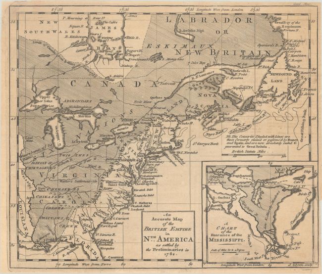
Auction 203, Lot 87
Subject: Colonial Eastern United States & Canada
Gibson, John
An Accurate Map of the British Empire in Nth. America as Settled by the Preliminaries in 1762, 1762
Size: 9.7 x 8.3 inches (24.6 x 21.1 cm)
Estimate: $275 - $350
Sold for: $210
Closed on 4/23/2025
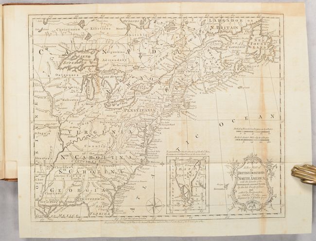
Auction 203, Lot 88
Subject: Colonial Eastern United States & Canada, History Book
Kitchin, Thomas
[Maps in Book] A New Map of the British Dominions in North America; with the Limits of the Governments Annexed Thereto by the Late Treaty of Peace... [bound in] The Annual Register, or a View of the History, Politicks, and Literature…, 1776
Size: 11.9 x 9.6 inches (30.2 x 24.4 cm)
Estimate: $600 - $750
Sold for: $450
Closed on 4/23/2025
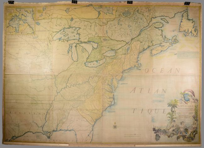
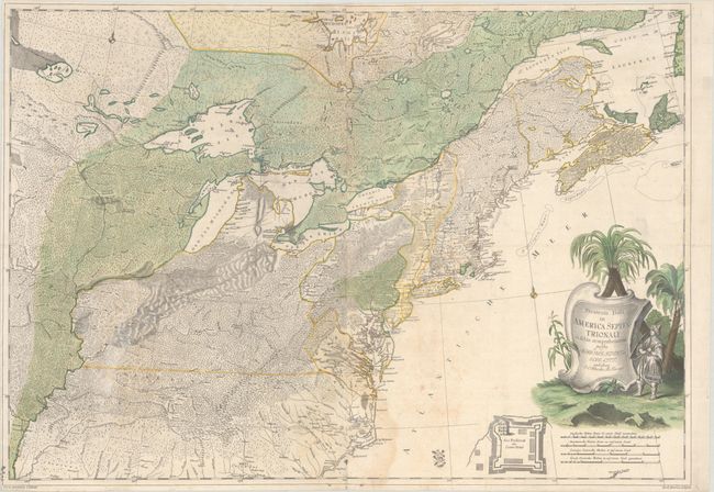
Auction 203, Lot 89
Subject: Colonial Eastern United States & Canada
Mitchell/Le Rouge
Amerique Septentrionale avec les Routes, Distances en Miles, Villages et Etablissements Francois et Anglois par le Docteur Mitchel, 1777
Size: 75 x 52.4 inches (190.5 x 133.1 cm)
Estimate: $9,500 - $12,000
Third French Edition of Mitchell's Monumental Map
Sold for: $5,000
Closed on 4/23/2025
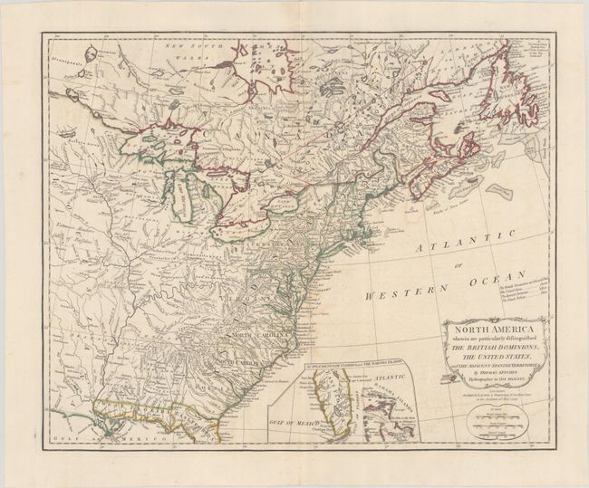
Auction 203, Lot 90
Subject: Eastern United States & Canada
Kitchin, Thomas
North America Wherein Are Particularly Distinguished the British Dominions, the United States, and the Adjacent Spanish Territories, 1794
Size: 21.4 x 17.4 inches (54.4 x 44.2 cm)
Estimate: $1,400 - $1,700
Sold for: $1,000
Closed on 4/23/2025
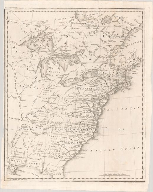
Auction 203, Lot 91
Subject: Eastern United States & Canada, Franklin
[Untitled - Map of the United States, Canada the River St. Lawrence, the Lakes &c.], 1804
Size: 13.1 x 16 inches (33.3 x 40.6 cm)
Estimate: $1,000 - $1,300
Features the Short-Lived Franklinia and Morgania
Sold for: $750
Closed on 4/23/2025
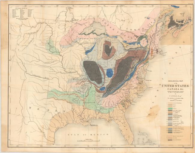
Auction 203, Lot 92
Subject: Eastern United States & Canada, Geology
Lyell, Charles
Geological Map of the United States Canada &c. Compiled from the State Surveys of the U.S. and Other Sources, 1845
Size: 19.8 x 15.3 inches (50.3 x 38.9 cm)
Estimate: $600 - $750
Unsold
Closed on 4/23/2025
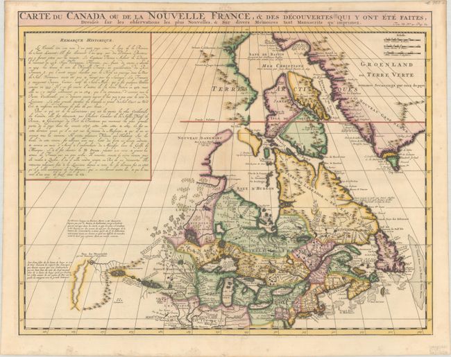
Auction 203, Lot 93
Subject: Colonial Northeastern United States & Canada
Chatelain, Henry Abraham
Carte du Canada ou de la Nouvelle France, & des Decouvertes qui y ont ete Faites, Dressee sur les Observations les Plus Nouvelles, & sur Divers Memoires tant Manuscrits qu' Imprimez, 1719
Size: 20.3 x 15.9 inches (51.6 x 40.4 cm)
Estimate: $600 - $750
Sold for: $400
Closed on 4/23/2025
Auction 203, Lot 94
Subject: Colonial Northeastern United States & Canada, Great Lakes
Robert de Vaugondy, Didier
Partie de l'Amerique Septent? qui Comprend la Nouvelle France ou le Canada, 1755
Size: 23.9 x 19 inches (60.7 x 48.3 cm)
Estimate: $400 - $500
Sold for: $200
Closed on 4/23/2025
Auction 203, Lot 95
Subject: Colonial Northeastern United States & Canada
Rhode, Johann Cristoph
Theatrum Belli in America Septentrionali II. Foiliis Comprehensum..., 1755
Size: 31.5 x 22 inches (80 x 55.9 cm)
Estimate: $8,000 - $9,500
Scarce German Map Illustrating the French & Indian War
Sold for: $5,000
Closed on 4/23/2025
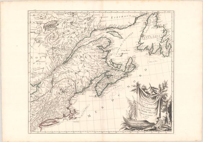
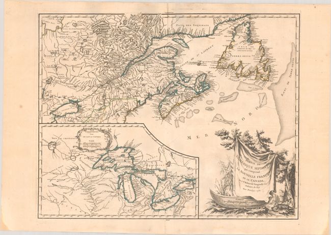
Auction 203, Lot 96
Subject: Colonial Northeastern United States & Canada
D'Anville/Santini
Partie Orientale du Canada, avec la Nouvelle Angleterre l'Acadie, et la Terre-Neuve, 1776
Size: 22.7 x 19.2 inches (57.7 x 48.8 cm)
Estimate: $400 - $475
Sold for: $250
Closed on 4/23/2025
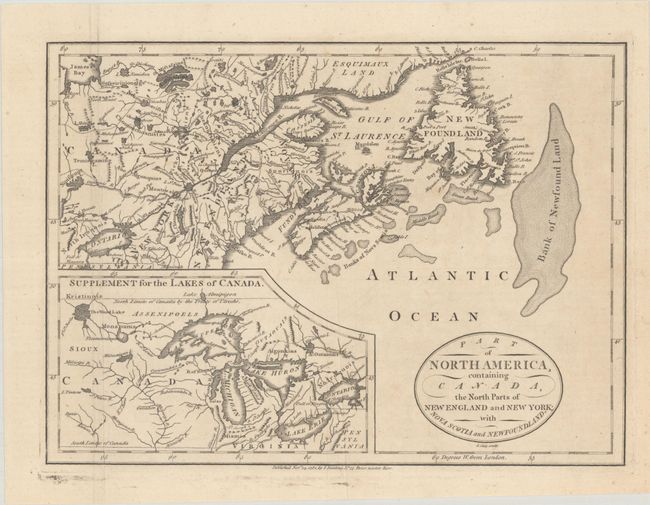
Auction 203, Lot 97
Subject: Colonial Northeastern United States & Canada, Great Lakes
Cary, John
Part of North America, Containing Canada, the North Parts of New England and New York; with Nova Scotia and Newfoundland, 1781
Size: 11.3 x 8.3 inches (28.7 x 21.1 cm)
Estimate: $190 - $220
Sold for: $120
Closed on 4/23/2025
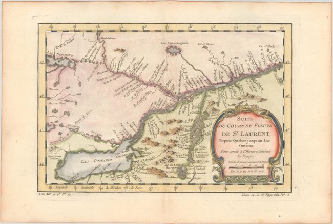
Auction 203, Lot 98
Subject: Colonial Lake Ontario & St. Lawrence River
Bellin, Jacques Nicolas
Suite du Cours du Fleuve de St. Laurent, Depuis Quebec Jusqu au Lac Ontario. Pour Servir a l'Histoire Generale des Voyages, 1757
Size: 11.3 x 7.6 inches (28.7 x 19.3 cm)
Estimate: $110 - $140
Sold for: $110
Closed on 4/23/2025
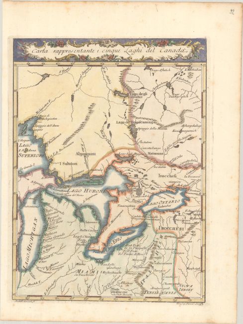
Auction 203, Lot 99
Subject: Colonial Central United States & Canada, Great Lakes
Pazzi, Giuseppe
Carta Rappresentante i Cinque Laghi del Canada, 1763
Size: 7.4 x 10 inches (18.8 x 25.4 cm)
Estimate: $240 - $300
Sold for: $180
Closed on 4/23/2025
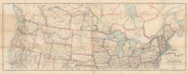
Auction 203, Lot 100
Subject: Northern United States & Canada
Bien, Julius
Map of the Northwest from Explorations by the United States Engineers & Royal Engineers of England and Union & Northern Pacific R.R. Surveys, 1870
Size: 41.2 x 15.2 inches (104.6 x 38.6 cm)
Estimate: $190 - $220
Sold for: $140
Closed on 4/23/2025
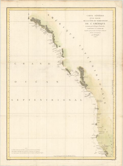
Auction 203, Lot 101
Subject: Western United States & Canada
La Perouse, Comte Jean F. Galoup, de
Carte Generale d'une Partie de la Cote du Nord-Ouest de l'Amerique Reconnue par les Fregates Francaises la Boussole et l'Astrolabe..., 1797
Size: 19.5 x 27.1 inches (49.5 x 68.8 cm)
Estimate: $200 - $230
Sold for: $75
Closed on 4/23/2025
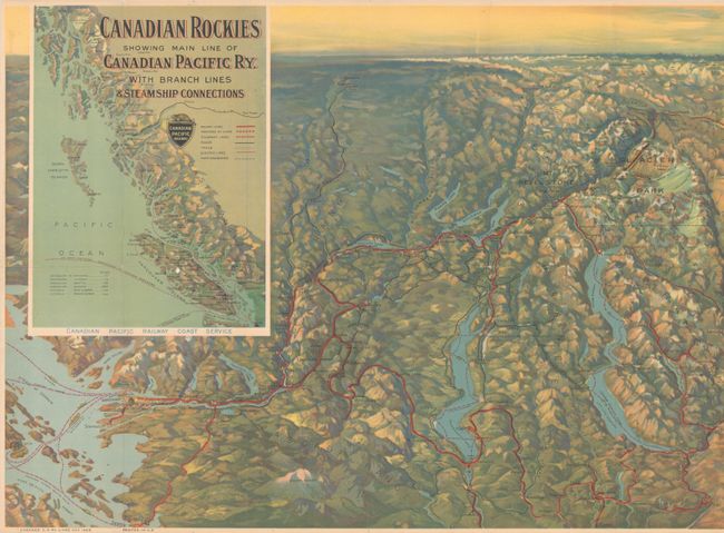
Auction 203, Lot 102
Subject: Western United States & Canada
Railroad Companies, (Various)
Canadian Rockies Showing Main Line of Canadian Pacific Ry. with Branch Lines & Steamship Connections, 1924
Size: 46.5 x 16.8 inches (118.1 x 42.7 cm)
Estimate: $100 - $130
Sold for: $75
Closed on 4/23/2025
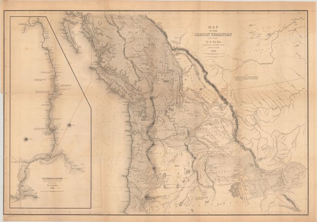
Auction 203, Lot 103
Subject: Northwestern United States & Canada
Wilkes, Charles
Map of the Oregon Territory by the U.S. Ex. Ex., 1841
Size: 34.1 x 22.9 inches (86.6 x 58.2 cm)
Estimate: $1,400 - $1,700
One of the Most Detailed and Important 19th-Century Maps of the American Northwest
Sold for: $1,100
Closed on 4/23/2025
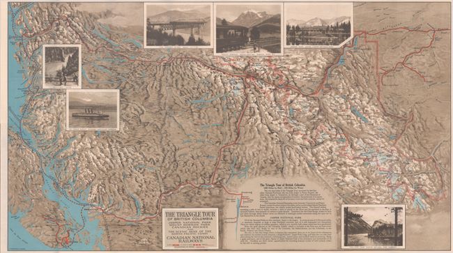
Auction 203, Lot 104
Subject: Northwestern United States & Canada
Railroad Companies, (Various)
The Triangle Tour of British Columbia - Jasper National Park Mount Robson Park Canadian Rockies and the Scenic Seas of the North Pacific Coast [on verso] Alaska and the Yukon, 1929
Size: 29.8 x 16.8 inches (75.7 x 42.7 cm)
Estimate: $150 - $180
NO RESERVE
Unsold
Closed on 4/23/2025
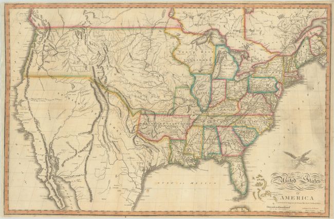
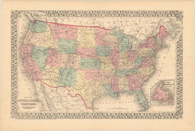
Auction 203, Lot 105
Subject: United States
Warner, Benjamin
United States of America Corrected & Improved from the Best Authorities, 1820
Size: 24.8 x 16.3 inches (63 x 41.4 cm)
Estimate: $1,200 - $1,500
Sold for: $900
Closed on 4/23/2025
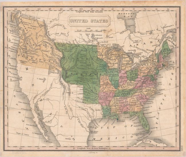
Auction 203, Lot 106
Subject: United States
Young, James H.
United States, 1830
Size: 9.8 x 8.1 inches (24.9 x 20.6 cm)
Estimate: $140 - $170
Sold for: $100
Closed on 4/23/2025
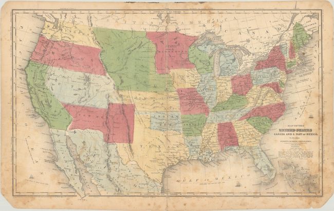
Auction 203, Lot 107
Subject: United States
Robinson, D.F. & Co.
Map of the United States Canada and a Part of Mexico. To Illustrate Olney's School Geography, 1844
Size: 17.7 x 10.8 inches (45 x 27.4 cm)
Estimate: $180 - $220
Sold for: $130
Closed on 4/23/2025
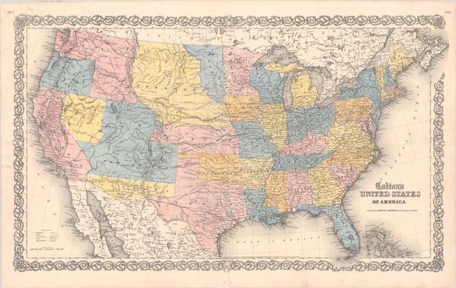
Auction 203, Lot 108
Subject: United States
Johnson & Browning
Colton's United States of America, 1859
Size: 26.5 x 15.7 inches (67.3 x 39.9 cm)
Estimate: $750 - $900
Scarce Map Featuring Colona
Sold for: $650
Closed on 4/23/2025
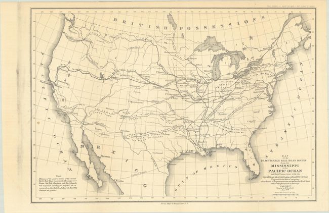
Auction 203, Lot 109
Subject: United States
U.S. War Department
[Map and Report] Map of the Practicable Rail Road Routes from the Mississippi to the Pacific Ocean… [and] Reports of the Majority and Minority of th Select Committee on the Pacific Railroad, 1860
Size: 14.2 x 9.7 inches (36.1 x 24.6 cm)
Estimate: $160 - $190
Sold for: $170
Closed on 4/23/2025
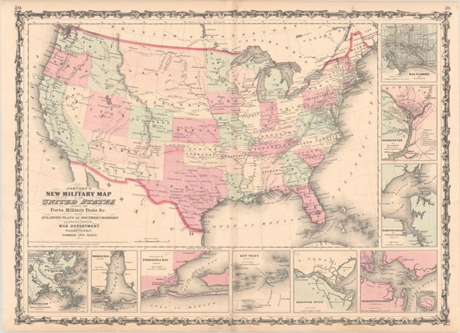
Auction 203, Lot 110
Subject: United States, Civil War
Johnson and Ward
Johnson's New Military Map of the United States Showing the Forts, Military Posts &c. With Enlarged Plans of Southern Harbors..., 1861
Size: 23.9 x 17.3 inches (60.7 x 43.9 cm)
Estimate: $240 - $300
Sold for: $180
Closed on 4/23/2025
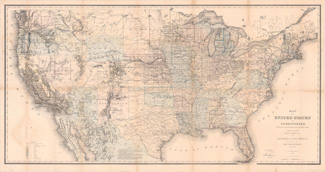
Auction 203, Lot 111
Subject: United States
General Land Office
Map of the United States and Territories, Showing the Extent of Public Surveys and Other Details, Constructed from the Plats and Official Sources of the General Land Office, 1868
Size: 28.8 x 56 inches (73.2 x 142.2 cm)
Estimate: $300 - $375
Sold for: $220
Closed on 4/23/2025
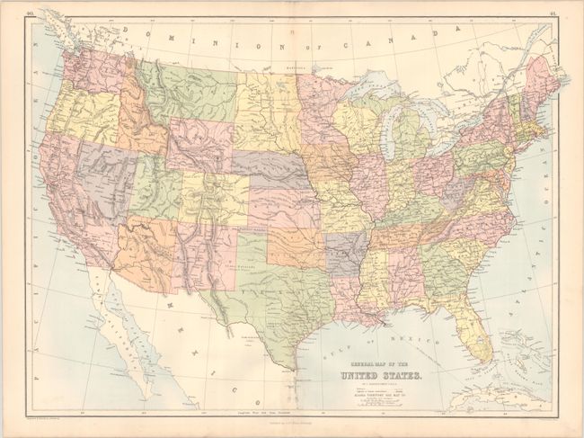
Auction 203, Lot 112
Subject: United States, Pembina
Bartholomew, John
General Map of the United States, 1875
Size: 22.3 x 16.6 inches (56.6 x 42.2 cm)
Estimate: $275 - $350
Scarce Map Depicting the Territory of Pembina
Unsold
Closed on 4/23/2025
Auction 203, Lot 113
Subject: United States
Mitchell, Samuel Augustus
Map of the United States, and Territories. Together with Canada &c., 1876
Size: 21.5 x 13.6 inches (54.6 x 34.5 cm)
Estimate: $120 - $150
Sold for: $90
Closed on 4/23/2025
Auction 203, Lot 114
Subject: United States
U.S. Department of Interior
Map of the United States Exhibiting the Grants of Lands Made by the General Government to Aid in the Construction of Railroads and Wagon Roads, 1878
Size: 28.5 x 19.8 inches (72.4 x 50.3 cm)
Estimate: $220 - $250
Sold for: $160
Closed on 4/23/2025
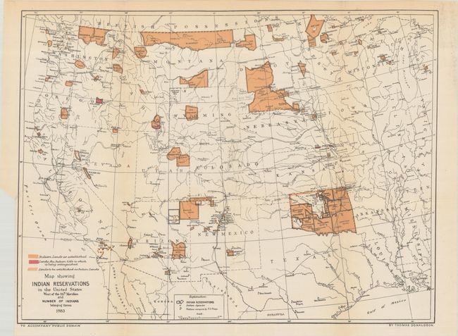
Auction 203, Lot 115
Subject: United States
U.S. Bureau of Indian Affairs
[Lot of 2] [Map with Report] Map Showing Indian Reservations in the United States West of the 84th Meridian... [with] Indian Reservations from the Public Domain [and] Map Showing Indian Reservations Within the Limits of the United States..., 1883-95
Size: See Description
Estimate: $275 - $350
Unsold
Closed on 4/23/2025
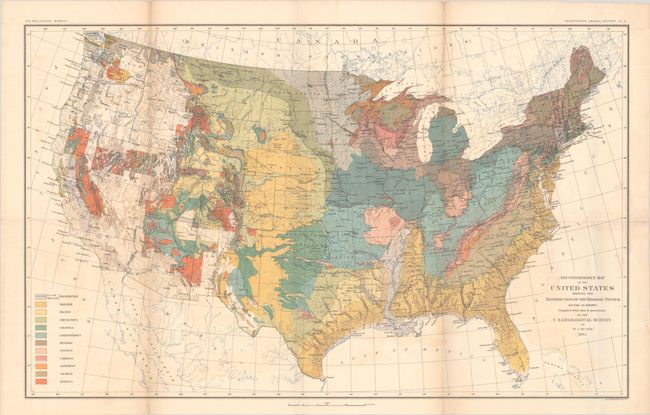
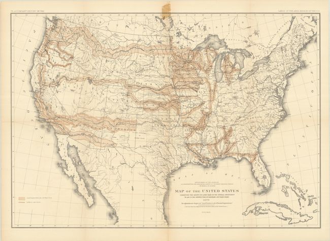
Auction 203, Lot 116
Subject: United States, Geology
U.S. Geological Survey (USGS)
Reconnoissance Map of the United States Showing the Distribution of the Geologic System So Far as Known..., 1893
Size: 28.4 x 17.6 inches (72.1 x 44.7 cm)
Estimate: $200 - $230
Sold for: $150
Closed on 4/23/2025
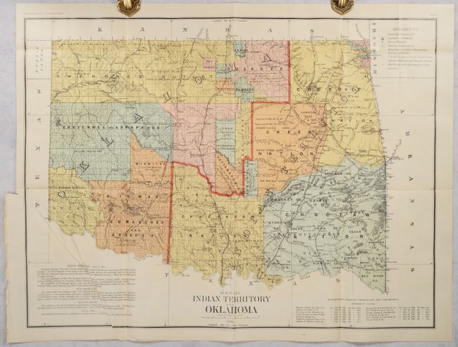
Auction 203, Lot 117
Subject: United States, Oklahoma
U.S. Department of Interior
[3 Maps in Report] Report on Indians Taxed and Indians Not Taxed in the United States (Except Alaska) at the Eleventh Census: 1890, 1894
Size: 9.4 x 11.8 inches (23.9 x 30 cm)
Estimate: $600 - $750
Sold for: $500
Closed on 4/23/2025
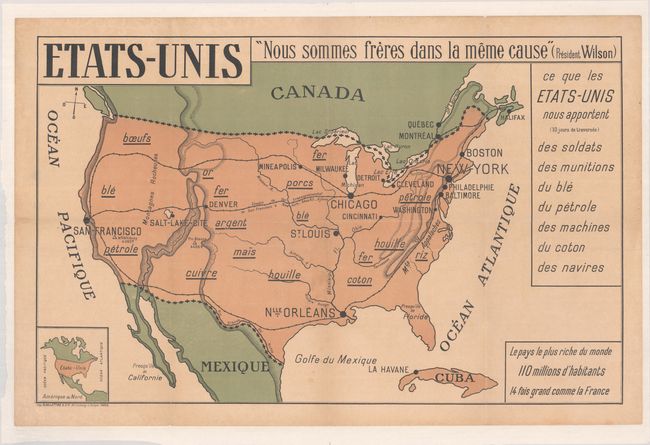
Auction 203, Lot 118
Subject: United States
Etats-Unis, 1917
Size: 36.9 x 23.3 inches (93.7 x 59.2 cm)
Estimate: $350 - $425
"We Are Brothers in the Same Cause"
Unsold
Closed on 4/23/2025
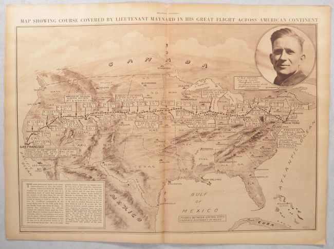
Auction 203, Lot 119
Subject: United States, Aviation
New York Times
[Map in Magazine] Map Showing Course Covered by Lieutenant Maynard in His Great Flight Across American Continent [in] Mid-Week Pictorial - Vol. X. No. 9. October 30, 1919, 1919
Size: 20.4 x 14.1 inches (51.8 x 35.8 cm)
Estimate: $300 - $375
Very Rare Map Commemorating the 1919 Transcontinental Aviation Race
Unsold
Closed on 4/23/2025
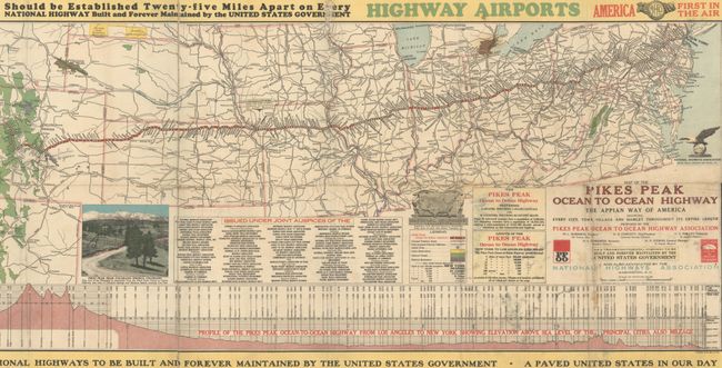
Auction 203, Lot 120
Subject: United States
Map of the Pikes Peak Ocean to Ocean Highway - The Appian Way of America Showing Every City, Town, Village and Hamlet Throughout Its Entire Length..., 1924
Size: 50.1 x 15.2 inches (127.3 x 38.6 cm)
Estimate: $160 - $190
Prototypical Persuasive Map Relating to Highways and Airports
Sold for: $140
Closed on 4/23/2025
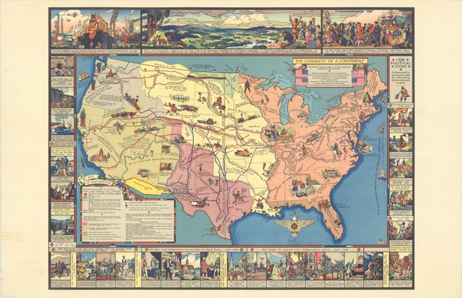
Auction 203, Lot 121
Subject: United States
The Conquest of a Continent, 1933
Size: 27.1 x 20.9 inches (68.8 x 53.1 cm)
Estimate: $400 - $475
Sold for: $550
Closed on 4/23/2025
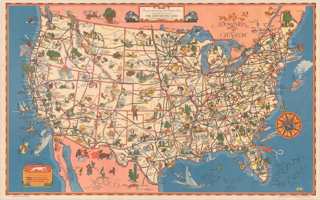
Auction 203, Lot 122
Subject: United States
[Lot of 2] A Good-Natured Map of the United States Setting Forth the Services of the Greyhound Lines and a Few Principal Connecting Bus Lines [and] Defense Map of America, 1939-42
Size: See Description
Estimate: $140 - $170
Sold for: $100
Closed on 4/23/2025
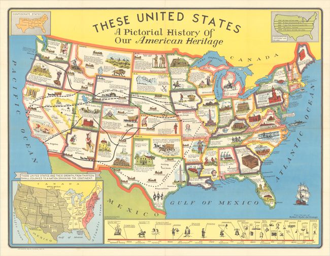
Auction 203, Lot 123
Subject: United States
These United States - A Pictorial History of Our American Heritage, 1949
Size: 34.6 x 26.4 inches (87.9 x 67.1 cm)
Estimate: $140 - $170
Sold for: $100
Closed on 4/23/2025
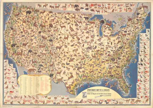
Auction 203, Lot 124
Subject: United States
Sportsman's Map of U.S. Wildlife..., 1956
Size: 31.2 x 22 inches (79.2 x 55.9 cm)
Estimate: $200 - $230
Sold for: $170
Closed on 4/23/2025
Auction 203, Lot 125
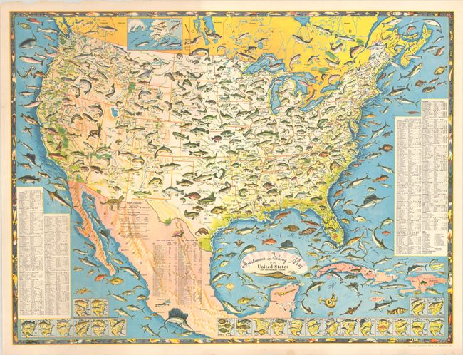
Subject: United States
Sportsmen's Fishing Map of the United States and Neighboring Waters, 1957
Size: 25.1 x 18.9 inches (63.8 x 48 cm)
Estimate: $200 - $230
Sold for: $150
Closed on 4/23/2025
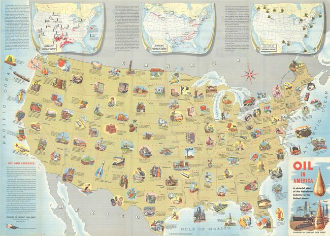
Auction 203, Lot 126
Subject: United States, Oil
Oil in America - A Pictorial Story of the Petroleum Industry in the United States, 1957
Size: 33.5 x 23.9 inches (85.1 x 60.7 cm)
Estimate: $180 - $220
Sold for: $120
Closed on 4/23/2025
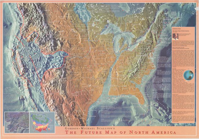
Auction 203, Lot 127
Subject: United States
Gordon-Michael Scallion's The Future Map of North America, 1997
Size: 37 x 25.5 inches (94 x 64.8 cm)
Estimate: $140 - $170
Futurist’s Dramatic Depiction of the Future Topography of North America
Sold for: $550
Closed on 4/23/2025
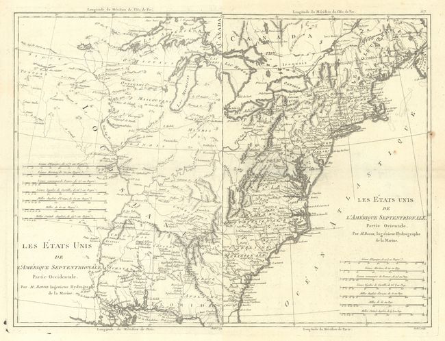
Auction 203, Lot 128
Subject: Eastern United States
Bonne, Rigobert
[Lot of 2] Les Etats Unis de l'Amerique Septentrionale, Partie Occidentale [and] ... Partie Orientale, 1787
Size: 9.3 x 13.7 inches (23.6 x 34.8 cm)
Estimate: $375 - $450
Sold for: $200
Closed on 4/23/2025
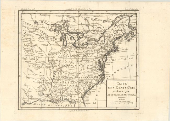
Auction 203, Lot 129
Subject: Eastern United States, Franklin
Brion de la Tour, Louis
Carte des Etats-Unis d'Amerique et du Cours du Mississipi, 1788
Size: 10.6 x 8.7 inches (26.9 x 22.1 cm)
Estimate: $750 - $900
Shows the State of Franklin
Sold for: $475
Closed on 4/23/2025
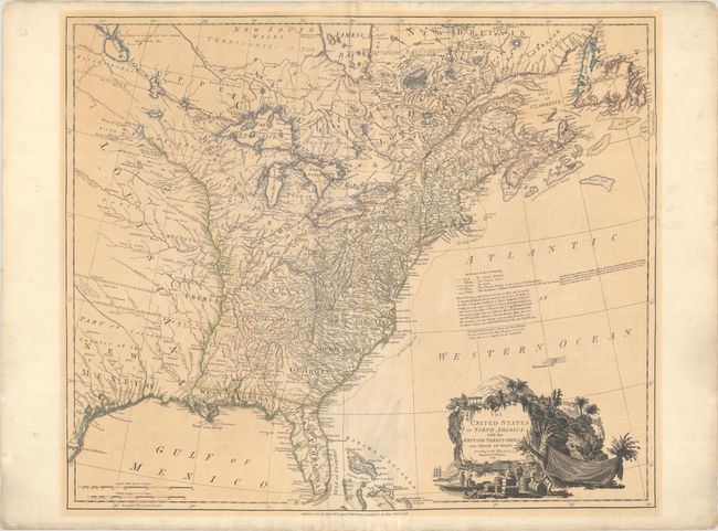
Auction 203, Lot 130
Subject: Eastern United States
Faden, William
The United States of North America: with the British Territories, and Those of Spain, According to the Treaty, of 1784, 1796
Size: 25 x 20.9 inches (63.5 x 53.1 cm)
Estimate: $4,000 - $4,750
Features the State of Franklin
Sold for: $2,500
Closed on 4/23/2025
233 lots
Page 1 of 5