Catalog Archive
Auction 203, Lot 99

"Carta Rappresentante i Cinque Laghi del Canada", Pazzi, Giuseppe

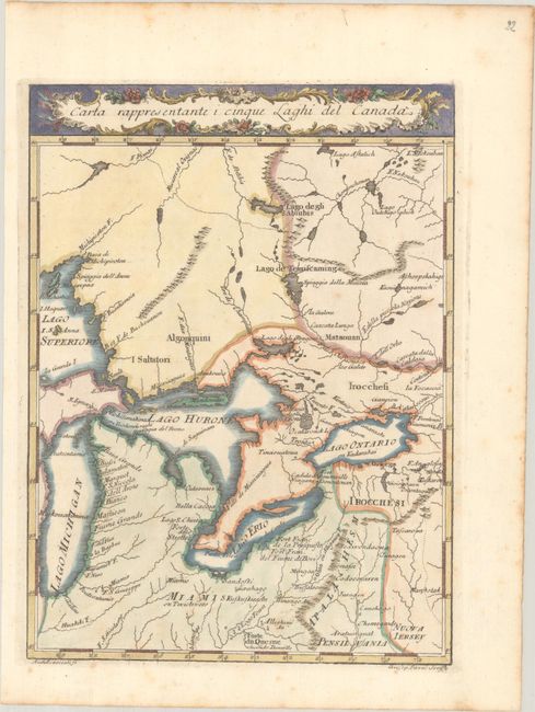
Subject: Colonial Central United States & Canada, Great Lakes

Period: 1763 (circa)

Publication: Il Gazzettiere Americano

Color: Hand Color

Size:
7.4 x 10 inches
18.8 x 25.4 cm
Download High Resolution Image
(or just click on image to launch the Zoom viewer)

This is an early Italian map showing the Great Lakes region. While all of the lakes are represented, the shorelines are somewhat distorted. Lake Huron is too far to the north while Lake Ontario is too wide. Numerous tribes are named such as the Irocchesi and Algonquini, and many forts are located. Boundaries are noted with small dotted lines. Engraved by A. Scacciati.

References: Kershaw #969; Sellers & Van Ee #221.

Condition: A

A crisp impression with light foxing that is mostly confined to the blank margins.

Estimate: $240 - $300

Sold for: $180

Closed on 4/23/2025

Archived