Subject: United States, Oklahoma
Period: 1894 (published)
Publication:
Color: Printed Color
Size:
9.4 x 11.8 inches
23.9 x 30 cm
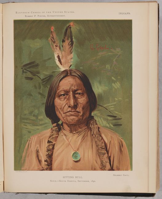
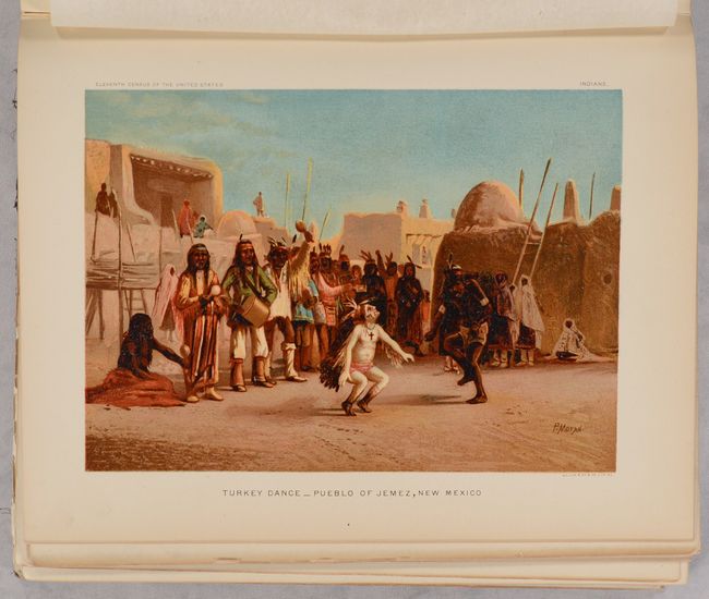
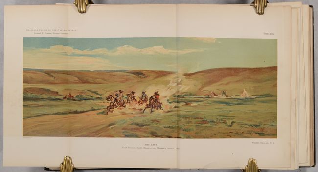
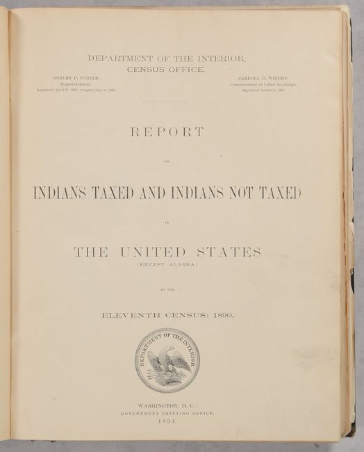
This 683-page volume dedicated to Native Americans was issued as part of the Eleventh Census of the United States. The comprehensive text includes: an introduction, historic review, policy and administration of Indian Affairs, population, social statistics, and a comprehensive assessment of "Condition of Indians Taxed and Indians Not Taxed" by state (where applicable). The volume is profusely illustrated with maps, photographic plates, statistical tables, 2 color folding plates, and 17 attractive tissue-guarded chromolithographs including portraits of Sitting Bull, Scar-Faced Charlie, and Tonto Apache to name a few. The volume also features the following three folding maps:
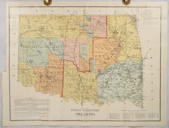
Map of Indian Territory and Oklahoma (29.4 x 22.1"). This large, colorful, and historically significant map presents the newly created Oklahoma Territory (created in 1889). This is possibly the only Census Office map showing the two territories together. Both would clamor for admission to statehood. The Dawes Commission would soon extinguish Indian land titles, which led to eventual statehood for the Oklahoma Territory. There is documentary backup for the Indian titles in each of the tribal areas and marginal notes with historical information on the various Indian Lands. Scale of 12 miles to the inch, legend in upper right. Lower right box lists the railroads authorized to operate in Indian Territory. This is the rarer issue of the map and should not be confused with the more common General Land Office issue. This map is loosely inserted.
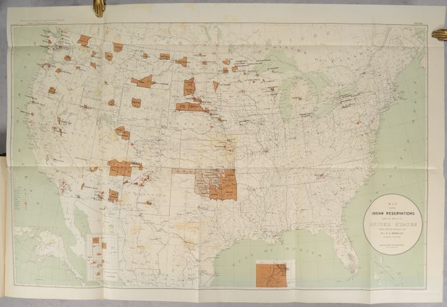
Map Showing Indian Reservations Within the Limits of the United States Compiled Under the Direction of the Hon. T. J. Morgan (33.3 x 20.9"). This large map focuses on the many Indian Reservations in the United States as of 1890. The reservations are named and shown in orange overprinting. The map also shows military stations, towns and villages, railroads, Indian agencies, and training schools. Includes insets of reservations in California and Indian Territory at bottom. Compiled under the direction of T.J. Morgan, Commissioner of Indian Affairs.
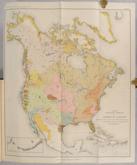
Map of Linguistic Stocks of American Indians Chiefly Within the Present Limits of the United States (17.4 x 20.2"). This colorful and useful map is helpful in understanding the early relationships of the various Native American tribes. While covering most of North America, the focus of the map is the Native American tribes of the United States. A small inset shows the Aleutian Islands at lower left. Chromolithographed by the New York firm of Sackett & Wilhelms. The map was compiled under the direction of Henry Gannett, who established the geography program in the U.S. Census Office for the Tenth (1880) census.
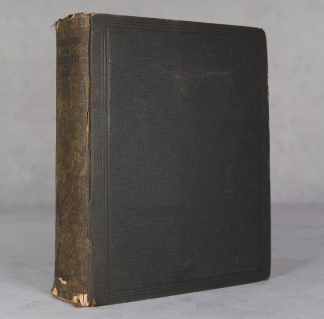
Hardbound in brown cloth with title on spine.
References:
Condition: B+
Condition code is for the maps and plates, which are all clean, bright and very good to near fine. The Indian Territory map is loose with some creasing at lower left. The Indian Reservation map has light color offsetting and a 1.25" repaired binding tear at left. Text has a hint of pleasant light toning. The binding is poor due to the volume's size, with several pages loose. Covers are worn and nearly detached.