Subject: United States, Civil War
Period: 1861 (dated)
Publication:
Color: Hand Color
Size:
23.9 x 17.3 inches
60.7 x 43.9 cm
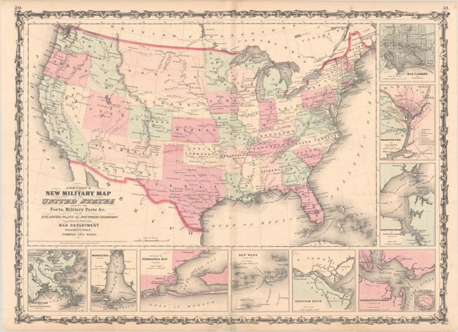
This is the more desirable issue of this Civil War period map, with the state and territory borders instead of the Military Districts. The large western territories include Dakota, which incorporates present-day Montana and part of Wyoming, Nebraska with its western border on Washington and Utah, Washington with the inverted "L" shape encompassing present-day Idaho, a very narrow Nevada, and Arizona located below New Mexico Territory. Hundreds of military forts are located. Below and to the right of the map are nine inset plans of the major towns and harbors including Hampton Roads, Charleston Harbor, Key West, Baltimore, and Washington. Copyright date 1861, but published circa 1862.
References:
Condition: B+
Contemporary color with minor foxing and a hint of toning along the centerfold. There is a centerfold separation that enters 1" into map image at bottom that has been closed on verso with tape.