Filtered by Category:United States(Show All Categories)
Showing results for:Auction 137
Catalog Archive
273 lots
Page 1 of 6
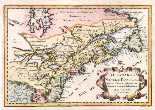
Auction 137, Lot 138
Subject: Colonial United States and Canada - Great Lakes
Sanson, Nicolas
Le Canada, ou Nouvelle France, &c. Tiree de diverses Relations des Francois, Anglois, Hollandois, &c., 1700
Size: 12 x 8.3 inches (30.5 x 21.1 cm)
Estimate: $800 - $950
Small Version of a Keystone Map for Great Lakes Collections
Sold for: $700
Closed on 9/14/2011
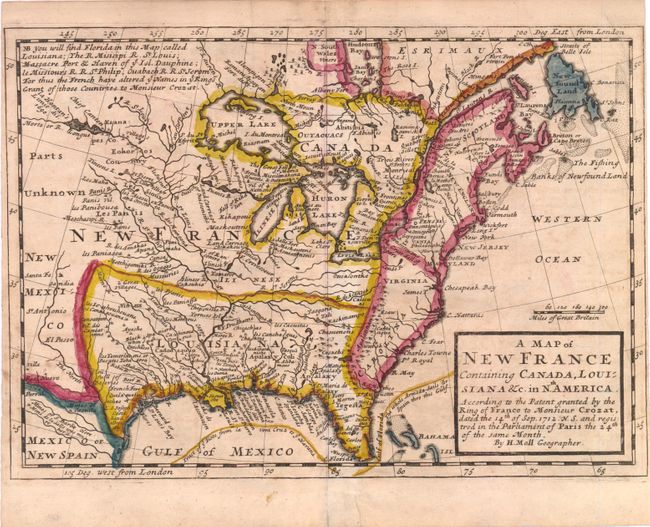
Auction 137, Lot 139
Subject: Colonial United States and Canada
Moll, Herman
A Map of New France Containing Canada, Louisiana &c. in Nth. America. According to the Patent Granted by the King of France to Monsieur Crozat, Dated the 14th of Sep. 1712 N.S. and Registered in the Parliament of Paris the 24th of Same Month, 1708
Size: 10.3 x 7.3 inches (26.2 x 18.5 cm)
Estimate: $450 - $550
Sold for: $650
Closed on 9/14/2011
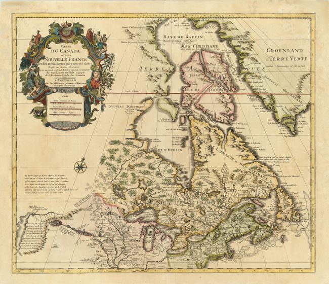
Auction 137, Lot 140
Subject: Colonial United States & Canada
Delisle/Covens & Mortier
Carte du Canada ou de la Nouvelle France et des Decouvertes qui y ont ete faites…, 1730
Size: 22.5 x 19.5 inches (57.2 x 49.5 cm)
Estimate: $1,300 - $1,600
One of the most influential maps of Canada, the Great Lakes and Upper Midwest
Unsold
Closed on 9/14/2011
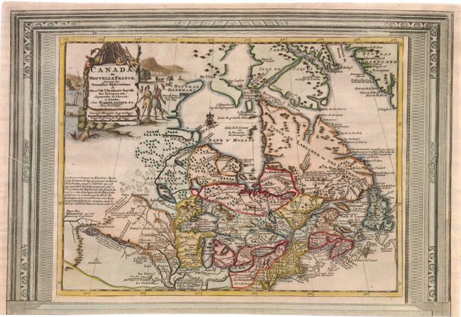
Auction 137, Lot 141
Subject: Colonial United States & Canada
Aa, Pieter van der
Canada ou Nouvelle France, Suivant les Nouvelles Observations de Messrs. de l'Academie Royale des Sciences…, 1730
Size: 15 x 10.5 inches (38.1 x 26.7 cm)
Estimate: $650 - $750
Unsold
Closed on 9/14/2011
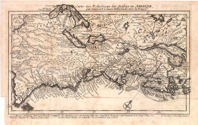
Auction 137, Lot 142
Subject: Colonial United States and Canada
Back, Jean C.
Carte des Possessions des Anglois en Amerique, par Rapport a Leurs Differends avec la France, 1759
Size: 11.8 x 7 inches (30 x 17.8 cm)
Estimate: $450 - $600
One of the Most Unusual French & Indian War Period Maps
Sold for: $475
Closed on 9/14/2011
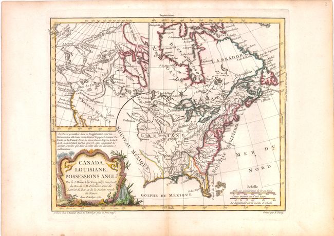
Auction 137, Lot 143
Subject: Colonial United States and Canada
Robert de Vaugondy, Didier
Canada, Louisiane, Possessions Angl?, 1762
Size: 11.3 x 9.3 inches (28.7 x 23.6 cm)
Estimate: $200 - $250
Sold for: $160
Closed on 9/14/2011
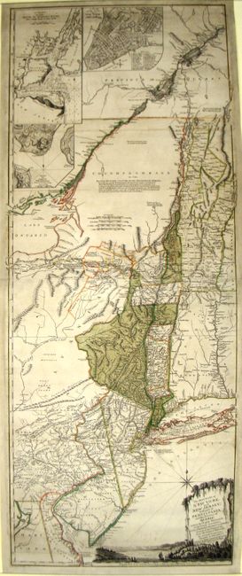
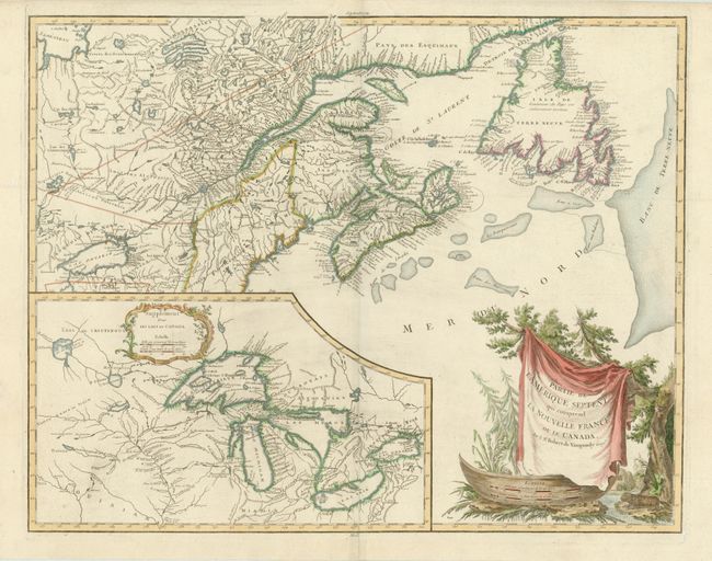
Auction 137, Lot 144
Subject: Colonial Northeast and Quebec
Holland/Pownal
The Provinces of New York, and New Jersey; with Part of Pensilvania, and the Province of Quebec. Drawn by Major Holland…, 1777
Size: 20 x 52.3 inches (50.8 x 132.8 cm)
Estimate: $4,000 - $5,000
Rare German Edition of an Important Revolutionary War Period Map
Sold for: $2,600
Closed on 9/14/2011
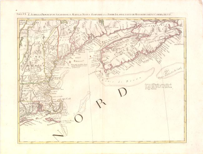
Auction 137, Lot 145
Subject: Colonial United States and Canada
Zatta, Antonio
L'Acadia, le Provincie di Sagadahook e Main, la Nuova Hampshire, la Rhode Island, e Parte di Massachusset e Connecticut, 1778
Size: 17 x 13 inches (43.2 x 33 cm)
Estimate: $300 - $400
Sold for: $160
Closed on 9/14/2011
Auction 137, Lot 146
Subject: Colonial United States and Canada
Robert de Vaugondy
Partie de l'Amerique Septent? qui comprend la Nouvelle France ou le Canada, 1788
Size: 23.7 x 18.6 inches (60.2 x 47.2 cm)
Estimate: $800 - $950
Unsold
Closed on 9/14/2011
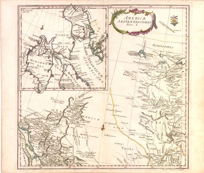
Auction 137, Lot 147
Subject: Canada & United States
Von Euler, Leonhard
Americae Septentrionalis Pars I, 1753
Size: 14.3 x 13.6 inches (36.3 x 34.5 cm)
Estimate: $400 - $500
Sold for: $210
Closed on 9/14/2011
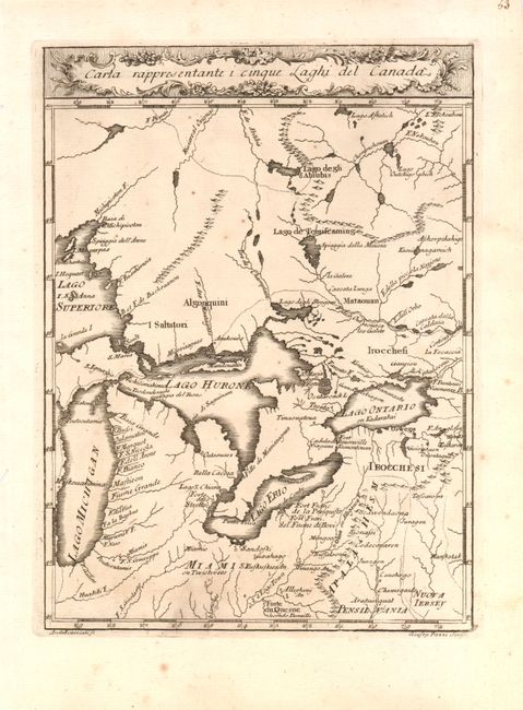
Auction 137, Lot 148
Subject: Canada & United States
Gazzettiere Americano
Carta Rappresentante i Cinque Laghi del Canada, 1763
Size: 7.5 x 10 inches (19.1 x 25.4 cm)
Estimate: $350 - $500
Sold for: $400
Closed on 9/14/2011
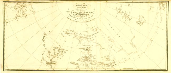
Auction 137, Lot 149
Subject: Canada & Alaska
[Lot of 2] General Chart Shewing the Track of H.M. Ships Fury and Hecla… [and] Carte des Voyages du King George et de la Reine Charlotte…, 1787-1824
Size: See Description
Estimate: $400 - $800
Sold for: $400
Closed on 9/14/2011
Auction 137, Lot 150
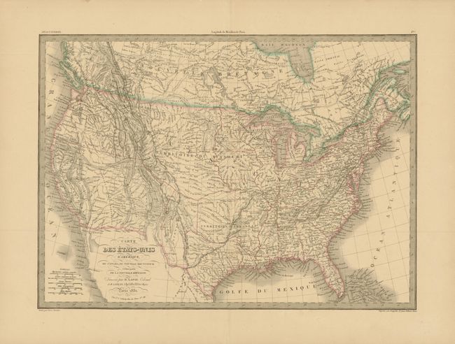
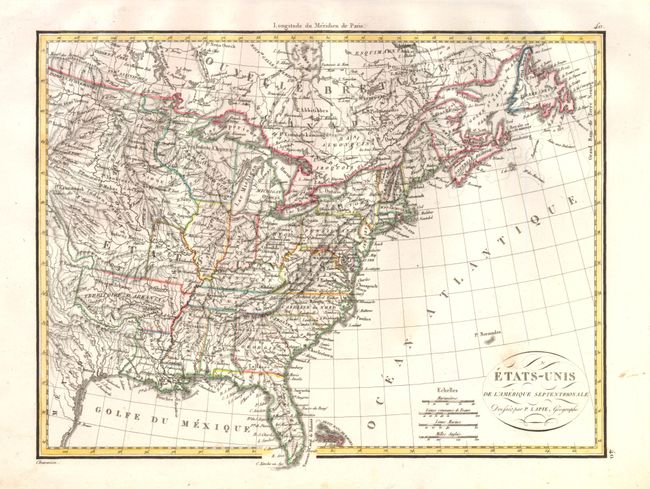
Subject: Canada & United States
Lapie, Alexander Emile & Pierre
Carte des Etats-Unis d'Amerique, du Canada, du Nouveau Brunswick et d'une partie de la Nouvelle Bretagne, 1851
Size: 21.7 x 15.8 inches (55.1 x 40.1 cm)
Estimate: $275 - $350
Sold for: $150
Closed on 9/14/2011
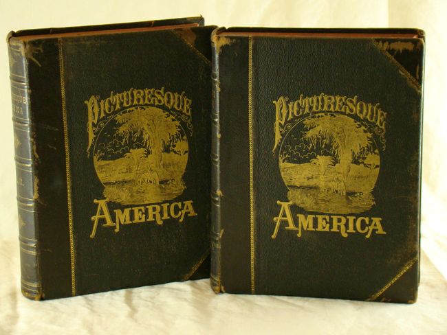
Auction 137, Lot 151
Subject: Canada & United States
Bryant, William C.
[2 Volumes] Picturesque America; or, the Land we Live in…, 1872-74
Size: 10 x 13.3 inches (25.4 x 33.8 cm)
Estimate: $375 - $500
Sold for: $190
Closed on 9/14/2011
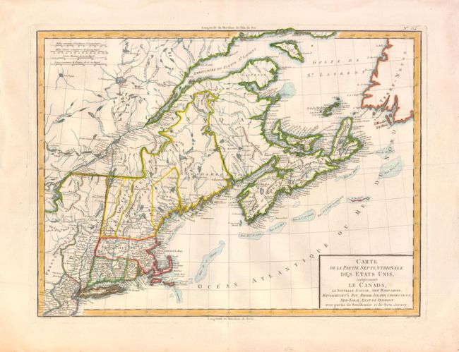
Auction 137, Lot 152
Subject: Eastern Canada & United States
Tardieu, Pierre Francois
Carte de la Partie Septentrionale des Etats Unis, comprenant le Canada, La Nouvelle Ecosse, New Hampshire, Massachuset's Bay, Rhode-Island, Connecticut, New-Yorck, Etat de Vermont avec partie de Pensilvanie et de New-Jersey, 1797
Size: 16.5 x 12.7 inches (41.9 x 32.3 cm)
Estimate: $300 - $400
Unsold
Closed on 9/14/2011
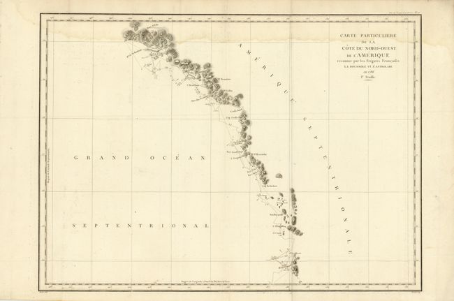
Auction 137, Lot 153
Subject: Western Canada and Alaska
La Perouse, Comte Jean F. Galoup, de
Carte Particuliere de la Cote du Nord-Ouest de l'Amerique reconnue par les Fregates Francaises la Boussole et l'Astrolabe en 1786. 1e. Feuille, 1797
Size: 27 x 19.5 inches (68.6 x 49.5 cm)
Estimate: $150 - $180
Sold for: $110
Closed on 9/14/2011
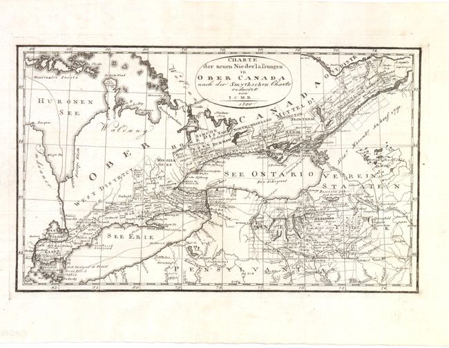
Auction 137, Lot 154
Subject: Canada, United States, & Great Lakes
I.C.M.R.
Charte der Neuen Niederlassungen in Ober Canada nach der Smythschen Charte, 1800
Size: 12.5 x 7.5 inches (31.8 x 19.1 cm)
Estimate: $200 - $250
Sold for: $150
Closed on 9/14/2011
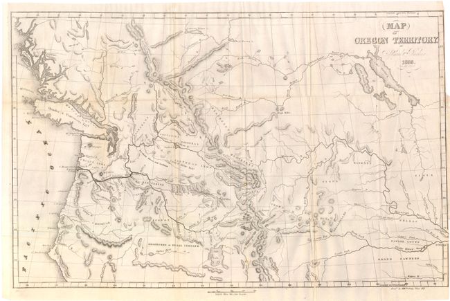
Auction 137, Lot 155
Subject: Northwestern United States, Canada
Parker, Samuel (Rev.)
Map of Oregon Territory, 1838
Size: 22.3 x 14 inches (56.6 x 35.6 cm)
Estimate: $300 - $350
Sold for: $230
Closed on 9/14/2011
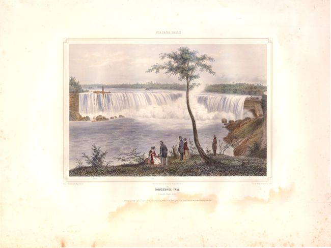
Auction 137, Lot 156
Subject: Niagara Falls
Niagara Falls / Horseshoe Fall (from the Canada side), 1848
Size: 11.9 x 8.3 inches (30.2 x 21.1 cm)
Estimate: $500 - $650
Sold for: $375
Closed on 9/14/2011
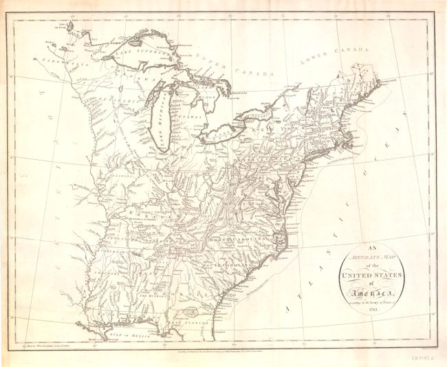
Auction 137, Lot 157
Subject: United States
Russell, John C.
An Accurate Map of the United States of America, According to the Treaty of Peace of 1783, 1794
Size: 18.3 x 14.3 inches (46.5 x 36.3 cm)
Estimate: $600 - $750
Sold for: $500
Closed on 9/14/2011
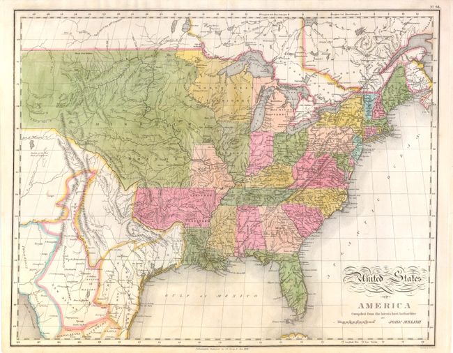
Auction 137, Lot 158
Subject: United States
Melish, John
United States of America Compiled from the Latest & Best Authorities, 1821
Size: 21.3 x 17 inches (54.1 x 43.2 cm)
Estimate: $800 - $1,100
Unsold
Closed on 9/14/2011
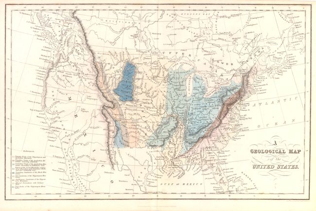
Auction 137, Lot 159
Subject: United States
Hinton, John Howard
A Geological Map of the United States, 1832
Size: 15.3 x 9.8 inches (38.9 x 24.9 cm)
Estimate: $300 - $500
Sold for: $240
Closed on 9/14/2011
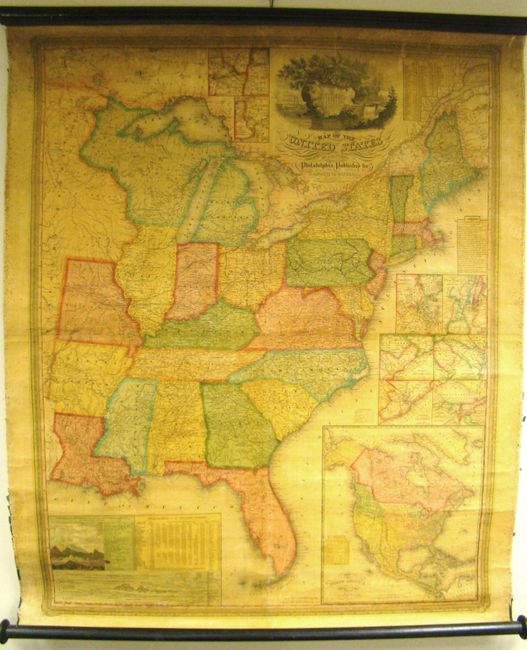
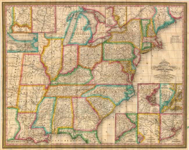
Auction 137, Lot 160
Subject: United States
Mitchell, Samuel Augustus
Map of the United States by J.H. Young, 1833
Size: 35 x 44 inches (88.9 x 111.8 cm)
Estimate: $1,400 - $1,800
Rare, Early Edition Mitchell Wall Map
Unsold
Closed on 9/14/2011
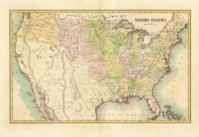
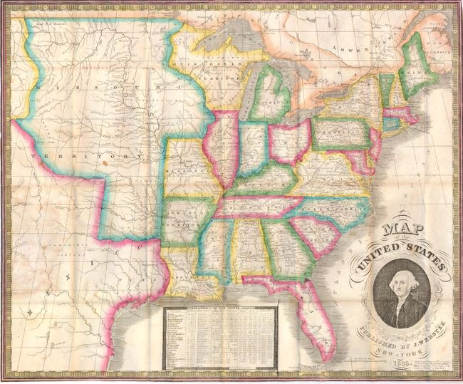
Auction 137, Lot 161
Subject: United States
Bradford, Thomas Gamaliel
United States, 1838
Size: 22.8 x 14.3 inches (57.9 x 36.3 cm)
Estimate: $450 - $550
Sold for: $325
Closed on 9/14/2011
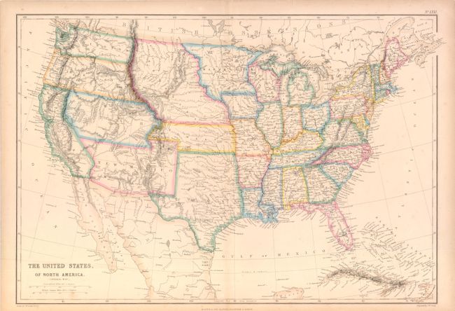
Auction 137, Lot 162
Subject: United States
Blackie, W. G. & Son
The United States, of North America. (General Map.), 1854
Size: 19.7 x 13.6 inches (50 x 34.5 cm)
Estimate: $220 - $275
Sold for: $160
Closed on 9/14/2011
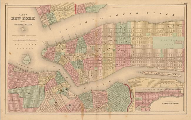
Auction 137, Lot 163
Subject: United States
Colton, Joseph Hutchins
[Lot of 5 - Various U.S. Cities], 1855
Size: See Description
Estimate: $100 - $200
Sold for: $80
Closed on 9/14/2011
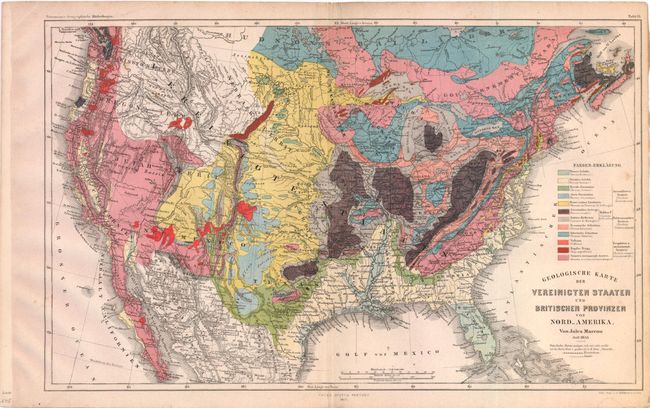
Auction 137, Lot 164
Subject: United States
Marcou, Jules
Geologische Karte der Vereinicten Staaten und Britischen Provinzen von Nord_Amerika, 1855
Size: 15 x 9.5 inches (38.1 x 24.1 cm)
Estimate: $350 - $450
Sold for: $300
Closed on 9/14/2011
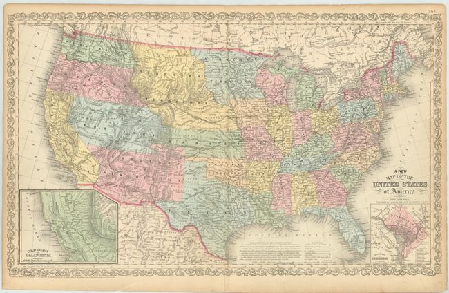
Auction 137, Lot 165
Subject: United States
Desilver, Charles
A New Map of the United States of America by J.H. Young, 1857
Size: 26.3 x 15.8 inches (66.8 x 40.1 cm)
Estimate: $300 - $375
Desilver's United States
Sold for: $220
Closed on 9/14/2011
Auction 137, Lot 166
Subject: United States
Phelps & Watson
Pictorial Map of the United States of America, the British Provinces, Mexico, the West Indies and Central America…, 1860
Size: 41.5 x 34 inches (105.4 x 86.4 cm)
Estimate: $1,200 - $1,600
Unsold
Closed on 9/14/2011
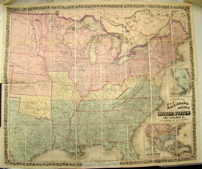
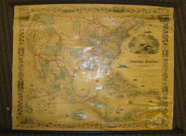
Auction 137, Lot 167
Subject: United States
Colton, Joseph Hutchins
Colton's New Railroad & County Map of the United States, 1862
Size: 39.5 x 33 inches (100.3 x 83.8 cm)
Estimate: $1,000 - $1,200
Rare Colton Civil War Map for a British Audience
Sold for: $1,200
Closed on 9/14/2011
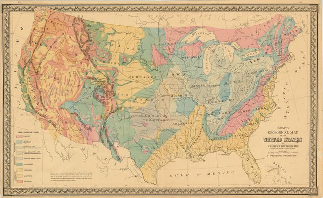
Auction 137, Lot 168
Subject: United States
Hitchcock, Charles Henry
Gray's Geological Map of the United States, 1881
Size: 27 x 16.3 inches (68.6 x 41.4 cm)
Estimate: $140 - $170
Sold for: $100
Closed on 9/14/2011
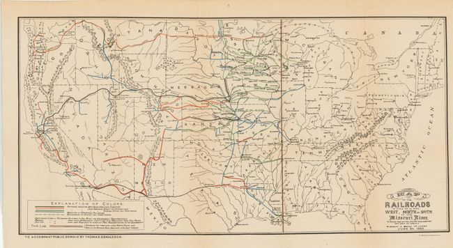
Auction 137, Lot 169
Subject: United States
[Lot of 2] Map of the Railroads in Whole or in Part West, North or South of the Missouri River… [and] Map Exhibiting the Leading Transportation Lines of the Pacific Coast, 1883-87
Size: See Description
Estimate: $350 - $450
Sold for: $200
Closed on 9/14/2011
Auction 137, Lot 170
Subject: United States
U.S. Geological Survey (USGS)
[Lot of 2] Map of the United States Exhibiting the Present Status of Knowledge Relating to the Areal Distribution of Geologic Groups [and] Map of the United States Exhibiting the Progress Made in the Geographic Survey, 1884
Size: 28 x 18 inches (71.1 x 45.7 cm)
Estimate: $325 - $400
Sold for: $240
Closed on 9/14/2011
Auction 137, Lot 171
Subject: United States
Rand McNally & Co.
New Official Railroad Map of the United States and Canada, 1885
Size: 6 x 9 inches (15.2 x 22.9 cm)
Estimate: $160 - $220
Sold for: $90
Closed on 9/14/2011
Auction 137, Lot 172
Subject: United States
Hitchcock, Charles Henry
Geological Map of the United States and Part of Canada, 1886
Size: 28 x 17.5 inches (71.1 x 44.5 cm)
Estimate: $500 - $650
Sold for: $350
Closed on 9/14/2011
Auction 137, Lot 173
Subject: United States
U.S. Geological Survey (USGS)
Reconnaissance Map of the United States Showing the Distribution of the Geologic System So Far As Known, 1893
Size: 28.2 x 17.4 inches (71.6 x 44.2 cm)
Estimate: $275 - $350
Sold for: $140
Closed on 9/14/2011
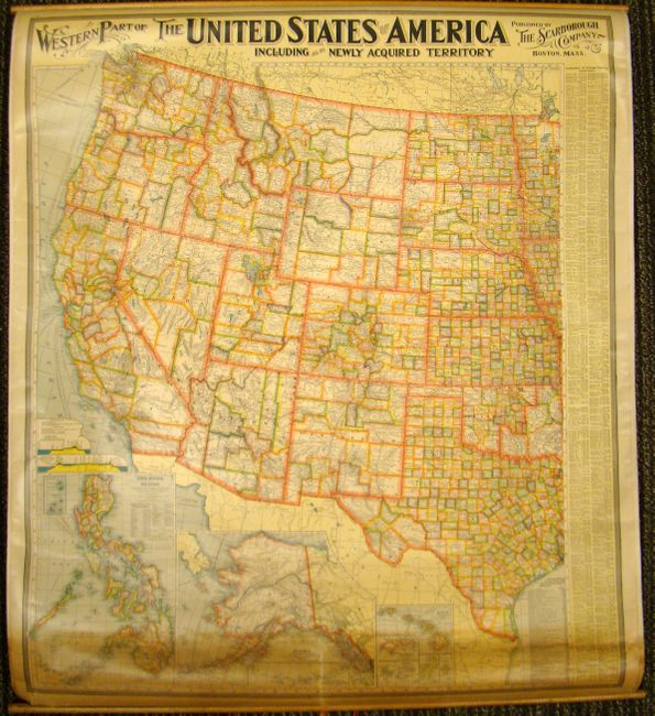
Auction 137, Lot 174
Subject: United States
Scarborough Company, The
[Double-sided wall map] Eastern Part of the United States of America Including All Its Newly Acquired Territories [and] Western Part…, 1900
Size: 34 x 39.5 inches (86.4 x 100.3 cm)
Estimate: $160 - $200
Unsold
Closed on 9/14/2011
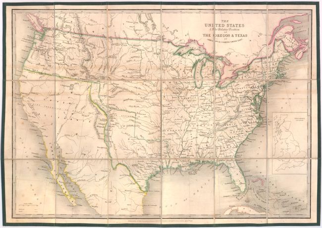
Auction 137, Lot 175
Subject: United States, Texas
Wyld, James
The United States & The Relative Position of the Oregon & Texas, 1845
Size: 21.5 x 15 inches (54.6 x 38.1 cm)
Estimate: $800 - $1,000
Sold for: $600
Closed on 9/14/2011
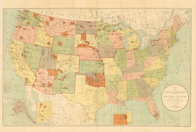
Auction 137, Lot 176
Subject: United States, Indian Reservations
U.S. Government
Map Showing Indian Reservations within the Limits of the United States Compiled under the Direction of the Hon. T.J. Morgan, 1891
Size: 33 x 20.8 inches (83.8 x 52.8 cm)
Estimate: $150 - $200
Sold for: $160
Closed on 9/14/2011
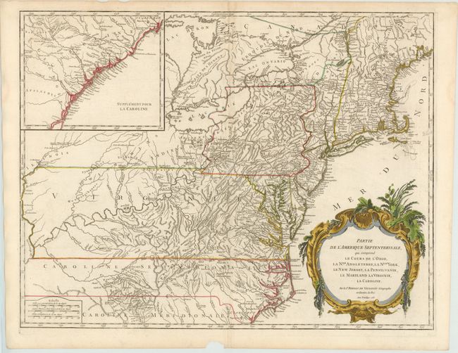
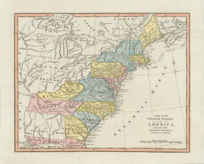
Auction 137, Lot 177
Subject: Colonial United States
Robert de Vaugondy
Partie de l'Amerique Septentrionale, qui Comprend le Cours De l'Ohio, la Nlle. Angleterre, la Nlle. York, le New Jersey, la Pensylvanie, le Maryland la Virginie, la Caroline., 1755
Size: 24.5 x 19 inches (62.2 x 48.3 cm)
Estimate: $800 - $1,000
Sold for: $600
Closed on 9/14/2011
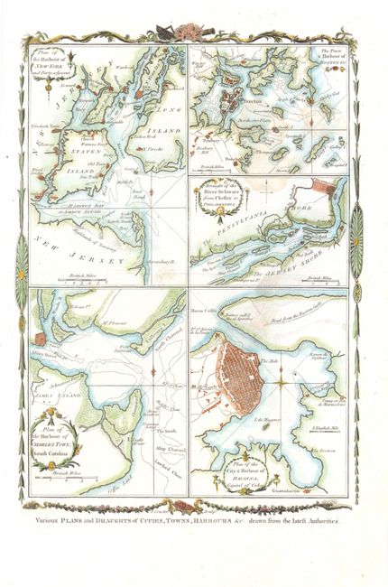
Auction 137, Lot 178
Subject: Eastern United States, Cuba
Conder, Thomas
Various Plans and Draughts of Cities, Towns, Harbours &c. Drawn from the Latest Authorities, 1779
Size: 8 x 12 inches (20.3 x 30.5 cm)
Estimate: $300 - $350
Sold for: $220
Closed on 9/14/2011
Auction 137, Lot 179
Subject: Eastern United States
Rochefoucald Liancourt, Francois Alexander
Carte des Provinces Septles. des Etats-Unis, 1807
Size: 19.8 x 12.8 inches (50.3 x 32.5 cm)
Estimate: $220 - $275
Sold for: $130
Closed on 9/14/2011
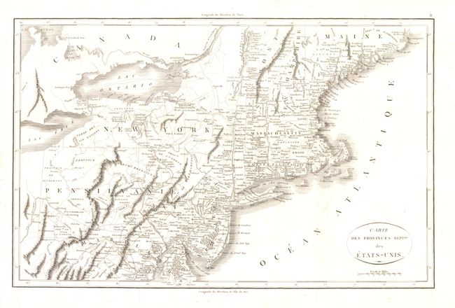
Auction 137, Lot 180
Subject: Eastern United States
Anon.
A Map of the United States of America, with Part of the Adjoining Provinces from the latest Authorities, 1810
Size: 10.5 x 8.5 inches (26.7 x 21.6 cm)
Estimate: $160 - $200
Sold for: $100
Closed on 9/14/2011
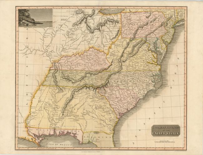
Auction 137, Lot 181
Subject: Eastern United States
Thomson, John
Southern Provinces of the United States, 1817
Size: 23.3 x 19.5 inches (59.2 x 49.5 cm)
Estimate: $650 - $800
Sold for: $550
Closed on 9/14/2011
Auction 137, Lot 182
Subject: Eastern United States
Lapie, Alexander Emile & Pierre
Etats-Unis de l'Amerique Septentrionale, 1830
Size: 11.7 x 8.8 inches (29.7 x 22.4 cm)
Estimate: $190 - $220
Sold for: $110
Closed on 9/14/2011
Auction 137, Lot 183
Subject: Eastern United States
Mitchell, Samuel Augustus
Mitchell's Travellers Guide Through the United States. A Map of the Roads, Distances, Steam Boat & Canal Routes & c. by J.H. Young, 1833
Size: 21.5 x 17.3 inches (54.6 x 43.9 cm)
Estimate: $1,000 - $1,200
Sold for: $750
Closed on 9/14/2011
Auction 137, Lot 184
Subject: Eastern United States
Phelps, Humphrey
Map of the United States, 1835
Size: 19.5 x 16.3 inches (49.5 x 41.4 cm)
Estimate: $500 - $600
Sold for: $500
Closed on 9/14/2011
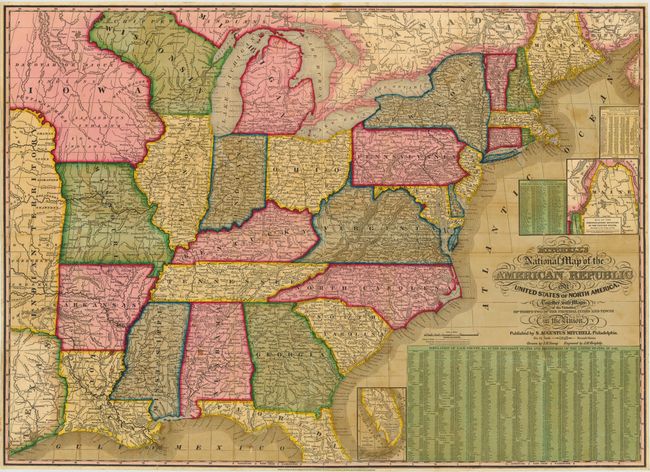
Auction 137, Lot 185
Subject: Eastern United States
Mitchell, Samuel Augustus
[On 2 Sheets] Mitchell's National Map of the American Republic or United States of North America. Together with Maps of the Vicinities of Thirty-Two of the Principal Cities & Towns in the Union …, 1843
Size: 34 x 24.5 inches (86.4 x 62.2 cm)
Estimate: $1,000 - $1,300
Unsold
Closed on 9/14/2011
Auction 137, Lot 186
Subject: Eastern United States
Phelps & Ensign
Phelps's National Map of the United States, A Traveller's Guide, 1849
Size: 25 x 20 inches (63.5 x 50.8 cm)
Estimate: $700 - $1,000
Unsold
Closed on 9/14/2011
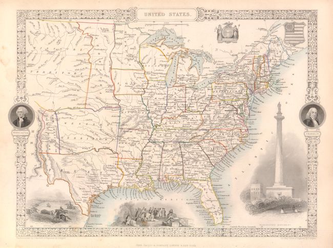
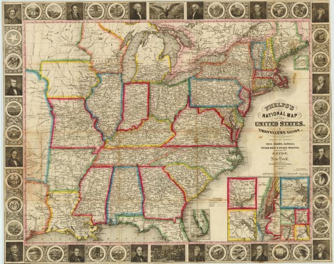
Auction 137, Lot 187
Subject: Eastern United States
Tallis, John
United States, 1851
Size: 13 x 9.5 inches (33 x 24.1 cm)
Estimate: $250 - $350
Sold for: $170
Closed on 9/14/2011
273 lots
Page 1 of 6