Subject: Eastern United States
Period: 1830 (circa)
Publication:
Color: Hand Color
Size:
11.7 x 8.8 inches
29.7 x 22.4 cm
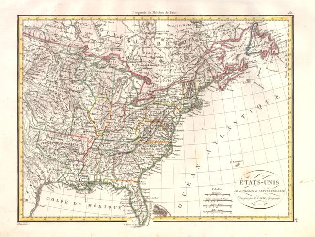
Interesting map of the United States in the first part of the 19th century that features a very well mapped watershed. Missouri has a vertical western border and the Northwest Territory takes in present day Wisconsin and Minnesota. Arkansas Territory is in its large format with its western boundary at Texas. Texas is still part of Mexico and includes a few place names such as S. Antonio and Nacogdoches, and a well defined river system. The balance of the Midwest is labeled with numerous Indian tribes. Fancy titling in a small oval cartouche. Four distance scales with longitude measured only from Paris.
References:
Condition: A
Near fine example with strong impression on thick paper with full margins. Faint, diffuse foxing mark in title cartouche and a printer's ink smudge in right blank margin.