Subject: Canada & United States
Period: 1851 (dated)
Publication: Atlas Universel de Geographie Ancienne et Moderne
Color: Hand Color
Size:
21.7 x 15.8 inches
55.1 x 40.1 cm
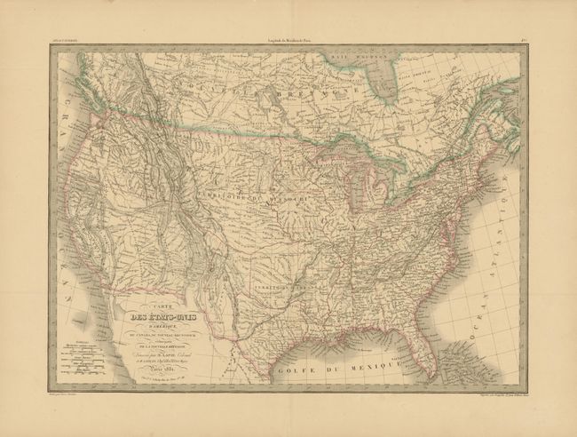
A great mid-nineteenth century map issued shortly after the Mexican War and reflecting incomplete knowledge of the border between the United States and Mexico. The Southwest still shows the Mexican states of Upper California, New Mexico and Texas, but the U.S./Mexican boundary along the Gila River is shown in a light, incomplete wash outline. The map is filled with interesting detail of Indian tribes, exploration and travel routes. There are large Missouri and Arkansas territories in the West and Midwest, and the entire Pacific Northwest is labeled District de Columbia. The map is surrounded with a bold keyboard style border. This map was published by Colonel Pierre Lapie (1777-1850) and his son Alexandre Emile, who was the Royal Geographer to the King in Paris. The map was engraved by Pierre Tardieu, a foremost French 19th century engraver.
References:
Condition: A
Light toning in blank margins and a short centerfold separation far from map image.