Subject: United States
Period: 1832 (published)
Publication: The History and Topography of the United States
Color: Hand Color
Size:
15.3 x 9.8 inches
38.9 x 24.9 cm
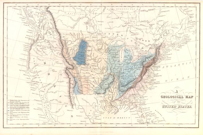
An attractive and interesting map that shows geologic formations in color all the way to the Rocky Mountains, here named Chippewayan Mountains, to the east of which is the Chippewayan Desert. Besides the geologic regions, there is quite a bit of information locating Indian tribes and naming waterways in the west. Several hypothetical rivers cross the great basin to the Pacific, holding out the hope of a river passage to the Pacific. The little known map was hand colored only in the London first edition of Hinton's "History." It was compiled from the geological maps of McClure and James (of the Long Expedition) by "several literary gentleman in America and England" who were unnamed. This map marks the last geological map of the US (except for reprints) presented in the Manchurian tradition. It is the first to extend from the Atlantic to the Rocky Mountains. This edition is unlisted in Marcou or Merrill.
References:
Condition: A
Near fine condition.