Subject: Pacific Islands
Period: 1788 (published)
Publication: Relation des Iles Pelew...
Color: Black & White
Size:
20.9 x 11 inches
53.1 x 27.9 cm
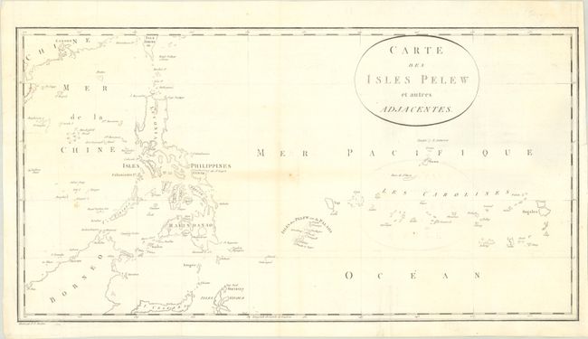
This is the French edition of Captain Henry Wilson's scarce chart centered on Palau. It was published in the French translation of George Keate's two-volume Relation des Iles Pelew, Situees dans la Partie Occidentale de l'Ocean Pacifique (1788). The map spans from Canton east to the Caroline Islands. It includes part of Borneo, the Philippines, Guam, and more. The Palau Islands later became a German colony as part of New Guinea. Engraved by Pierre Francois Tardieu.
The Antelope, a 300-ton East India Company packet ship under the command of Henry Wilson, was wrecked on the Pelew Islands on August 10, 1783, when it struck a reef. The officers and crew constructed a ship from the Antelope's timbers and eventually reached Macao in it.
References:
Condition: B+
Issued folding with light toning along a couple folds, a few small rust spots, and minor offsetting. A short archivally repaired edge tear at right just touches the neatline.