Showing No Reserve Lots(remove filter)
Filtered by Category:Canada(Show All Categories)
Catalog Archive
67 lots
Page 1 of 2
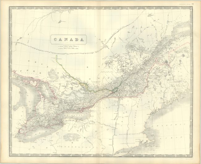
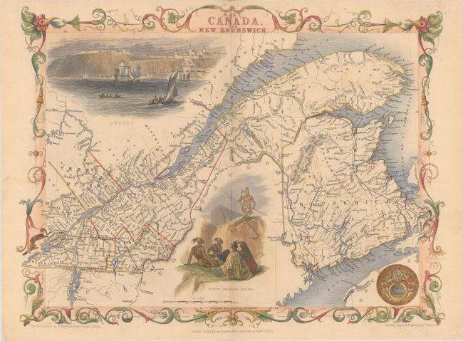
Auction 208, Lot 112
Subject: Eastern Canada
Johnston, Alexander K.
Canada, 1845
Size: 24 x 19.8 inches (61 x 50.3 cm)
Estimate: $70 - $90
NO RESERVE
Sold for: $11
Closed on 4/22/2026
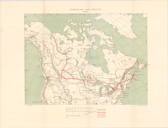
Auction 207, Lot 103
Subject: Canada
Canadian Air Routes 1930, 1931
Size: 16.8 x 12.3 inches (42.7 x 31.2 cm)
Estimate: $50 - $70
NO RESERVE
Sold for: $95
Closed on 2/11/2026
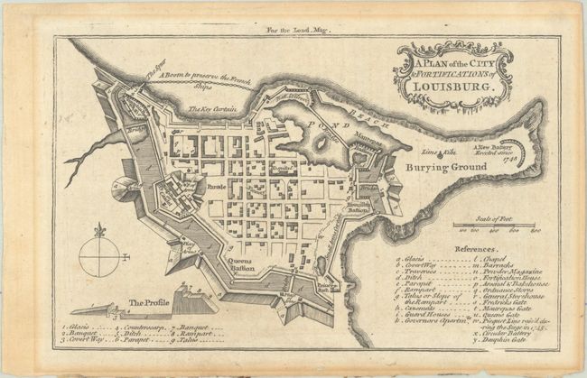
Auction 207, Lot 110
Subject: Louisburg, Cape Breton Island, Canada
Anon.
A Plan of the City & Fortifications of Louisburg, 1758
Size: 7.1 x 4.4 inches (18 x 11.2 cm)
Estimate: $60 - $80
NO RESERVE
Sold for: $65
Closed on 2/11/2026
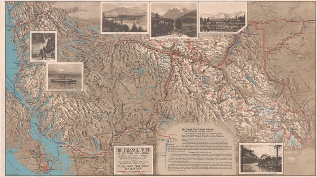
Auction 205, Lot 123
Subject: Northwestern United States & Canada
Railroad Companies, (Various)
The Triangle Tour of British Columbia - Jasper National Park Mount Robson Park Canadian Rockies and the Scenic Seas of the North Pacific Coast [on verso] Alaska and the Yukon, 1929
Size: 29.8 x 16.8 inches (75.7 x 42.7 cm)
Estimate: $150 - $180
NO RESERVE
Sold for: $46
Closed on 9/10/2025
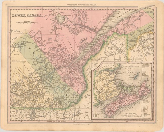
Auction 204, Lot 87
Subject: Eastern Canada
Tanner, Henry Schenck
Lower Canada, 1836
Size: 14.8 x 11.8 inches (37.6 x 30 cm)
Estimate: $60 - $75
NO RESERVE
Sold for: $16
Closed on 6/18/2025
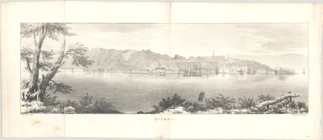
Auction 202, Lot 98
Subject: Quebec City, Canada
Quebec, 1827
Size: 17.7 x 5.6 inches (45 x 14.2 cm)
Estimate: $80 - $100
NO RESERVE
Sold for: $50
Closed on 2/12/2025
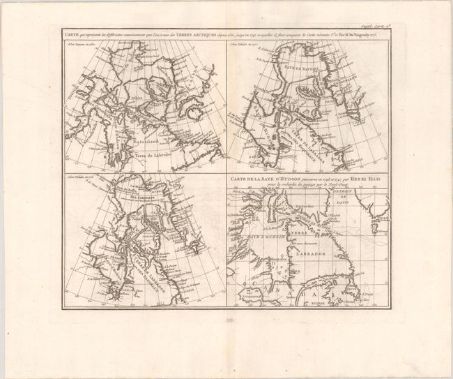
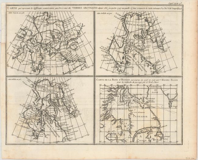
Auction 201, Lot 91
Subject: Eastern Canada
Robert de Vaugondy, Didier
Carte qui Represente les Differentes Connoissances que l'on a eues des Terres Arctiques Depuis 1650 Jusqu'en 1747..., 1773
Size: 13.6 x 11.6 inches (34.5 x 29.5 cm)
Estimate: $70 - $90
NO RESERVE
Sold for: $27
Closed on 11/20/2024
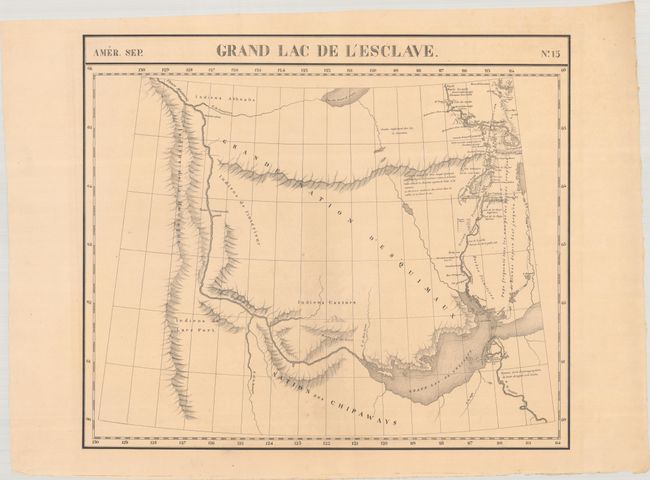
Auction 199, Lot 98
Subject: Western Canada
Vandermaelen, Philippe Marie Guillaume
Amer. Sep. Grand Lac de l'Esclave. No. 15, 1827
Size: 22.3 x 19 inches (56.6 x 48.3 cm)
Estimate: $100 - $130
NO RESERVE
Sold for: $14
Closed on 9/11/2024
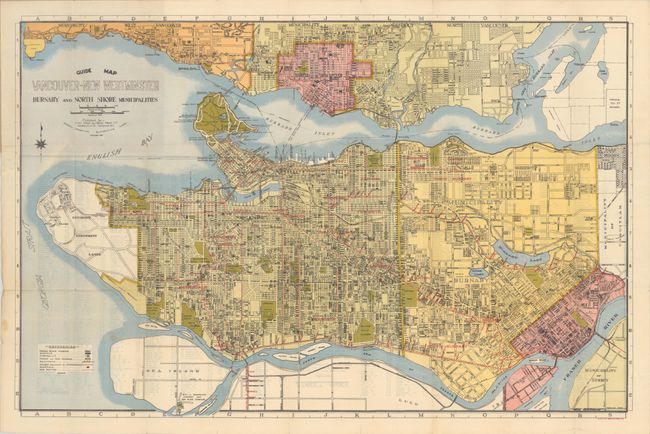
Auction 199, Lot 99
Subject: Vancouver, Canada
Guide Map Vancouver - New Westminster Burnaby and North Shore Municipalities, 1935
Size: 29.6 x 19.3 inches (75.2 x 49 cm)
Estimate: $90 - $120
NO RESERVE
Sold for: $180
Closed on 9/11/2024
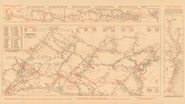
Auction 199, Lot 106
Subject: Northeastern United States & Canada
The Air Line - Fastest Motor Route Between New York and Boston - Connecting Routes to and from Washington - Pittsburgh - Cleveland - Montreal - Quebec, 1927
Size: 32.4 x 15.8 inches (82.3 x 40.1 cm)
Estimate: $80 - $100
NO RESERVE
Sold for: $21
Closed on 9/11/2024
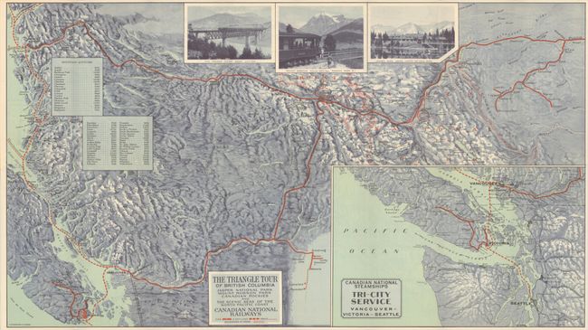
Auction 199, Lot 112
Subject: Northwestern United States & Canada
Railroad Companies, (Various)
The Triangle Tour of British Columbia - Jasper National Park Mount Robson Park Canadian Rockies and the Scenic Seas of the North Pacific Coast [on verso] Alaska and the Yukon, 1930
Size: 29.8 x 16.8 inches (75.7 x 42.7 cm)
Estimate: $150 - $180
NO RESERVE
Sold for: $60
Closed on 9/11/2024
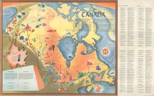
Auction 197, Lot 85
Subject: Canada
Canada - 100 Important New Resources... / 100 Nouvelles Ressources Importantes..., 1950
Size: 25.3 x 20.6 inches (64.3 x 52.3 cm)
Estimate: $110 - $140
NO RESERVE
Sold for: $34
Closed on 4/24/2024
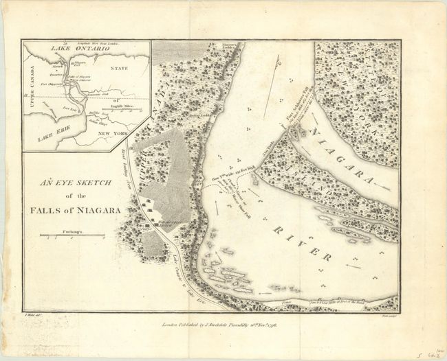
Auction 195, Lot 146
Subject: Niagara Falls, New York & Canada
Stockdale, John
An Eye Sketch of the Falls of Niagara, 1798
Size: 9 x 6.6 inches (22.9 x 16.8 cm)
Estimate: $70 - $90
NO RESERVE
Sold for: $65
Closed on 11/15/2023
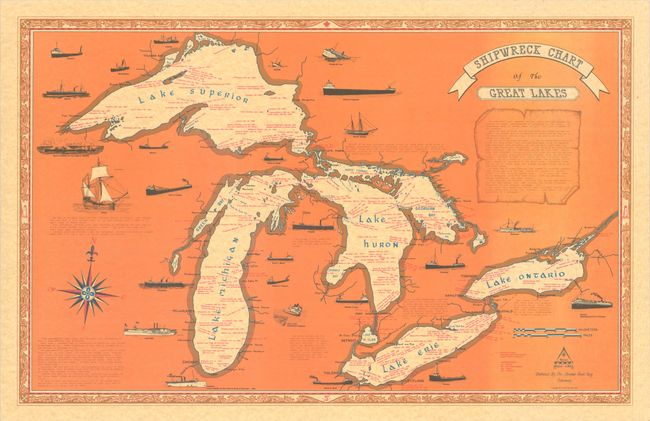
Auction 195, Lot 149
Subject: Great Lakes
Shipwreck Chart of the Great Lakes, 1977
Size: 32.8 x 20.8 inches (83.3 x 52.8 cm)
Estimate: $60 - $90
NO RESERVE
Sold for: $100
Closed on 11/15/2023
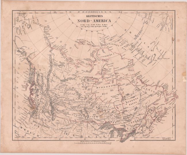
Auction 195, Lot 151
Subject: Northern United States & Canada
Flemming, Carl
Britisches Nord-America, 1844
Size: 15.8 x 12.6 inches (40.1 x 32 cm)
Estimate: $100 - $130
NO RESERVE
Sold for: $11
Closed on 11/15/2023
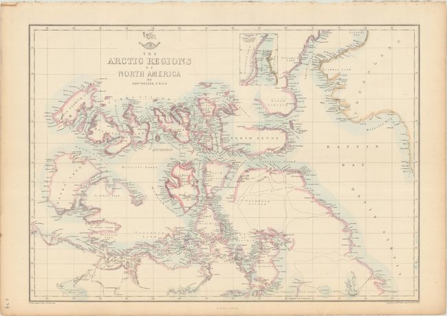
Auction 194, Lot 101
Subject: Northern Canada
Weller, Edward
The Arctic Regions of North America, 1860
Size: 17 x 12.1 inches (43.2 x 30.7 cm)
Estimate: $60 - $80
NO RESERVE
Sold for: $30
Closed on 9/13/2023
Auction 194, Lot 112
Subject: Northeastern United States & Canada
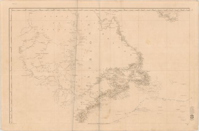
Direccion de Hidrografia
[Carta General del Oceano Atlantico Septentrional en Cuatro Hojas... - Northwestern Sheet] Hoja 3a. su Precio 13 Rs. Vn. En America 7 Rs. Pta. Fte., 1855
Size: 35.8 x 22.9 inches (90.9 x 58.2 cm)
Estimate: $300 - $400
NO RESERVE
Sold for: $21
Closed on 9/13/2023
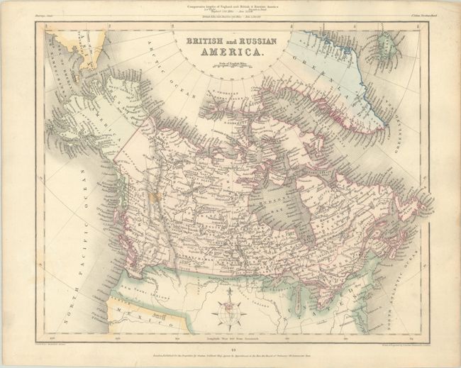
Auction 191, Lot 109
Subject: Canada
Grattan & Gilbert
British and Russian America, 1841
Size: 11.4 x 9.1 inches (29 x 23.1 cm)
Estimate: $100 - $130
NO RESERVE
Sold for: $220
Closed on 2/8/2023
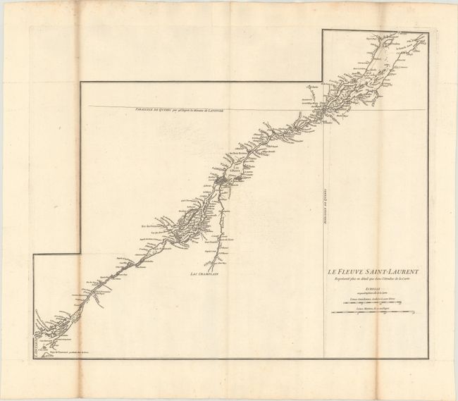
Auction 191, Lot 116
Subject: St. Lawrence River, Canada
Anville, Jean Baptiste Bourguignon d'
Le Fleuve Saint-Laurent Represente Plus en Detail que dans l'Etendue de la Carte, 1755
Size: 22.1 x 18.2 inches (56.1 x 46.2 cm)
Estimate: $140 - $180
NO RESERVE
Sold for: $30
Closed on 2/8/2023
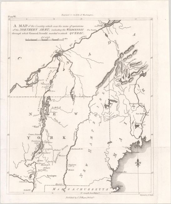
Auction 190, Lot 108
Subject: Northeastern United States & Canada
Marshall, John
A Map of the Country Which Was the Scene of Operations of the Northern Army; Including the Wilderness Through Which General Arnold Marched to Attack Quebec, 1807
Size: 8.6 x 10.3 inches (21.8 x 26.2 cm)
Estimate: $100 - $130
NO RESERVE
Sold for: $110
Closed on 11/16/2022
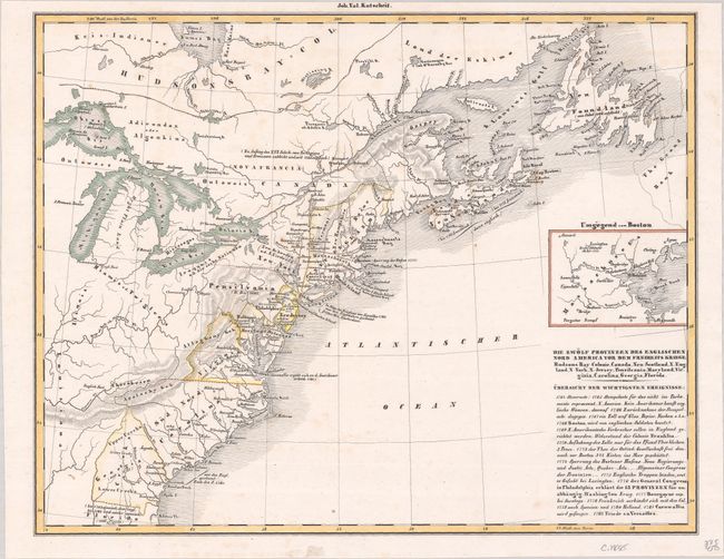
Auction 189, Lot 127
Subject: Northeastern United States & Canada
Petermann, Augustus Herman
[Lot of 2] Die Zwolf Provinzen des Englischen Nord America vor dem Freiheits Kriege... [and] Die Atlantischen Staaten Zwischen Washington & Boston, 1855-79
Size: See Description
Estimate: $60 - $80
NO RESERVE
Sold for: $55
Closed on 9/14/2022
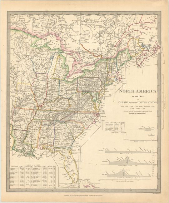
Auction 185, Lot 142
Subject: Eastern United States & Canada
SDUK Society for the Diffusion of Useful Knowledge
North America Index Map to Canada and the United States, 1834
Size: 12.7 x 14.5 inches (32.3 x 36.8 cm)
Estimate: $50 - $70
NO RESERVE
Sold for: $75
Closed on 11/17/2021
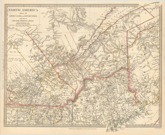
Auction 185, Lot 149
Subject: Northeastern United States & Canada
[Lot of 2] North America Sheet II Lower-Canada and New Brunswick with Part of New-York, Vermont and Maine [and] Lower Canada, New Brunswick, Nova Scotia &c., 1832-60
Size: See Description
Estimate: $80 - $100
NO RESERVE
Sold for: $120
Closed on 11/17/2021
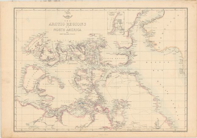
Auction 184, Lot 128
Subject: Northern Canada
Weller, Edward
The Arctic Regions of North America, 1860
Size: 16.8 x 12 inches (42.7 x 30.5 cm)
Estimate: $60 - $80
NO RESERVE
Sold for: $41
Closed on 9/15/2021
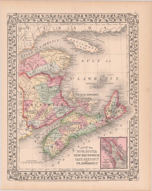
Auction 183, Lot 79
Subject: Eastern Canada
Mitchell, Samuel Augustus
County Map of Nova Scotia New Brunswick Cape Breton Id. and Pr. Edward's Id., 1867
Size: 10.7 x 13.6 inches (27.2 x 34.5 cm)
Estimate: $40 - $60
NO RESERVE
Sold for: $170
Closed on 6/9/2021
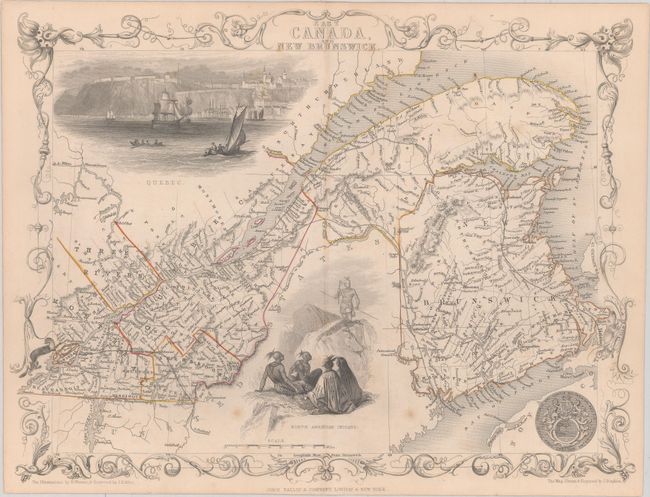
Auction 182, Lot 112
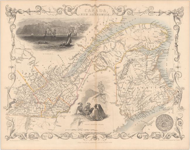
Subject: Eastern Canada
Tallis, John
East Canada, and New Brunswick, 1850
Size: 13.5 x 10.1 inches (34.3 x 25.7 cm)
Estimate: $120 - $150
NO RESERVE
Sold for: $80
Closed on 4/28/2021
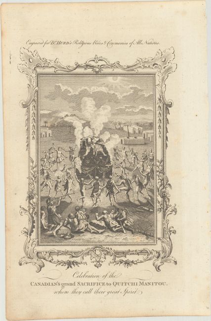
Auction 179, Lot 123
Subject: Canada, Natives
[Lot of 2] Celebration of the Canadian's Grand Sacrifice to Quitchi Manitou, Whom They Call Their Great Spirit [and] The Ceremony of a Divorce, as Practised by the Natives of Canada, in North America, 1780-94
Size: See Description
Estimate: $90 - $120
NO RESERVE
Sold for: $48
Closed on 9/16/2020
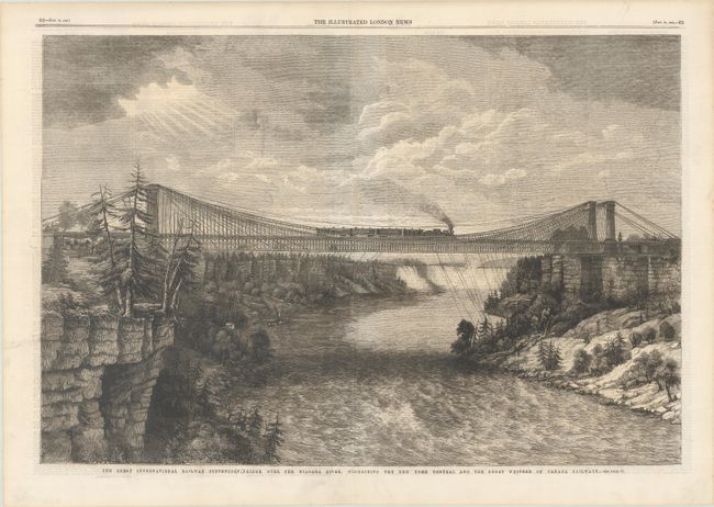
Auction 179, Lot 132
Subject: Niagara Falls, New York, Canada
The Great International Railway Suspension Bridge Over the Niagara River, Connecting the New York Central and the Great Western of Canada Railways, 1862
Size: 20.3 x 13.6 inches (51.6 x 34.5 cm)
Estimate: $60 - $80
NO RESERVE
Sold for: $75
Closed on 9/16/2020
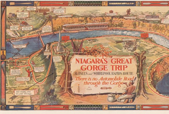
Auction 179, Lot 133
Subject: Niagara Falls, New York, Canada
Niagara's Great Gorge Trip - The Fals and Whirlpool Rapids Route, 1930
Size: 31.1 x 7.6 inches (79 x 19.3 cm)
Estimate: $80 - $100
NO RESERVE
Sold for: $90
Closed on 9/16/2020
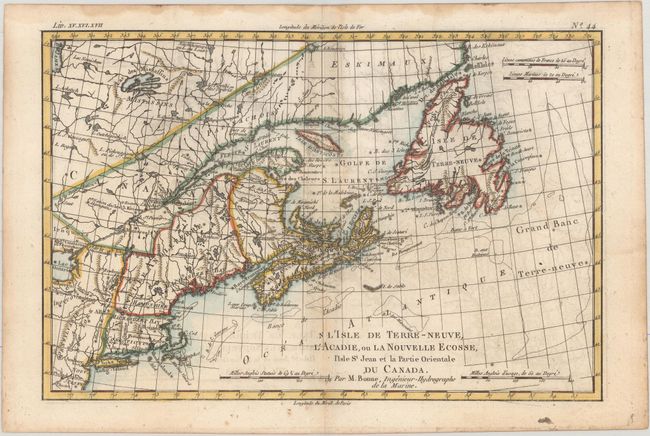
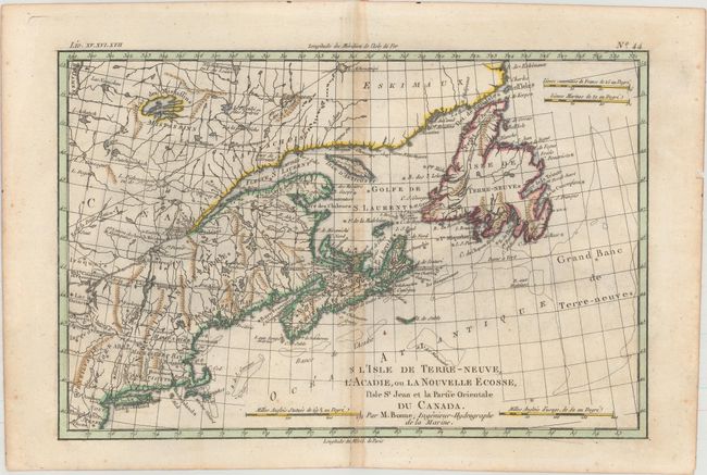
Auction 176, Lot 99
Subject: Colonial Northeastern United States & Canada
Bonne, Rigobert
L'Isle de Terre-Neuve, l'Acadie, ou la Nouvelle Ecosse, l'Isle St Jean et la Partie Orientale du Canada, 1775
Size: 12.6 x 8.3 inches (32 x 21.1 cm)
Estimate: $150 - $180
NO RESERVE
Sold for: $90
Closed on 2/12/2020
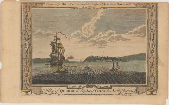
Auction 175, Lot 85
Subject: Quebec City, Canada
Millar, George H.
A View of Quebec the Capital of Canada, in North America, 1782
Size: 11.9 x 8.1 inches (30.2 x 20.6 cm)
Estimate: $60 - $80
NO RESERVE
Sold for: $55
Closed on 11/13/2019
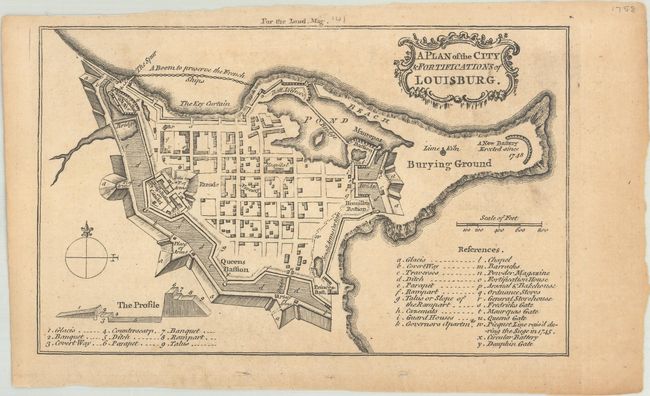
Auction 174, Lot 109
Subject: Cape Breton Island, Canada
Anon.
A Plan of the City & Fortifications of Louisburg, 1758
Size: 7.1 x 4.4 inches (18 x 11.2 cm)
Estimate: $60 - $80
NO RESERVE
Sold for: $36
Closed on 9/11/2019
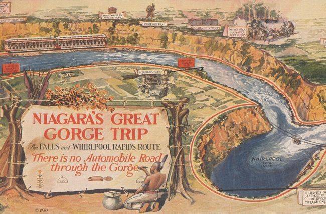
Auction 174, Lot 117
Subject: Niagara Falls, New York, Canada
Niagara's Great Gorge Trip - The Falls and Whirlpool Rapids Route, 1930
Size: 31.3 x 7.6 inches (79.5 x 19.3 cm)
Estimate: $60 - $80
NO RESERVE
Sold for: $85
Closed on 9/11/2019
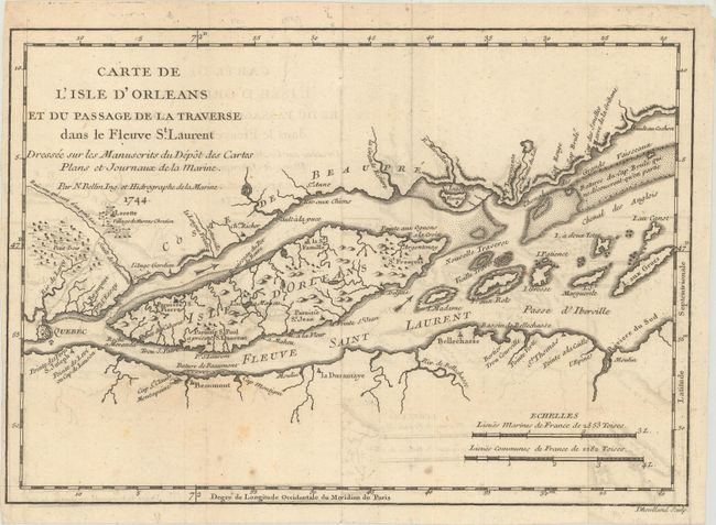
Auction 169, Lot 121
Subject: St. Lawrence River, Canada
Bellin, Jacques Nicolas
Carte de l'Isle d'Orleans et du Passage de la Traverse dans le Fleuve St. Laurent Dressee sur les Manuscrits du Depot des Cartes Plans et Journaux de la Marine, 1744
Size: 10.8 x 7.6 inches (27.4 x 19.3 cm)
Estimate: $110 - $140
NO RESERVE
Sold for: $55
Closed on 9/12/2018
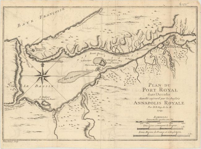
Auction 169, Lot 124
Subject: Nova Scotia, Canada
Bellin, Jacques Nicolas
Plan du Port Royal dans l'Accadie Appelle Aujourd' par les Anglois Annapolis Royale, 1744
Size: 11.1 x 7.6 inches (28.2 x 19.3 cm)
Estimate: $90 - $120
NO RESERVE
Sold for: $120
Closed on 9/12/2018
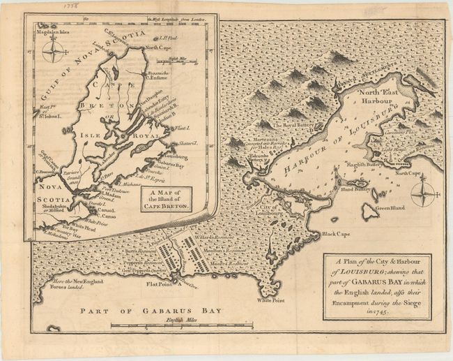
Auction 169, Lot 125
Subject: Nova Scotia, Canada
Anon.
A Plan of the City & Harbour of Louisburg; Shewing That Part of Gabarus Bay in Which the English Landed, Also Their Encampment During the Siege in 1745, 1758
Size: 10.1 x 7.6 inches (25.7 x 19.3 cm)
Estimate: $110 - $140
NO RESERVE
Sold for: $110
Closed on 9/12/2018
Auction 164, Lot 101
Subject: Eastern Canada
Tallis, John
East Canada, and New Brunswick, 1850
Size: 13.6 x 10.2 inches (34.5 x 25.9 cm)
Estimate: $140 - $180
NO RESERVE
Sold for: $90
Closed on 9/13/2017
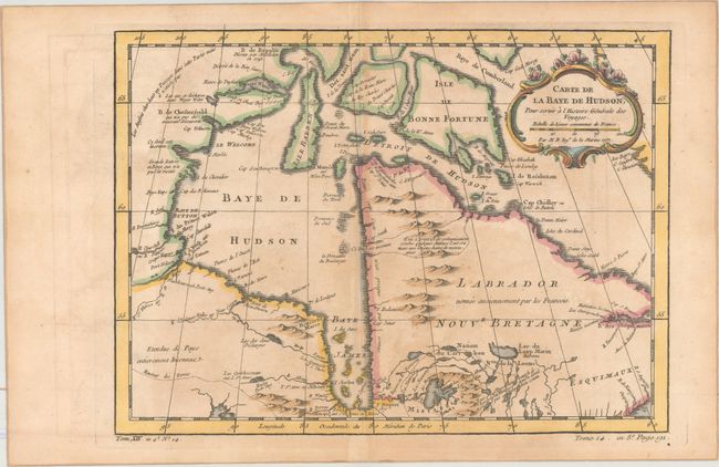
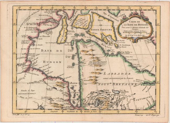
Auction 162, Lot 106
Subject: Eastern Canada
Bellin, Jacques Nicolas
[Lot of 2] Carte de la Baye de Hudson, pour Servir a l'Histoire Generale des Voyages [and] Carte de l'Acadie, Isle Royale, et Pais Voisins. Pour Servir a l'Histoire Generale des Voyages, 1757
Size: See Description
Estimate: $180 - $210
NO RESERVE
Sold for: $85
Closed on 4/26/2017
Auction 162, Lot 107
Subject: Eastern Canada
Robert de Vaugondy, Didier
Carte qui Represente les Differentes Connoissances que l'on a eues des Terres Arctiques Depuis 1650 Jusqu'en 1747..., 1773
Size: 15.1 x 12 inches (38.4 x 30.5 cm)
Estimate: $70 - $90
NO RESERVE
Sold for: $41
Closed on 4/26/2017
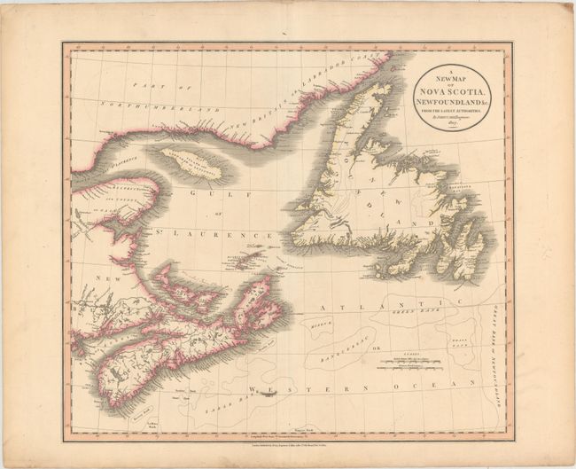
Auction 162, Lot 109
Subject: Eastern Canada
Cary, John
A New Map of Nova Scotia, Newfoundland &c. from the Latest Authorities, 1807
Size: 20.3 x 18 inches (51.6 x 45.7 cm)
Estimate: $160 - $190
NO RESERVE
Sold for: $75
Closed on 4/26/2017
Auction 161, Lot 149
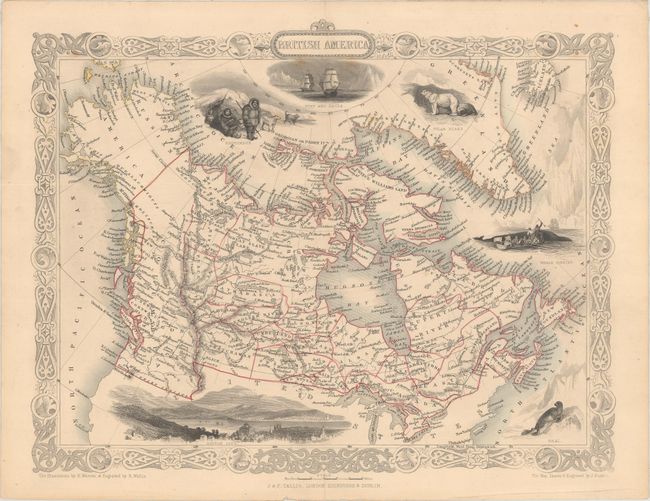
Subject: Canada & Alaska
Tallis, John
British America, 1850
Size: 12.9 x 10.1 inches (32.8 x 25.7 cm)
Estimate: $130 - $170
NO RESERVE
Sold for: $350
Closed on 2/8/2017
Auction 160, Lot 125
Subject: Canada
[Lot of 3] East Canada, and New Brunswick [and] Johnson's Lower Canada and New Brunswick [on sheet with] Johnson's Upper Canada [and] Johnson's New Brunswick, Nova Scotia, Newfoundland. And Prince Edward Id., 1850-65
Size: See Description
Estimate: $140 - $170
NO RESERVE
Sold for: $100
Closed on 11/16/2016
Auction 160, Lot 138
Subject: Colonial Northeastern United States & Canada
[Lot of 2] L'Isle de Terre-Neuve, l'Acadie, ou la Nouvelle Ecosse, l'Isle St Jean et la Partie Orientale du Canada [and] British North America Sheet 1, East. Newfoundland, New Brunswick, Nova Scotia, Prince Edward Island &c., 1775-1872
Size: See Description
Estimate: $200 - $230
NO RESERVE
Sold for: $110
Closed on 11/16/2016
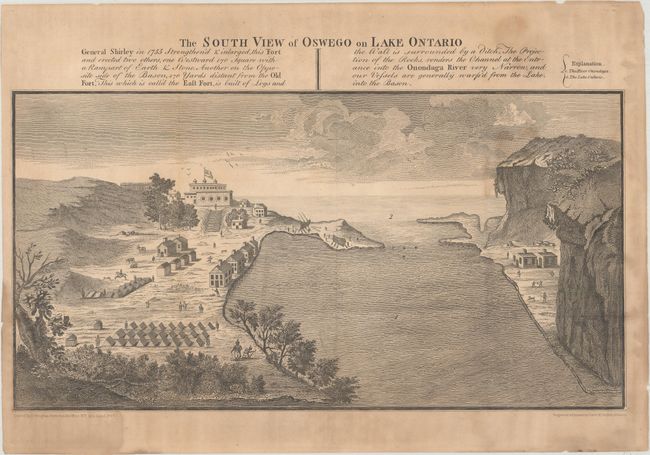
Auction 160, Lot 144
Subject: Colonial Northeastern United States & Canada, Great Lakes
[Lot of 3] The South View of Oswego on Lake Ontario... [and] Map of the Frontiers of the Northern Colonies with the Boundary Line Established Between Them and the Indians at the Treaty... [and] Carte des Frontieres Francoises..., 1850
Size: See Description
Estimate: $100 - $130
NO RESERVE
Sold for: $45
Closed on 11/16/2016
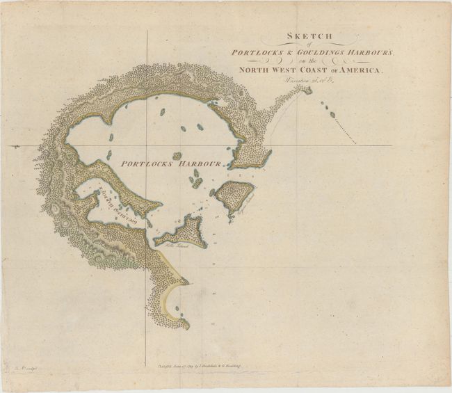
Auction 160, Lot 154
Subject: Alaska, Nootka Sound
[Lot of 2] Sketch of Portlocks & Gouldings Harbour's, on the North West Coast of America [and] Sketch of Nootka Sound, 1778-89
Size: See Description
Estimate: $300 - $400
NO RESERVE
Sold for: $55
Closed on 11/16/2016
Auction 159, Lot 115
Subject: Colonial Eastern Canada
Bellin, Jacques Nicolas
[Lot of 3] Carte de la Baye de Hudson, pour Servir a l'Histoire Generale des Voyages [and] Carte de l'Acadie, Isle Royale, et Pais Voisins... [and] Carte du Golphe de St. Laurent et Pays Voisins..., 1757
Size: See Description
Estimate: $250 - $325
NO RESERVE
Sold for: $250
Closed on 9/14/2016
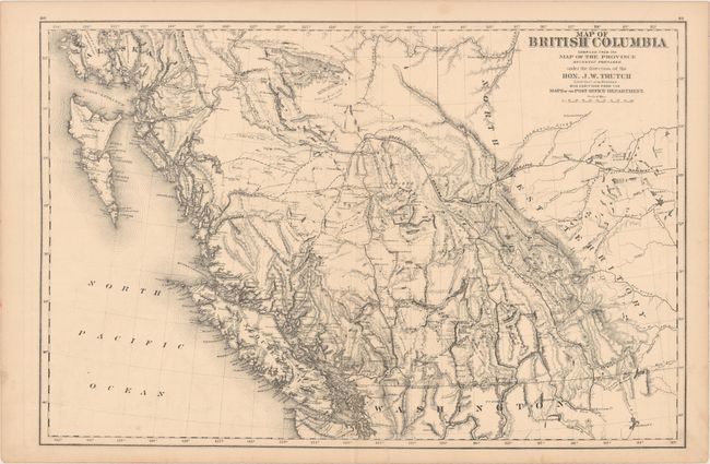
Auction 159, Lot 116
Subject: Western Canada
Map of British Columbia Compiled from the Map of the Province Recently Prepared Under the Direction of the Hon. J.W. Trutch..., 1878
Size: 24.2 x 16.1 inches (61.5 x 40.9 cm)
Estimate: $275 - $350
NO RESERVE
Sold for: $150
Closed on 9/14/2016
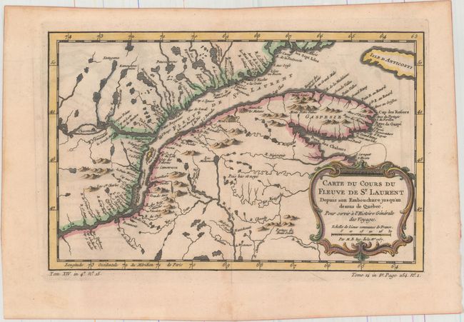
Auction 159, Lot 117
Subject: St. Lawrence River, Canada
Bellin, Jacques Nicolas
[Lot of 2] Carte du Cours du Fleuve de St. Laurent Depuis son Embouchure Jusqu'au Dessus de Quebec. Pour Servir a l'Histoire Generale des Voyages [and] Suite du Cours du Fleuve de St. Laurent, Depuis Quebec Jusqu'au Lac Ontario..., 1757
Size: 11.9 x 7.6 inches (30.2 x 19.3 cm)
Estimate: $140 - $170
NO RESERVE
Sold for: $190
Closed on 9/14/2016
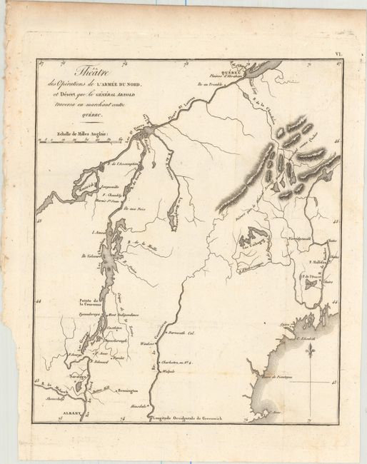
Auction 159, Lot 139
Subject: New England & Eastern Canada
Marshall, John
Theatre des Operations de l'Armee du Nord, et Desert que le General Arnold Traversa en Marchant Contre Quebec, 1807
Size: 8.4 x 10 inches (21.3 x 25.4 cm)
Estimate: $150 - $180
NO RESERVE
Sold for: $95
Closed on 9/14/2016
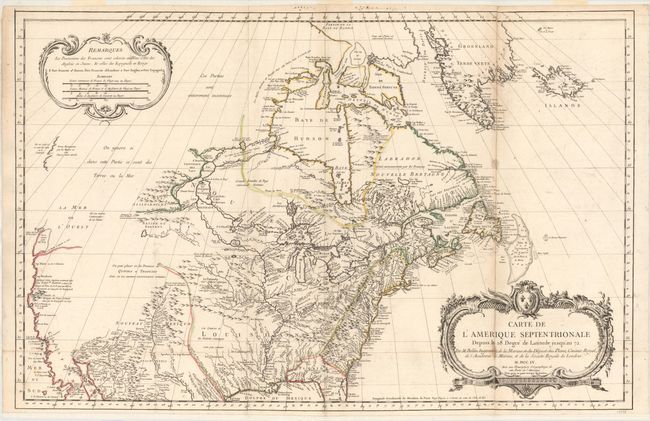
Auction 157, Lot 127
Subject: Colonial United States & Canada
Bellin, Jacques Nicolas
Carte de l'Amerique Septentrionale Depuis le 28 Degre de Latitude Jusqu'au 72, 1755
Size: 34 x 22 inches (86.4 x 55.9 cm)
Estimate: $1,500 - $1,800
NO RESERVE - Bellin's Important, Large Format Map of North America
Sold for: $950
Closed on 5/4/2016
67 lots
Page 1 of 2